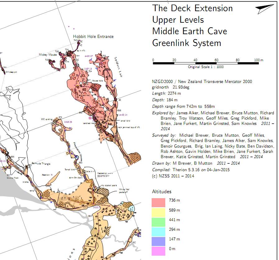
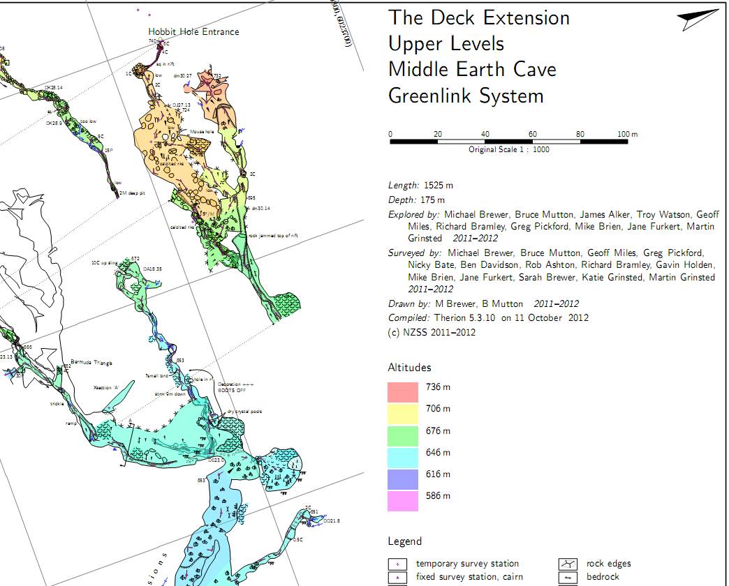
OK, the problem is not the previews or the offsets, as it occurs in the map examples below regardless of presence of previews or offsets. What does seem to control whether the altitudes start at zero meters is whether the map definition includes a survey centerline. If part of map definition includes a survey centerline, then altitudes are coloured from zero meters to survey maxima (a bug?). If map definition has no survey centerline as part of it's definition, then coloured from survey minima to survey maxima (correct behaviour). Hence I find this behaviour manifests in maps in progress, but when they are finished and I (usually) turn off the centerline maps, they correct themselves. Bruce _____ From: therion-bounces@speleo.sk [mailto:therion-bounces@speleo.sk] On Behalf Of Bruce Sent: Sunday, 4 January 2015 10:42 a.m. To: 'List for Therion users' Subject: Re: [Therion] Altitude colors range Hmm, seems like there is an issue here. Comparing 5.3.10 map with 5.3.16 map as attached. Not sure if it might be a side effect of something else, as I think the colour range is OK sometimes (I think I noticed some irregularities with 5.3.15 but assumed I was imagining things at the time) - maybe the preview below triggers it? - I might investigate further if I get time. Bruce _____ From: therion-bounces@speleo.sk [mailto:therion-bounces@speleo.sk] On Behalf Of Marco Menchise Sent: Saturday, 3 January 2015 8:45 a.m. To: List for Therion users Subject: [Therion] Altitude colors range Hello, I use to color maps by scrap altitude. Lately I noticed Therion color gradient starts from 0 m altitude to maximum cave altitude. Because caves don't reach 0 m almost all color range is unused and most scraps are colored with similar colors. If I remember correctly some time ago Therion used all color range because color gradient extended from minimum cave altitude (not 0 m) to maximum. Am I missing something? Is there a way to use all available colors? Thanks, Marco