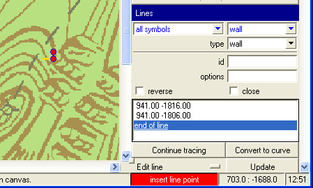
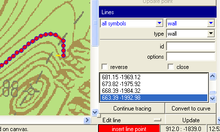
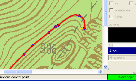
Thanks Stacho All these years I've been tracing cave outlines by hand! However on trying it out it seems to be quite fussy, or a least there is a knack I don't yet have. PocketTopo sketches don't work, in fact any scan with thin lines seems not to work. I had partial success with fat lines scanned at a low resolution (line width about 1.5 pixels) only when zoomed in to 400%. Generally it does between 0 and 5 extra points then stops, sometimes with the last point at an acute angle to the general trend of the line. So am I right in guessing that this will work best for reasonably fat well lined drawings? (your example line looks about 4-5 pixels wide) Bruce _____ From: therion-bounces@speleo.sk [mailto:therion-bounces@speleo.sk] On Behalf Of Stacho Mudrak Sent: Thursday, 7 June 2012 10:55 p.m. To: List for Therion users Subject: Re: [Therion] xtherion trace line, convert to curve I am afraid, there are no instructions :( I needed it to convert raster surface contours to vector data, to be able to generate 3D model. You need to load a background image. Then - on a raster line - add first two points of line, their distance defines tracing step. Like this: Inline images 2 Then click continue tracing and this is the result. Inline images 3 You can then convert this line to bezier curve. Inline images 4 HTH, S.