
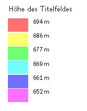
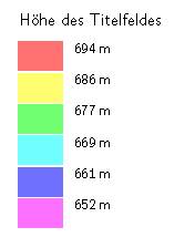
Hello, if I let make a legend for the depth by color (colour map-fg altitude) the title of that legend is Höhe des Titelfeldes. That is nonsense for me. Is it possible to change that? May be with some TEX or METAPOST? In the wiki I have found how it is possible to make changes by myself. But in my installation (5.3.16/Win7) is no directory named therion/thlang ? AND I thing I`am too stupid for that .. Many thanks for an answer Greetings Markus
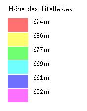

Markus Top of page 49 in the Therion Book describes, but you need to download the source files to decode what it means. The part of texts.txt that is relevant is; therion: title color-legend-altitude bg: Височинна скала cz: Nadmořské výšky de: Höhe des Titelfeldes el: Υψομετρικά en: Altitudes es: color (altitud) fr: Altitudes it: Profondità mi: Teitei, Tiketike pl: wysokości npm pt: Altitudes ru: Высотная шкала sk: Nadmorské výšky sq: titulli ngjyra-permbajtja-lartesia mbidetare So you want to add a statement to your th-config file (OUTSIDE of a layout block) something like this… text de "title color-legend-altitude" "Markus’ version of Höhe des Titelfeldes" Bruce _____ From: therion-bounces@speleo.sk [mailto:therion-bounces@speleo.sk] On Behalf Of Markus Boldt Sent: Thursday, 5 March 2015 9:31 a.m. To: therion@speleo.sk Subject: [Therion] german expression for depth-legend Hello, if I let make a legend for the depth by color (colour map-fg altitude) the title of that legend is „Höhe des Titelfeldes“. That is nonsense for me. Is it possible to change that? May be with some TEX or METAPOST? In the wiki I have found how it is possible to make changes by myself. But in my installation (5.3.16/Win7) is no directory named therion/thlang ? AND I thing I`am too stupid for that….. Many thanks for an answer Greetings Markus
Dear Bruce, thank you very much for your very fast answer. It is working!! Nothing else I have thought J. It is a thing, if a pro does something or if only a (stupid) user is working J. It would be a fine thing if “someone” would change the german expression to simply “Höhe” (Height) or better “Höhe (NN)”. But that brings me to the question: What happens if there are a cave deeper than 0m (NHN)? Get I a minus before the numbers? Greetings Markus Von: therion-bounces@speleo.sk [mailto:therion-bounces@speleo.sk] Im Auftrag von Bruce Gesendet: Donnerstag, 5. März 2015 07:07 An: 'List for Therion users' Betreff: Re: [Therion] german expression for depth-legend Markus Top of page 49 in the Therion Book describes, but you need to download the source files to decode what it means. The part of texts.txt that is relevant is; therion: title color-legend-altitude bg: Височинна скала cz: Nadmořské výšky de: Höhe des Titelfeldes el: Υψομετρικά en: Altitudes es: color (altitud) fr: Altitudes it: Profondità mi: Teitei, Tiketike pl: wysokości npm pt: Altitudes ru: Высотная шкала sk: Nadmorské výšky sq: titulli ngjyra-permbajtja-lartesia mbidetare So you want to add a statement to your th-config file (OUTSIDE of a layout block) something like this… text de "title color-legend-altitude" "Markus’ version of Höhe des Titelfeldes" Bruce _____ From: therion-bounces@speleo.sk [mailto:therion-bounces@speleo.sk] On Behalf Of Markus Boldt Sent: Thursday, 5 March 2015 9:31 a.m. To: therion@speleo.sk Subject: [Therion] german expression for depth-legend Hello, if I let make a legend for the depth by color (colour map-fg altitude) the title of that legend is „Höhe des Titelfeldes“. That is nonsense for me. Is it possible to change that? May be with some TEX or METAPOST? In the wiki I have found how it is possible to make changes by myself. But in my installation (5.3.16/Win7) is no directory named therion/thlang ? AND I thing I`am too stupid for that….. Many thanks for an answer Greetings Markus

+++ Markus Boldt [2015-03-05 18:04 +0100]:
Dear Bruce,
thank you very much for your very fast answer. It is working!! Nothing else I have thought J. It is a thing, if a pro does something or if only a (stupid) user is working J.
It would be a fine thing if “someone” would change the german expression to simply “Höhe” (Height) or better “Höhe (NN)”.
I've fixed this in the Debian version. And will upload shortly. BTW isn't the spanish version also wrong? It says: color (altitud) I reckon it should just be Altitud same for the next item "color-legend-map" color (mapa) -> Mapa I think the translator has misunderstood. Any spanish speakers/users care to confirm? Wookey -- Principal hats: Linaro, Debian, Wookware, ARM http://wookware.org/
Not stupid Markus. Took me years to figure out how to change Therion’s ‘text’s. Then I wondered why it took me so long. The cave depth that Therion reports is always positive, regardless of whether you have surveyed upwards or surveyed downwards. Bruce _____ From: therion-bounces@speleo.sk [mailto:therion-bounces@speleo.sk] On Behalf Of Markus Boldt Sent: Friday, 6 March 2015 6:04 a.m. To: 'List for Therion users' Subject: Re: [Therion] german expression for depth-legend Dear Bruce, thank you very much for your very fast answer. It is working!! … But that brings me to the question: What happens if there are a cave deeper than 0m (NHN)? Get I a minus before the numbers? Greetings Markus Von: therion-bounces@speleo.sk [mailto:therion-bounces@speleo.sk] Im Auftrag von Bruce Gesendet: Donnerstag, 5. März 2015 07:07 An: 'List for Therion users' Betreff: Re: [Therion] german expression for depth-legend Markus Top of page 49 in the Therion Book describes, but you need to download the source files to decode what it means. The part of texts.txt that is relevant is; therion: title color-legend-altitude bg: Височинна скала cz: Nadmořské výšky de: Höhe des Titelfeldes el: Υψομετρικά en: Altitudes es: color (altitud) fr: Altitudes it: Profondità mi: Teitei, Tiketike pl: wysokości npm pt: Altitudes ru: Высотная шкала sk: Nadmorské výšky sq: titulli ngjyra-permbajtja-lartesia mbidetare So you want to add a statement to your th-config file (OUTSIDE of a layout block) something like this… text de "title color-legend-altitude" "Markus’ version of Höhe des Titelfeldes" Bruce

Yes, I have. With a signature from Therion AND with the Altitude in fix-command. Why you are asking? Only for Info, or is there an important Information. Greetings Markus Von: therion-bounces@speleo.sk [mailto:therion-bounces@speleo.sk] Im Auftrag von Martin Sluka (External) Gesendet: Freitag, 6. März 2015 10:09 An: List for Therion users Betreff: Re: [Therion] german expression for depth-legend 6. 3. 2015 v 9:55, Bruce <bruce@tomo.co.nz<mailto:bruce@tomo.co.nz>>: The cave depth that Therion reports is always positive, regardless of whether you have surveyed upwards or surveyed downwards Have you flagged the entrance? m This message is intended solely for the designated recipient(s). It may contain confidential or proprietary information and may be subject to attorney-client privilege or other confidentiality protections. If you are not a designated recipient you may not review, copy or distribute this message. If you receive this in error, please notify the sender by reply e-mail and delete this message. Thank you. Diese Nachricht ist nur für vorgesehene Empfänger bestimmt. Die Nachricht kann vertrauliche oder persönliche Informationen enthalten und kann datenschutzrechtlichen Bestimmungen unterliegen. Wenn Sie kein vorgesehener Empfänger dieser Nachricht sind, ist es Ihnen untersagt, die darin enthaltenen Informationen einzusehen, zu vervielfältigen und zu veröffentlichen. Sollten Sie diese Nachricht versehentlich erhalten, bitten wir Sie, den Sender zu informieren, indem Sie auf diese Nachricht antworten und die Nachricht dann löschen. Vielen Dank.

6. 3. 2015 v 10:44, Markus Boldt <markus.boldt@ratiopharm.de>:
Yes, I have. With a signature from Therion AND with the Altitude in fix-command. Why you are asking? Only for Info, or is there an important Information.
Hi, if there isn’t entrance definition Therion calculates altitude difference from bottom most or from upper most station. m.s.
Hi, ah, yes. Thanks! for that Information. Markus Von: therion-bounces@speleo.sk [mailto:therion-bounces@speleo.sk] Im Auftrag von Martin Sluka Gesendet: Freitag, 6. März 2015 17:05 An: List for Therion users Betreff: Re: [Therion] german expression for depth-legend 6. 3. 2015 v 10:44, Markus Boldt <markus.boldt@ratiopharm.de>: Yes, I have. With a signature from Therion AND with the Altitude in fix-command. Why you are asking? Only for Info, or is there an important Information. Hi, if there isn’t entrance definition Therion calculates altitude difference from bottom most or from upper most station. m.s.
if there isn't entrance definition Therion calculates altitude difference from bottom most or from upper most station.
????? And what if there is an entrance defined? Or many entrances at various altitudes? Or many caves defined for that matter? What does Therion do? (I have not often checked, but any anomalies I found I assumed were my mistakes). Surely the best estimate Therion can make of cave depth is always the altitude difference between the bottom-most and top-most station of the caves selected for export? (ignoring for now niceties of splays or up-down dimensions) Bruce
And from where poor Therion should recognize what is the entrance of cave? Station 1, or station 15, or … Any station which ends a branch could be entrance theoretically. m.
6. 3. 2015 v 21:25, Bruce <bruce@tomo.co.nz>:
if there isn’t entrance definition Therion calculates altitude difference from bottom most or from upper most station.
????? And what if there is an entrance defined? Or many entrances at various altitudes? Or many caves defined for that matter? What does Therion do? (I have not often checked, but any anomalies I found I assumed were my mistakes).
Surely the best estimate Therion can make of cave depth is always the altitude difference between the bottom-most and top-most station of the caves selected for export? (ignoring for now niceties of splays or up-down dimensions)
Bruce
_______________________________________________ Therion mailing list Therion@speleo.sk <mailto:Therion@speleo.sk> http://mailman.speleo.sk/mailman/listinfo/therion <http://mailman.speleo.sk/mailman/listinfo/therion>
Hi Martin My point was, what relevance does an entrance have to the depth of a cave (from Therion's perspective)? Entrances may occur anywhere in underground survey network, at end of branch or mid branch (hole in roof of shallow cave). Software should only take survey network as being of relevance to the depth calculation. The flagging of entrances (or not) is quite an independent concept that should not alter the way depth is calculated. Bruce
+++ Bruce [2015-03-07 10:31 +1300]:
Hi Martin
My point was, what relevance does an entrance have to the depth of a cave (from Therion’s perspective)?
Entrances may occur anywhere in underground survey network, at end of branch or mid branch (hole in roof of shallow cave). Software should only take survey network as being of relevance to the depth calculation. The flagging of entrances (or not) is quite an independent concept that should not alter the way depth is calculated.
Well the depth could become +15, -230, rather than just 245m if there is one entrance 15m below the highest point. You may or may not prefer that - just saying that they could be related in that way. Wookey -- Principal hats: Linaro, Debian, Wookware, ARM http://wookware.org/
Well the depth could become +15, -230, rather than just 245m if there is one entrance 15m below the highest point. You may or may not prefer that - just saying that they could be related in that way.
Yes I agree, there are other ways of thinking about definition of cave depth, but not yet able or likely to be automated using Therion. Although the recent \cave[max|min]z variables are a step in allowing users to customise in that direction. Bruce
I had a thought! Exported cave lists already report (among other things) station comments with flag entrance set against the elevation, and grouped by cave. I have already experimented with redefining the map header so that depth is reported like; Length: 1232m Depth: 126m, from altitude 100m to 226m What would it take to make the station comments for flagged entrances available in the map-headers so that we could add entrance station comments and elevations? Like this? Length: 1232m Depth: 126m, from altitude 100m to 226m Middle Earth Entrance 202m Perseverance Cave 186m Hobbit Hole Entrance 150m Bruce
participants (5)
-
 Bruce
-
 Markus Boldt
-
 Markus Boldt
-
 Martin Sluka
-
 Wookey