Therion 5.3.16 using raft symbol both for rafts and raft cones

Hi, I'm producing PDFs of a map with raft cones but Therion is preparing a PDF with raft (calcite raft) symbols instead. I tried changing the points to raft but the rendering doesn't change. I'm using Ubuntu Therion 5.3.16. How can I further debug this issue? Regards, Rodrigo Severo

There is the file thTrans.mp in the mpost directory of Therion. In that file there are the rules which symbol to use for the final output. Anyway it should work as you presume: let p_scallop = p_scallop_UIS; let p_flute = p_flute_UIS; let p_raft = p_raft_NSS; let p_raftcone = p_raftcone_NSS; let p_spring = p_spring_SKBB; let p_sink = p_sink_SKBB; Check it, please. Martin s.
26. 9. 2016 v 23:30, Rodrigo Severo <rodrigo@fabricadeideias.com>:
Hi,
I'm producing PDFs of a map with raft cones but Therion is preparing a PDF with raft (calcite raft) symbols instead.
I tried changing the points to raft but the rendering doesn't change.
I'm using Ubuntu Therion 5.3.16.
How can I further debug this issue?
Regards,
Rodrigo Severo _______________________________________________ Therion mailing list Therion@speleo.sk https://mailman.speleo.sk/listinfo/therion
2016-09-27 3:03 GMT-03:00 Martin Sluka <martinsluka@mac.com>: First of all, thanks for your help and attention.
There is the file thTrans.mp in the mpost directory of Therion.
In that file there are the rules which symbol to use for the final output.
Anyway it should work as you presume:
let p_scallop = p_scallop_UIS; let p_flute = p_flute_UIS; let p_raft = p_raft_NSS; let p_raftcone = p_raftcone_NSS; let p_spring = p_spring_SKBB; let p_sink = p_sink_SKBB;
Check it, please.
Unfortunatelly I don`t have neither this file nor this directory on my system. Did I mention that I`m using a Ubuntu package? ;) Can`t I get this info from some file in the thTMPDIR? I found this on the data.mp file: root@prata15:~/Dropbox/EGB/exploracao poco surubim/topografia/thTMPDIR# grep -irn raft . ./data.mp:1305:def p_raft_NSS (expr pos,theta,sc,al)= ./data.mp:1313:def p_raftcone_NSS (expr pos,theta,sc,al)= ./data.mp:4794:let p_raft = p_raft_NSS; ./data.mp:4795:let p_raftcone = p_raftcone_NSS; ./data.mp:4986:initsymbol("p_raft_NSS"); ./data.mp:4987:initsymbol("p_raftcone_NSS"); ./data.mp:5137:p_raft((-22.99,-140.49),0.0,1.00,(0,0)); ./data.mp:5139:p_raft((-20.97,-127.92),0.0,1.00,(0,0)); ./data.mp:5141:p_raft((-23.21,-110.27),0.0,1.00,(0,0)); ./data.mp:5143:p_raft((-10.48,-105.85),0.0,1.00,(0,0)); . . . There is this ¨:let p_raftcone = p_raftcone_NSS;¨ line that looks promising but only p_raft is called, never p_raftcone Ideias?
Martin s.
26. 9. 2016 v 23:30, Rodrigo Severo <rodrigo@fabricadeideias.com>:
Hi,
I'm producing PDFs of a map with raft cones but Therion is preparing a PDF with raft (calcite raft) symbols instead.
I tried changing the points to raft but the rendering doesn't change.
I'm using Ubuntu Therion 5.3.16.
How can I further debug this issue?
Regards,
Rodrigo Severo _______________________________________________ Therion mailing list Therion@speleo.sk https://mailman.speleo.sk/listinfo/therion
_______________________________________________ Therion mailing list Therion@speleo.sk https://mailman.speleo.sk/listinfo/therion
2016-09-27 8:20 GMT-03:00 Rodrigo Severo <rodrigo@fabricadeideias.com>: Could the problem be related to the fact that the point type written on my th2 file is "raft-cone" with a hyphen and the p_ type is named "raftcone" without a hyphen?
2016-09-27 3:03 GMT-03:00 Martin Sluka <martinsluka@mac.com>:
First of all, thanks for your help and attention.
There is the file thTrans.mp in the mpost directory of Therion.
In that file there are the rules which symbol to use for the final output.
Anyway it should work as you presume:
let p_scallop = p_scallop_UIS; let p_flute = p_flute_UIS; let p_raft = p_raft_NSS; let p_raftcone = p_raftcone_NSS; let p_spring = p_spring_SKBB; let p_sink = p_sink_SKBB;
Check it, please.
Unfortunatelly I don`t have neither this file nor this directory on my system. Did I mention that I`m using a Ubuntu package? ;)
Can`t I get this info from some file in the thTMPDIR?
I found this on the data.mp file:
root@prata15:~/Dropbox/EGB/exploracao poco surubim/topografia/thTMPDIR# grep -irn raft . ./data.mp:1305:def p_raft_NSS (expr pos,theta,sc,al)= ./data.mp:1313:def p_raftcone_NSS (expr pos,theta,sc,al)= ./data.mp:4794:let p_raft = p_raft_NSS; ./data.mp:4795:let p_raftcone = p_raftcone_NSS; ./data.mp:4986:initsymbol("p_raft_NSS"); ./data.mp:4987:initsymbol("p_raftcone_NSS"); ./data.mp:5137:p_raft((-22.99,-140.49),0.0,1.00,(0,0)); ./data.mp:5139:p_raft((-20.97,-127.92),0.0,1.00,(0,0)); ./data.mp:5141:p_raft((-23.21,-110.27),0.0,1.00,(0,0)); ./data.mp:5143:p_raft((-10.48,-105.85),0.0,1.00,(0,0)); . . .
There is this ¨:let p_raftcone = p_raftcone_NSS;¨ line that looks promising but only p_raft is called, never p_raftcone
Ideias?
Martin s.
26. 9. 2016 v 23:30, Rodrigo Severo <rodrigo@fabricadeideias.com>:
Hi,
I'm producing PDFs of a map with raft cones but Therion is preparing a PDF with raft (calcite raft) symbols instead.
I tried changing the points to raft but the rendering doesn't change.
I'm using Ubuntu Therion 5.3.16.
How can I further debug this issue?
Regards,
Rodrigo Severo _______________________________________________ Therion mailing list Therion@speleo.sk https://mailman.speleo.sk/listinfo/therion
_______________________________________________ Therion mailing list Therion@speleo.sk https://mailman.speleo.sk/listinfo/therion
It could be. Just to delete manually hyphen in raft-cone in .th2 file and compile it again. m. On Sep 27, 2016, at 01:38 PM, Rodrigo Severo <rodrigo@fabricadeideias.com> wrote: 2016-09-27 8:20 GMT-03:00 Rodrigo Severo <rodrigo@fabricadeideias.com>: Could the problem be related to the fact that the point type written on my th2 file is "raft-cone" with a hyphen and the p_ type is named "raftcone" without a hyphen? 2016-09-27 3:03 GMT-03:00 Martin Sluka <martinsluka@mac.com>: First of all, thanks for your help and attention. There is the file thTrans.mp in the mpost directory of Therion. In that file there are the rules which symbol to use for the final output. Anyway it should work as you presume: let p_scallop = p_scallop_UIS; let p_flute = p_flute_UIS; let p_raft = p_raft_NSS; let p_raftcone = p_raftcone_NSS; let p_spring = p_spring_SKBB; let p_sink = p_sink_SKBB; Check it, please. Unfortunatelly I don`t have neither this file nor this directory on my system. Did I mention that I`m using a Ubuntu package? ;) Can`t I get this info from some file in the thTMPDIR? I found this on the data.mp file: root@prata15:~/Dropbox/EGB/exploracao poco surubim/topografia/thTMPDIR# grep -irn raft . ./data.mp:1305:def p_raft_NSS (expr pos,theta,sc,al)= ./data.mp:1313:def p_raftcone_NSS (expr pos,theta,sc,al)= ./data.mp:4794:let p_raft = p_raft_NSS; ./data.mp:4795:let p_raftcone = p_raftcone_NSS; ./data.mp:4986:initsymbol("p_raft_NSS"); ./data.mp:4987:initsymbol("p_raftcone_NSS"); ./data.mp:5137:p_raft((-22.99,-140.49),0.0,1.00,(0,0)); ./data.mp:5139:p_raft((-20.97,-127.92),0.0,1.00,(0,0)); ./data.mp:5141:p_raft((-23.21,-110.27),0.0,1.00,(0,0)); ./data.mp:5143:p_raft((-10.48,-105.85),0.0,1.00,(0,0)); . . . There is this ¨:let p_raftcone = p_raftcone_NSS;¨ line that looks promising but only p_raft is called, never p_raftcone Ideias? Martin s. 26. 9. 2016 v 23:30, Rodrigo Severo <rodrigo@fabricadeideias.com>: Hi, I'm producing PDFs of a map with raft cones but Therion is preparing a PDF with raft (calcite raft) symbols instead. I tried changing the points to raft but the rendering doesn't change. I'm using Ubuntu Therion 5.3.16. How can I further debug this issue? Regards, Rodrigo Severo _______________________________________________ Therion mailing list Therion@speleo.sk https://mailman.speleo.sk/listinfo/therion _______________________________________________ Therion mailing list Therion@speleo.sk https://mailman.speleo.sk/listinfo/therion _______________________________________________ Therion mailing list Therion@speleo.sk https://mailman.speleo.sk/listinfo/therion
2016-09-27 8:41 GMT-03:00 Martin Sluka <martinsluka@mac.com>:
It could be. Just to delete manually hyphen in raft-cone in .th2 file and compile it again.
Unfortunatelly not: therion: error -- croqui4.th2 [57] -- unknown point type -- raftcone What now? Rodrigo
m.
On Sep 27, 2016, at 01:38 PM, Rodrigo Severo <rodrigo@fabricadeideias.com> wrote:
2016-09-27 8:20 GMT-03:00 Rodrigo Severo <rodrigo@fabricadeideias.com>:
Could the problem be related to the fact that the point type written on my th2 file is "raft-cone" with a hyphen and the p_ type is named "raftcone" without a hyphen?
2016-09-27 3:03 GMT-03:00 Martin Sluka <martinsluka@mac.com>:
First of all, thanks for your help and attention.
There is the file thTrans.mp in the mpost directory of Therion.
In that file there are the rules which symbol to use for the final output.
Anyway it should work as you presume:
let p_scallop = p_scallop_UIS;
let p_flute = p_flute_UIS;
let p_raft = p_raft_NSS;
let p_raftcone = p_raftcone_NSS;
let p_spring = p_spring_SKBB;
let p_sink = p_sink_SKBB;
Check it, please.
Unfortunatelly I don`t have neither this file nor this directory on my
system. Did I mention that I`m using a Ubuntu package? ;)
Can`t I get this info from some file in the thTMPDIR?
I found this on the data.mp file:
root@prata15:~/Dropbox/EGB/exploracao poco
surubim/topografia/thTMPDIR# grep -irn raft .
./data.mp:1305:def p_raft_NSS (expr pos,theta,sc,al)=
./data.mp:1313:def p_raftcone_NSS (expr pos,theta,sc,al)=
./data.mp:4794:let p_raft = p_raft_NSS;
./data.mp:4795:let p_raftcone = p_raftcone_NSS;
./data.mp:4986:initsymbol("p_raft_NSS");
./data.mp:4987:initsymbol("p_raftcone_NSS");
./data.mp:5137:p_raft((-22.99,-140.49),0.0,1.00,(0,0));
./data.mp:5139:p_raft((-20.97,-127.92),0.0,1.00,(0,0));
./data.mp:5141:p_raft((-23.21,-110.27),0.0,1.00,(0,0));
./data.mp:5143:p_raft((-10.48,-105.85),0.0,1.00,(0,0));
.
.
.
There is this ¨:let p_raftcone = p_raftcone_NSS;¨ line that looks
promising but only p_raft is called, never p_raftcone
Ideias?
Martin s.
26. 9. 2016 v 23:30, Rodrigo Severo <rodrigo@fabricadeideias.com>:
Hi,
I'm producing PDFs of a map with raft cones but Therion is preparing a
PDF with raft (calcite raft) symbols instead.
I tried changing the points to raft but the rendering doesn't change.
I'm using Ubuntu Therion 5.3.16.
How can I further debug this issue?
Regards,
Rodrigo Severo
_______________________________________________
Therion mailing list
Therion@speleo.sk
https://mailman.speleo.sk/listinfo/therion
_______________________________________________
Therion mailing list
Therion@speleo.sk
https://mailman.speleo.sk/listinfo/therion
_______________________________________________ Therion mailing list Therion@speleo.sk https://mailman.speleo.sk/listinfo/therion
_______________________________________________ Therion mailing list Therion@speleo.sk https://mailman.speleo.sk/listinfo/therion
2016-09-27 10:14 GMT-03:00 Rodrigo Severo <rodrigo@fabricadeideias.com>:
2016-09-27 8:41 GMT-03:00 Martin Sluka <martinsluka@mac.com>:
It could be. Just to delete manually hyphen in raft-cone in .th2 file and compile it again.
Unfortunatelly not:
therion: error -- croqui4.th2 [57] -- unknown point type -- raftcone
What now?
I've just searched the therion executable with an hex editor. I found what seems to be the relation between point type name and the p_ type: raft.p_raft.point raft-cone.p_raftcone.point Everything seems to be fine. Except that's not working as expected. Any ideias? Rodrigo
On Sep 27, 2016, at 01:38 PM, Rodrigo Severo <rodrigo@fabricadeideias.com> wrote:
2016-09-27 8:20 GMT-03:00 Rodrigo Severo <rodrigo@fabricadeideias.com>:
Could the problem be related to the fact that the point type written on my th2 file is "raft-cone" with a hyphen and the p_ type is named "raftcone" without a hyphen?
2016-09-27 3:03 GMT-03:00 Martin Sluka <martinsluka@mac.com>:
First of all, thanks for your help and attention.
There is the file thTrans.mp in the mpost directory of Therion.
In that file there are the rules which symbol to use for the final output.
Anyway it should work as you presume:
let p_scallop = p_scallop_UIS;
let p_flute = p_flute_UIS;
let p_raft = p_raft_NSS;
let p_raftcone = p_raftcone_NSS;
let p_spring = p_spring_SKBB;
let p_sink = p_sink_SKBB;
Check it, please.
Unfortunatelly I don`t have neither this file nor this directory on my
system. Did I mention that I`m using a Ubuntu package? ;)
Can`t I get this info from some file in the thTMPDIR?
I found this on the data.mp file:
root@prata15:~/Dropbox/EGB/exploracao poco
surubim/topografia/thTMPDIR# grep -irn raft .
./data.mp:1305:def p_raft_NSS (expr pos,theta,sc,al)=
./data.mp:1313:def p_raftcone_NSS (expr pos,theta,sc,al)=
./data.mp:4794:let p_raft = p_raft_NSS;
./data.mp:4795:let p_raftcone = p_raftcone_NSS;
./data.mp:4986:initsymbol("p_raft_NSS");
./data.mp:4987:initsymbol("p_raftcone_NSS");
./data.mp:5137:p_raft((-22.99,-140.49),0.0,1.00,(0,0));
./data.mp:5139:p_raft((-20.97,-127.92),0.0,1.00,(0,0));
./data.mp:5141:p_raft((-23.21,-110.27),0.0,1.00,(0,0));
./data.mp:5143:p_raft((-10.48,-105.85),0.0,1.00,(0,0));
.
.
.
There is this ¨:let p_raftcone = p_raftcone_NSS;¨ line that looks
promising but only p_raft is called, never p_raftcone
Ideias?
Martin s.
26. 9. 2016 v 23:30, Rodrigo Severo <rodrigo@fabricadeideias.com>:
Hi,
I'm producing PDFs of a map with raft cones but Therion is preparing a
PDF with raft (calcite raft) symbols instead.
I tried changing the points to raft but the rendering doesn't change.
I'm using Ubuntu Therion 5.3.16.
How can I further debug this issue?
Regards,
Rodrigo Severo
_______________________________________________
Therion mailing list
Therion@speleo.sk
https://mailman.speleo.sk/listinfo/therion
_______________________________________________
Therion mailing list
Therion@speleo.sk
https://mailman.speleo.sk/listinfo/therion
_______________________________________________ Therion mailing list Therion@speleo.sk https://mailman.speleo.sk/listinfo/therion
_______________________________________________ Therion mailing list Therion@speleo.sk https://mailman.speleo.sk/listinfo/therion
what's happen when you manually remove those "-" from "raft-cone" in .th2 file? point raft-cone -> point raftcone m. On Sep 27, 2016, at 04:57 PM, Rodrigo Severo <rodrigo@fabricadeideias.com> wrote: 2016-09-27 10:14 GMT-03:00 Rodrigo Severo <rodrigo@fabricadeideias.com>: 2016-09-27 8:41 GMT-03:00 Martin Sluka <martinsluka@mac.com>: It could be. Just to delete manually hyphen in raft-cone in .th2 file and compile it again. Unfortunatelly not: therion: error -- croqui4.th2 [57] -- unknown point type -- raftcone What now? I've just searched the therion executable with an hex editor. I found what seems to be the relation between point type name and the p_ type: raft.p_raft.point raft-cone.p_raftcone.point Everything seems to be fine. Except that's not working as expected. Any ideias? Rodrigo On Sep 27, 2016, at 01:38 PM, Rodrigo Severo <rodrigo@fabricadeideias.com> wrote: 2016-09-27 8:20 GMT-03:00 Rodrigo Severo <rodrigo@fabricadeideias.com>: Could the problem be related to the fact that the point type written on my th2 file is "raft-cone" with a hyphen and the p_ type is named "raftcone" without a hyphen? 2016-09-27 3:03 GMT-03:00 Martin Sluka <martinsluka@mac.com>: First of all, thanks for your help and attention. There is the file thTrans.mp in the mpost directory of Therion. In that file there are the rules which symbol to use for the final output. Anyway it should work as you presume: let p_scallop = p_scallop_UIS; let p_flute = p_flute_UIS; let p_raft = p_raft_NSS; let p_raftcone = p_raftcone_NSS; let p_spring = p_spring_SKBB; let p_sink = p_sink_SKBB; Check it, please. Unfortunatelly I don`t have neither this file nor this directory on my system. Did I mention that I`m using a Ubuntu package? ;) Can`t I get this info from some file in the thTMPDIR? I found this on the data.mp file: root@prata15:~/Dropbox/EGB/exploracao poco surubim/topografia/thTMPDIR# grep -irn raft . ./data.mp:1305:def p_raft_NSS (expr pos,theta,sc,al)= ./data.mp:1313:def p_raftcone_NSS (expr pos,theta,sc,al)= ./data.mp:4794:let p_raft = p_raft_NSS; ./data.mp:4795:let p_raftcone = p_raftcone_NSS; ./data.mp:4986:initsymbol("p_raft_NSS"); ./data.mp:4987:initsymbol("p_raftcone_NSS"); ./data.mp:5137:p_raft((-22.99,-140.49),0.0,1.00,(0,0)); ./data.mp:5139:p_raft((-20.97,-127.92),0.0,1.00,(0,0)); ./data.mp:5141:p_raft((-23.21,-110.27),0.0,1.00,(0,0)); ./data.mp:5143:p_raft((-10.48,-105.85),0.0,1.00,(0,0)); . . . There is this ¨:let p_raftcone = p_raftcone_NSS;¨ line that looks promising but only p_raft is called, never p_raftcone Ideias? Martin s. 26. 9. 2016 v 23:30, Rodrigo Severo <rodrigo@fabricadeideias.com>: Hi, I'm producing PDFs of a map with raft cones but Therion is preparing a PDF with raft (calcite raft) symbols instead. I tried changing the points to raft but the rendering doesn't change. I'm using Ubuntu Therion 5.3.16. How can I further debug this issue? Regards, Rodrigo Severo _______________________________________________ Therion mailing list Therion@speleo.sk https://mailman.speleo.sk/listinfo/therion _______________________________________________ Therion mailing list Therion@speleo.sk https://mailman.speleo.sk/listinfo/therion _______________________________________________ Therion mailing list Therion@speleo.sk https://mailman.speleo.sk/listinfo/therion _______________________________________________ Therion mailing list Therion@speleo.sk https://mailman.speleo.sk/listinfo/therion _______________________________________________ Therion mailing list Therion@speleo.sk https://mailman.speleo.sk/listinfo/therion
There is really a bug, because both symbols therion draws as raft. Work around - define the user symbol raft_cone in your thconfig. Data are in attached zip file. m. On Sep 27, 2016, at 06:27 PM, Martin Sluka <martinsluka@mac.com> wrote: what's happen when you manually remove those "-" from "raft-cone" in .th2 file? point raft-cone -> point raftcone m. On Sep 27, 2016, at 04:57 PM, Rodrigo Severo <rodrigo@fabricadeideias.com> wrote: 2016-09-27 10:14 GMT-03:00 Rodrigo Severo <rodrigo@fabricadeideias.com>: 2016-09-27 8:41 GMT-03:00 Martin Sluka <martinsluka@mac.com>: It could be. Just to delete manually hyphen in raft-cone in .th2 file and compile it again. Unfortunatelly not: therion: error -- croqui4.th2 [57] -- unknown point type -- raftcone What now? I've just searched the therion executable with an hex editor. I found what seems to be the relation between point type name and the p_ type: raft.p_raft.point raft-cone.p_raftcone.point Everything seems to be fine. Except that's not working as expected. Any ideias? Rodrigo On Sep 27, 2016, at 01:38 PM, Rodrigo Severo <rodrigo@fabricadeideias.com> wrote: 2016-09-27 8:20 GMT-03:00 Rodrigo Severo <rodrigo@fabricadeideias.com>: Could the problem be related to the fact that the point type written on my th2 file is "raft-cone" with a hyphen and the p_ type is named "raftcone" without a hyphen? 2016-09-27 3:03 GMT-03:00 Martin Sluka <martinsluka@mac.com>: First of all, thanks for your help and attention. There is the file thTrans.mp in the mpost directory of Therion. In that file there are the rules which symbol to use for the final output. Anyway it should work as you presume: let p_scallop = p_scallop_UIS; let p_flute = p_flute_UIS; let p_raft = p_raft_NSS; let p_raftcone = p_raftcone_NSS; let p_spring = p_spring_SKBB; let p_sink = p_sink_SKBB; Check it, please. Unfortunatelly I don`t have neither this file nor this directory on my system. Did I mention that I`m using a Ubuntu package? ;) Can`t I get this info from some file in the thTMPDIR? I found this on the data.mp file: root@prata15:~/Dropbox/EGB/exploracao poco surubim/topografia/thTMPDIR# grep -irn raft . ./data.mp:1305:def p_raft_NSS (expr pos,theta,sc,al)= ./data.mp:1313:def p_raftcone_NSS (expr pos,theta,sc,al)= ./data.mp:4794:let p_raft = p_raft_NSS; ./data.mp:4795:let p_raftcone = p_raftcone_NSS; ./data.mp:4986:initsymbol("p_raft_NSS"); ./data.mp:4987:initsymbol("p_raftcone_NSS"); ./data.mp:5137:p_raft((-22.99,-140.49),0.0,1.00,(0,0)); ./data.mp:5139:p_raft((-20.97,-127.92),0.0,1.00,(0,0)); ./data.mp:5141:p_raft((-23.21,-110.27),0.0,1.00,(0,0)); ./data.mp:5143:p_raft((-10.48,-105.85),0.0,1.00,(0,0)); . . . There is this ¨:let p_raftcone = p_raftcone_NSS;¨ line that looks promising but only p_raft is called, never p_raftcone Ideias? Martin s. 26. 9. 2016 v 23:30, Rodrigo Severo <rodrigo@fabricadeideias.com>: Hi, I'm producing PDFs of a map with raft cones but Therion is preparing a PDF with raft (calcite raft) symbols instead. I tried changing the points to raft but the rendering doesn't change. I'm using Ubuntu Therion 5.3.16. How can I further debug this issue? Regards, Rodrigo Severo _______________________________________________ Therion mailing list Therion@speleo.sk https://mailman.speleo.sk/listinfo/therion _______________________________________________ Therion mailing list Therion@speleo.sk https://mailman.speleo.sk/listinfo/therion _______________________________________________ Therion mailing list Therion@speleo.sk https://mailman.speleo.sk/listinfo/therion _______________________________________________ Therion mailing list Therion@speleo.sk https://mailman.speleo.sk/listinfo/therion _______________________________________________ Therion mailing list Therion@speleo.sk https://mailman.speleo.sk/listinfo/therion _______________________________________________ Therion mailing list Therion@speleo.sk https://mailman.speleo.sk/listinfo/therion

Hi there, i wonder how i can make my own custom map symbols recognize the "symbol-color" command. Maybe i also get some spare time and can adjust some of the default symbols to honor it too? Greetings, Beni
All symbols in the Therion are the Metapost macros. Best way is to read the addendum with samples in TherionBook. All symbols are in directory mpost in the therion's directory, if you download the source code. m. On Sep 27, 2016, at 08:56 PM, Benedikt Hallinger <beni@hallinger.org> wrote: Hi there, i wonder how i can make my own custom map symbols recognize the "symbol-color" command. Maybe i also get some spare time and can adjust some of the default symbols to honor it too? Greetings, Beni _______________________________________________ Therion mailing list Therion@speleo.sk https://mailman.speleo.sk/listinfo/therion

Beni Long ago I thought about such things. There were some challenges I did not crack. I forget now. Have a look at Colour Dependant Visualization of Symbols in https://therion.speleo.sk/wiki/doku.php/metapost Bruce -----Original Message----- From: Therion [mailto:therion-bounces@speleo.sk] On Behalf Of Benedikt Hallinger Sent: Wednesday, 28 September 2016 7:39 AM To: therion@speleo.sk Subject: [Therion] Making custom metapost symbols recognize "symbol-color" thconfig command Hi there, i wonder how i can make my own custom map symbols recognize the "symbol-color" command. Maybe i also get some spare time and can adjust some of the default symbols to honor it too? Greetings, Beni _______________________________________________ Therion mailing list Therion@speleo.sk https://mailman.speleo.sk/listinfo/therion
Thank yu for the fast answers, is this "colour_block_bg" variable the bit im looking for?
if known colour_block_bg: thfill p withcolor colour_block_bg; else: thfill p withcolor (0.75,0.75,0.75); fi;
Am 2016-09-27 21:40, schrieb Bruce Mutton:
Beni Long ago I thought about such things. There were some challenges I did not crack. I forget now. Have a look at Colour Dependant Visualization of Symbols in https://therion.speleo.sk/wiki/doku.php/metapost
Bruce
-----Original Message----- From: Therion [mailto:therion-bounces@speleo.sk] On Behalf Of Benedikt Hallinger Sent: Wednesday, 28 September 2016 7:39 AM To: therion@speleo.sk Subject: [Therion] Making custom metapost symbols recognize "symbol-color" thconfig command
Hi there, i wonder how i can make my own custom map symbols recognize the "symbol-color" command.
Maybe i also get some spare time and can adjust some of the default symbols to honor it too?
Greetings, Beni _______________________________________________ Therion mailing list Therion@speleo.sk https://mailman.speleo.sk/listinfo/therion
_______________________________________________ Therion mailing list Therion@speleo.sk https://mailman.speleo.sk/listinfo/therion
Beni If you look on that page, and scroll down to " Code to make full colour symbols", you will see the nature of the code and Layout I wrote. I forget whether colour_water_bg and colour_block_bg etc are built in variables, or custom variables that Dave and I used to compliment the built in symbol-color statement. The later I expect. As Martin suggested, perusing the files in the mpost folder should help with deciphering. Bruce -----Original Message----- From: Therion [mailto:therion-bounces@speleo.sk] On Behalf Of Benedikt Hallinger Sent: Wednesday, 28 September 2016 9:11 AM To: therion@speleo.sk Subject: Re: [Therion] Making custom metapost symbols recognize "symbol-color" thconfig command Thank yu for the fast answers, is this "colour_block_bg" variable the bit im looking for?
if known colour_block_bg: thfill p withcolor colour_block_bg; else: thfill p withcolor (0.75,0.75,0.75); fi;
Am 2016-09-27 21:40, schrieb Bruce Mutton:
Beni Long ago I thought about such things. There were some challenges I did not crack. I forget now. Have a look at Colour Dependant Visualization of Symbols in https://therion.speleo.sk/wiki/doku.php/metapost
Bruce
-----Original Message----- From: Therion [mailto:therion-bounces@speleo.sk] On Behalf Of Benedikt Hallinger Sent: Wednesday, 28 September 2016 7:39 AM To: therion@speleo.sk Subject: [Therion] Making custom metapost symbols recognize "symbol-color" thconfig command
Hi there, i wonder how i can make my own custom map symbols recognize the "symbol-color" command.
Maybe i also get some spare time and can adjust some of the default symbols to honor it too?
Greetings, Beni _______________________________________________
Hello, for a recent project i made a grades file (based on the BCRE-example in therion distribution) for UISv1 specifications (see attachment). It would be a pleasure for me if it is useful to somebody; it would also be very nice if i could get some feedback on it. With the naming i had the intention that exporting from databases is easily doable. The prefix is "UISv1_" followed by the actual grades number. I included all the grades to faciliate documentation inside the th-files, so one can stright export "-1" surveys too. With best regards, Benedikt Hallinger For better archiving and searchability, here is the code reproduced: ---------------- UISv1Grades.th ------------- encoding utf-8 # UIS Grades - International standard grades specification # from: http://www.uisic.uis-speleo.org/UISmappingGrades.pdf # Version 2 from 14 Sep 2012 (cosmetic update; UISv1 values still apply) # # Note: UIS standards says nothing about accuracy of the stations # positions, so it is probably good practice to include a # "sd position <value> <units>" definition in your centrelines. # # Grade -1: no map available # Only for database purposes: It means that the cave map has not been drawn yet. grade "UISv1_-1" -title "UISv1 ungraded survey without map" # Not applicaple for therion data. # It is mainly here to support automated data exports from # databases wich may export such a number. endgrade # Grade 0: ungraded # Only for database purposes. If a cave survey is ungraded, its quality cannot be # assessed. This is most usually true for historic or otherwise old maps. grade "UISv1_0" -title "UISv1 ungraded survey" # Nothing defined here. # Specifying such an grade may be useful to document that the survey was # not graded. As it is documented in the *.th-datafiles it may easily be # searched for. Use it as a kind of "todo" flag... endgrade # Grade 1: sketch from memory, not to scale grade "UISv1_1" -title "UISv1 survey grade 1" # nothing defined here. # Specifying such an grade may be useful to document that the survey was # just the result of a sketch and shpuld be redone. endgrade # Grade 2: No instruments, from annotations/sketches/estimates # Map compiled from annotations, sketches and estimates made # in the cave. No instruments used. grade "UISv1_2" -title "UISv1 survey grade 2" # nothing defined here. # Specifying such an grade may be useful to document that the survey # was the result of sketches/annotations in the cave. endgrade # Grade 3: Rough magnetic/analogue survey # Directions measured by compass, distances measured by chord, # pace, or body dimensions. Significant slopes estimated. # # A Silva clinometer or comparable, relatively simple means without precise # readings qualify for grade 3. Mapping from head to head of the surveyors # qualifies only for grade 3. Topofil measurements qualify generally for # grade 3 or 4. grade "UISv1_3" -title "UISv1 survey grade 3" # 95.44% of readings are within 0.5m (2 S.D.) length 0.25 metres # 95.44% of readings are within 5.0 degrees (2 S.D.) bearing 2.50 degrees # 95.44% of readings are within 30.0 degrees (2 S.D.) # (estimating is allowed, no measurement needed - value guessed by me) gradient 15.0 degrees # UIS specifications say nothing about station position accuracy. # Add "sd position <value> <units>" to your centreline. endgrade # Grade 4: Magnetic survey # Compass and tape survey, using deliberately chosen and fixed # stations. Slopes measured by clinometer or horizontal and vertical # components of line. # # Topofil measurements may qualify for grade 4 if the survey shots are not too # long and care is given to correctly read all data. Laser rangefinder can be # used throughout grades 4 to 5. In order to attain grade 4, fixed and # re-findable survey stations must be made. They have not to be necessarily on # the walls; tripod-mounted points with a defined length above the floor are # also accepted grade "UISv1_4" -title "UISv1 survey grade 4" # 95.44% of readings are within 0.1m (2 S.D.) length 0.05 metres # 95.44% of readings are within 2.0 degrees (2 S.D.) bearing 1.00 degrees # 95.44% of readings are within 2.0 degrees (2 S.D.) gradient 1.00 degrees # UIS specifications say nothing about station position accuracy. # Add "sd position <value> <units>" to your centreline. endgrade # Grade 5: # Compass and tape survey. Directions and slope by calibrated # instruments, distances by fibreglass or metallic tape, or tachometry. # # Calibrated DistoX, DUSI or comparable instruments attain grade 5. With a # calibration of the length measurement, they attain grade 6. If they are # uncalibrated, they are to be graded with 1! Topofil used for vertical pits # may reach grade 5. In order to reach grade 5, the survey coordinates have to # be calculated (xyz coordinates, no polar coordinates plotted with scale rule # a d protactor). grade "UISv1_5" -title "UISv1 survey grade 5" # 95.44% of readings are within 0.05m (2 S.D.) length 0.025 metres # 95.44% of readings are within 1.0 degrees (2 S.D.) bearing 0.5 degrees # 95.44% of readings are within 1.0 degrees (2 S.D.) gradient 0.5 degrees # UIS specifications say nothing about station position accuracy. # Add "sd position <value> <units>" to your centreline. endgrade # Grade 6: # Survey or triangulation using calibrated, tripod-mounted instruments # for directions and slope. Distances by calibrated tape, precise # tacheometry, or calibrated DistoX type (angles and length). grade "UISv1_6" -title "UISv1 survey grade 6" # 95.44% of readings are within 0.02m (2 S.D.) length 0.01 metres # 95.44% of readings are within 0.25 degrees (2 S.D.) bearing 0.125 degrees # 95.44% of readings are within 0.25 degrees (2 S.D.) gradient 1.125 degrees # UIS specifications say nothing about station position accuracy. # Add "sd position <value> <units>" to your centreline. endgrade # Grade X: Survey by theodolite or comparable means # Theodolite models or other similar equipment may vary as well as the measuring # techniques. Therefore, all grade X surveys must include, in the written # description of the cave, descriptions of the instruments and techniques used # as well as an estimate of the probable accuracy of the survey. grade "UISv1_X" -title "UISv1 survey grade X" # Details must be laid out at the survey. # custom "sd ... <value> <units>" have to be specified for your centrelines! # # That said, a construction site thedolite is about 0.08 gon # and a engineering theodolite about 0.02 gon. # Example: "sd bearing gradient 0.08 grad" # theodolite endgrade -------------------- E O F ------------------

This looks potentially very useful, but I have not yet explored defining sd settings in my survey data. So I may need to learn a bit more in order to use it. I spotted one potential error? In the grade 6 section, the compass bearing is to 0.125 degrees. But the clino is stated as 1.125 degrees. I think both should be 0.125 right? Footleg On Mon, Nov 7, 2016 at 10:17 PM Benedikt Hallinger <beni@hallinger.org> wrote:
Hello,
for a recent project i made a grades file (based on the BCRE-example in therion distribution) for UISv1 specifications (see attachment). It would be a pleasure for me if it is useful to somebody; it would also be very nice if i could get some feedback on it.
With the naming i had the intention that exporting from databases is easily doable. The prefix is "UISv1_" followed by the actual grades number. I included all the grades to faciliate documentation inside the th-files, so one can stright export "-1" surveys too.
With best regards, Benedikt Hallinger
For better archiving and searchability, here is the code reproduced: ---------------- UISv1Grades.th ------------- encoding utf-8 # UIS Grades - International standard grades specification # from: http://www.uisic.uis-speleo.org/UISmappingGrades.pdf # Version 2 from 14 Sep 2012 (cosmetic update; UISv1 values still apply) # # Note: UIS standards says nothing about accuracy of the stations # positions, so it is probably good practice to include a # "sd position <value> <units>" definition in your centrelines. #
# Grade -1: no map available # Only for database purposes: It means that the cave map has not been drawn yet. grade "UISv1_-1" -title "UISv1 ungraded survey without map" # Not applicaple for therion data. # It is mainly here to support automated data exports from # databases wich may export such a number. endgrade
# Grade 0: ungraded # Only for database purposes. If a cave survey is ungraded, its quality cannot be # assessed. This is most usually true for historic or otherwise old maps. grade "UISv1_0" -title "UISv1 ungraded survey" # Nothing defined here. # Specifying such an grade may be useful to document that the survey was # not graded. As it is documented in the *.th-datafiles it may easily be # searched for. Use it as a kind of "todo" flag... endgrade
# Grade 1: sketch from memory, not to scale grade "UISv1_1" -title "UISv1 survey grade 1" # nothing defined here. # Specifying such an grade may be useful to document that the survey was # just the result of a sketch and shpuld be redone. endgrade
# Grade 2: No instruments, from annotations/sketches/estimates # Map compiled from annotations, sketches and estimates made # in the cave. No instruments used. grade "UISv1_2" -title "UISv1 survey grade 2" # nothing defined here. # Specifying such an grade may be useful to document that the survey # was the result of sketches/annotations in the cave. endgrade
# Grade 3: Rough magnetic/analogue survey # Directions measured by compass, distances measured by chord, # pace, or body dimensions. Significant slopes estimated. # # A Silva clinometer or comparable, relatively simple means without precise # readings qualify for grade 3. Mapping from head to head of the surveyors # qualifies only for grade 3. Topofil measurements qualify generally for # grade 3 or 4. grade "UISv1_3" -title "UISv1 survey grade 3"
# 95.44% of readings are within 0.5m (2 S.D.) length 0.25 metres
# 95.44% of readings are within 5.0 degrees (2 S.D.) bearing 2.50 degrees
# 95.44% of readings are within 30.0 degrees (2 S.D.) # (estimating is allowed, no measurement needed - value guessed by me) gradient 15.0 degrees
# UIS specifications say nothing about station position accuracy. # Add "sd position <value> <units>" to your centreline.
endgrade
# Grade 4: Magnetic survey # Compass and tape survey, using deliberately chosen and fixed # stations. Slopes measured by clinometer or horizontal and vertical # components of line. # # Topofil measurements may qualify for grade 4 if the survey shots are not too # long and care is given to correctly read all data. Laser rangefinder can be # used throughout grades 4 to 5. In order to attain grade 4, fixed and # re-findable survey stations must be made. They have not to be necessarily on # the walls; tripod-mounted points with a defined length above the floor are # also accepted grade "UISv1_4" -title "UISv1 survey grade 4"
# 95.44% of readings are within 0.1m (2 S.D.) length 0.05 metres
# 95.44% of readings are within 2.0 degrees (2 S.D.) bearing 1.00 degrees
# 95.44% of readings are within 2.0 degrees (2 S.D.) gradient 1.00 degrees
# UIS specifications say nothing about station position accuracy. # Add "sd position <value> <units>" to your centreline.
endgrade
# Grade 5: # Compass and tape survey. Directions and slope by calibrated # instruments, distances by fibreglass or metallic tape, or tachometry. # # Calibrated DistoX, DUSI or comparable instruments attain grade 5. With a # calibration of the length measurement, they attain grade 6. If they are # uncalibrated, they are to be graded with 1! Topofil used for vertical pits # may reach grade 5. In order to reach grade 5, the survey coordinates have to # be calculated (xyz coordinates, no polar coordinates plotted with scale rule # a d protactor). grade "UISv1_5" -title "UISv1 survey grade 5"
# 95.44% of readings are within 0.05m (2 S.D.) length 0.025 metres
# 95.44% of readings are within 1.0 degrees (2 S.D.) bearing 0.5 degrees
# 95.44% of readings are within 1.0 degrees (2 S.D.) gradient 0.5 degrees
# UIS specifications say nothing about station position accuracy. # Add "sd position <value> <units>" to your centreline.
endgrade
# Grade 6: # Survey or triangulation using calibrated, tripod-mounted instruments # for directions and slope. Distances by calibrated tape, precise # tacheometry, or calibrated DistoX type (angles and length). grade "UISv1_6" -title "UISv1 survey grade 6"
# 95.44% of readings are within 0.02m (2 S.D.) length 0.01 metres
# 95.44% of readings are within 0.25 degrees (2 S.D.) bearing 0.125 degrees
# 95.44% of readings are within 0.25 degrees (2 S.D.) gradient 1.125 degrees
# UIS specifications say nothing about station position accuracy. # Add "sd position <value> <units>" to your centreline.
endgrade
# Grade X: Survey by theodolite or comparable means # Theodolite models or other similar equipment may vary as well as the measuring # techniques. Therefore, all grade X surveys must include, in the written # description of the cave, descriptions of the instruments and techniques used # as well as an estimate of the probable accuracy of the survey. grade "UISv1_X" -title "UISv1 survey grade X" # Details must be laid out at the survey. # custom "sd ... <value> <units>" have to be specified for your centrelines! # # That said, a construction site thedolite is about 0.08 gon # and a engineering theodolite about 0.02 gon. # Example: "sd bearing gradient 0.08 grad" # theodolite endgrade -------------------- E O F ------------------_______________________________________________ Therion mailing list Therion@speleo.sk https://mailman.speleo.sk/listinfo/therion
Oops, yes, thank you for spotting this! It must read 0.125 of course! Am 2016-11-09 15:21, schrieb Footleg:
This looks potentially very useful, but I have not yet explored defining sd settings in my survey data. So I may need to learn a bit more in order to use it.
I spotted one potential error? In the grade 6 section, the compass bearing is to 0.125 degrees. But the clino is stated as 1.125 degrees. I think both should be 0.125 right?
Footleg
On Mon, Nov 7, 2016 at 10:17 PM Benedikt Hallinger <beni@hallinger.org [4]> wrote:
Hello,
for a recent project i made a grades file (based on the BCRE-example in therion distribution) for UISv1 specifications (see attachment). It would be a pleasure for me if it is useful to somebody; it would also be very nice if i could get some feedback on it.
With the naming i had the intention that exporting from databases is easily doable. The prefix is "UISv1_" followed by the actual grades number. I included all the grades to faciliate documentation inside the th-files, so one can stright export "-1" surveys too.
With best regards, Benedikt Hallinger
For better archiving and searchability, here is the code reproduced: ---------------- UISv1Grades.th ------------- encoding utf-8 # UIS Grades - International standard grades specification # from: http://www.uisic.uis-speleo.org/UISmappingGrades.pdf [1] # Version 2 from 14 Sep 2012 (cosmetic update; UISv1 values still apply) # # Note: UIS standards says nothing about accuracy of the stations # positions, so it is probably good practice to include a # "sd position <value> <units>" definition in your centrelines. #
# Grade -1: no map available # Only for database purposes: It means that the cave map has not been drawn yet. grade "UISv1_-1" -title "UISv1 ungraded survey without map" # Not applicaple for therion data. # It is mainly here to support automated data exports from # databases wich may export such a number. endgrade
# Grade 0: ungraded # Only for database purposes. If a cave survey is ungraded, its quality cannot be # assessed. This is most usually true for historic or otherwise old maps. grade "UISv1_0" -title "UISv1 ungraded survey" # Nothing defined here. # Specifying such an grade may be useful to document that the survey was # not graded. As it is documented in the *.th-datafiles it may easily be # searched for. Use it as a kind of "todo" flag... endgrade
# Grade 1: sketch from memory, not to scale grade "UISv1_1" -title "UISv1 survey grade 1" # nothing defined here. # Specifying such an grade may be useful to document that the survey was # just the result of a sketch and shpuld be redone. endgrade
# Grade 2: No instruments, from annotations/sketches/estimates # Map compiled from annotations, sketches and estimates made # in the cave. No instruments used. grade "UISv1_2" -title "UISv1 survey grade 2" # nothing defined here. # Specifying such an grade may be useful to document that the survey # was the result of sketches/annotations in the cave. endgrade
# Grade 3: Rough magnetic/analogue survey # Directions measured by compass, distances measured by chord, # pace, or body dimensions. Significant slopes estimated. # # A Silva clinometer or comparable, relatively simple means without precise # readings qualify for grade 3. Mapping from head to head of the surveyors # qualifies only for grade 3. Topofil measurements qualify generally for # grade 3 or 4. grade "UISv1_3" -title "UISv1 survey grade 3"
# 95.44% of readings are within 0.5m (2 S.D.) length 0.25 metres
# 95.44% of readings are within 5.0 degrees (2 S.D.) bearing 2.50 degrees
# 95.44% of readings are within 30.0 degrees (2 S.D.) # (estimating is allowed, no measurement needed - value guessed by me) gradient 15.0 degrees
# UIS specifications say nothing about station position accuracy. # Add "sd position <value> <units>" to your centreline.
endgrade
# Grade 4: Magnetic survey # Compass and tape survey, using deliberately chosen and fixed # stations. Slopes measured by clinometer or horizontal and vertical # components of line. # # Topofil measurements may qualify for grade 4 if the survey shots are not too # long and care is given to correctly read all data. Laser rangefinder can be # used throughout grades 4 to 5. In order to attain grade 4, fixed and # re-findable survey stations must be made. They have not to be necessarily on # the walls; tripod-mounted points with a defined length above the floor are # also accepted grade "UISv1_4" -title "UISv1 survey grade 4"
# 95.44% of readings are within 0.1m (2 S.D.) length 0.05 metres
# 95.44% of readings are within 2.0 degrees (2 S.D.) bearing 1.00 degrees
# 95.44% of readings are within 2.0 degrees (2 S.D.) gradient 1.00 degrees
# UIS specifications say nothing about station position accuracy. # Add "sd position <value> <units>" to your centreline.
endgrade
# Grade 5: # Compass and tape survey. Directions and slope by calibrated # instruments, distances by fibreglass or metallic tape, or tachometry. # # Calibrated DistoX, DUSI or comparable instruments attain grade 5. With a # calibration of the length measurement, they attain grade 6. If they are # uncalibrated, they are to be graded with 1! Topofil used for vertical pits # may reach grade 5. In order to reach grade 5, the survey coordinates have to # be calculated (xyz coordinates, no polar coordinates plotted with scale rule # a d protactor). grade "UISv1_5" -title "UISv1 survey grade 5"
# 95.44% of readings are within 0.05m (2 S.D.) length 0.025 metres
# 95.44% of readings are within 1.0 degrees (2 S.D.) bearing 0.5 degrees
# 95.44% of readings are within 1.0 degrees (2 S.D.) gradient 0.5 degrees
# UIS specifications say nothing about station position accuracy. # Add "sd position <value> <units>" to your centreline.
endgrade
# Grade 6: # Survey or triangulation using calibrated, tripod-mounted instruments # for directions and slope. Distances by calibrated tape, precise # tacheometry, or calibrated DistoX type (angles and length). grade "UISv1_6" -title "UISv1 survey grade 6"
# 95.44% of readings are within 0.02m (2 S.D.) length 0.01 metres
# 95.44% of readings are within 0.25 degrees (2 S.D.) bearing 0.125 degrees
# 95.44% of readings are within 0.25 degrees (2 S.D.) gradient 1.125 degrees
# UIS specifications say nothing about station position accuracy. # Add "sd position <value> <units>" to your centreline.
endgrade
# Grade X: Survey by theodolite or comparable means # Theodolite models or other similar equipment may vary as well as the measuring # techniques. Therefore, all grade X surveys must include, in the written # description of the cave, descriptions of the instruments and techniques used # as well as an estimate of the probable accuracy of the survey. grade "UISv1_X" -title "UISv1 survey grade X" # Details must be laid out at the survey. # custom "sd ... <value> <units>" have to be specified for your centrelines! # # That said, a construction site thedolite is about 0.08 gon # and a engineering theodolite about 0.02 gon. # Example: "sd bearing gradient 0.08 grad" # theodolite endgrade -------------------- E O F ------------------_______________________________________________ Therion mailing list Therion@speleo.sk [2] https://mailman.speleo.sk/listinfo/therion [3]
Links: ------ [1] http://www.uisic.uis-speleo.org/UISmappingGrades.pdf [2] mailto:Therion@speleo.sk [3] https://mailman.speleo.sk/listinfo/therion [4] mailto:beni@hallinger.org
Hi there, here the updated version. Am 2016-11-10 18:15, schrieb Benedikt Hallinger:
Oops, yes, thank you for spotting this! It must read 0.125 of course!
Am 2016-11-09 15:21, schrieb Footleg:
This looks potentially very useful, but I have not yet explored defining sd settings in my survey data. So I may need to learn a bit more in order to use it.
I spotted one potential error? In the grade 6 section, the compass bearing is to 0.125 degrees. But the clino is stated as 1.125 degrees. I think both should be 0.125 right?
Footleg
On Mon, Nov 7, 2016 at 10:17 PM Benedikt Hallinger <beni@hallinger.org [4]> wrote:
Hello,
for a recent project i made a grades file (based on the BCRE-example in therion distribution) for UISv1 specifications (see attachment). It would be a pleasure for me if it is useful to somebody; it would also be very nice if i could get some feedback on it.
With the naming i had the intention that exporting from databases is easily doable. The prefix is "UISv1_" followed by the actual grades number. I included all the grades to faciliate documentation inside the th-files, so one can stright export "-1" surveys too.
With best regards, Benedikt Hallinger
For better archiving and searchability, here is the code reproduced: ---------------- UISv1Grades.th ------------- encoding utf-8 # UIS Grades - International standard grades specification # from: http://www.uisic.uis-speleo.org/UISmappingGrades.pdf [1] # Version 2 from 14 Sep 2012 (cosmetic update; UISv1 values still apply) # # Note: UIS standards says nothing about accuracy of the stations # positions, so it is probably good practice to include a # "sd position <value> <units>" definition in your centrelines. #
# Grade -1: no map available # Only for database purposes: It means that the cave map has not been drawn yet. grade "UISv1_-1" -title "UISv1 ungraded survey without map" # Not applicaple for therion data. # It is mainly here to support automated data exports from # databases wich may export such a number. endgrade
# Grade 0: ungraded # Only for database purposes. If a cave survey is ungraded, its quality cannot be # assessed. This is most usually true for historic or otherwise old maps. grade "UISv1_0" -title "UISv1 ungraded survey" # Nothing defined here. # Specifying such an grade may be useful to document that the survey was # not graded. As it is documented in the *.th-datafiles it may easily be # searched for. Use it as a kind of "todo" flag... endgrade
# Grade 1: sketch from memory, not to scale grade "UISv1_1" -title "UISv1 survey grade 1" # nothing defined here. # Specifying such an grade may be useful to document that the survey was # just the result of a sketch and shpuld be redone. endgrade
# Grade 2: No instruments, from annotations/sketches/estimates # Map compiled from annotations, sketches and estimates made # in the cave. No instruments used. grade "UISv1_2" -title "UISv1 survey grade 2" # nothing defined here. # Specifying such an grade may be useful to document that the survey # was the result of sketches/annotations in the cave. endgrade
# Grade 3: Rough magnetic/analogue survey # Directions measured by compass, distances measured by chord, # pace, or body dimensions. Significant slopes estimated. # # A Silva clinometer or comparable, relatively simple means without precise # readings qualify for grade 3. Mapping from head to head of the surveyors # qualifies only for grade 3. Topofil measurements qualify generally for # grade 3 or 4. grade "UISv1_3" -title "UISv1 survey grade 3"
# 95.44% of readings are within 0.5m (2 S.D.) length 0.25 metres
# 95.44% of readings are within 5.0 degrees (2 S.D.) bearing 2.50 degrees
# 95.44% of readings are within 30.0 degrees (2 S.D.) # (estimating is allowed, no measurement needed - value guessed by me) gradient 15.0 degrees
# UIS specifications say nothing about station position accuracy. # Add "sd position <value> <units>" to your centreline.
endgrade
# Grade 4: Magnetic survey # Compass and tape survey, using deliberately chosen and fixed # stations. Slopes measured by clinometer or horizontal and vertical # components of line. # # Topofil measurements may qualify for grade 4 if the survey shots are not too # long and care is given to correctly read all data. Laser rangefinder can be # used throughout grades 4 to 5. In order to attain grade 4, fixed and # re-findable survey stations must be made. They have not to be necessarily on # the walls; tripod-mounted points with a defined length above the floor are # also accepted grade "UISv1_4" -title "UISv1 survey grade 4"
# 95.44% of readings are within 0.1m (2 S.D.) length 0.05 metres
# 95.44% of readings are within 2.0 degrees (2 S.D.) bearing 1.00 degrees
# 95.44% of readings are within 2.0 degrees (2 S.D.) gradient 1.00 degrees
# UIS specifications say nothing about station position accuracy. # Add "sd position <value> <units>" to your centreline.
endgrade
# Grade 5: # Compass and tape survey. Directions and slope by calibrated # instruments, distances by fibreglass or metallic tape, or tachometry. # # Calibrated DistoX, DUSI or comparable instruments attain grade 5. With a # calibration of the length measurement, they attain grade 6. If they are # uncalibrated, they are to be graded with 1! Topofil used for vertical pits # may reach grade 5. In order to reach grade 5, the survey coordinates have to # be calculated (xyz coordinates, no polar coordinates plotted with scale rule # a d protactor). grade "UISv1_5" -title "UISv1 survey grade 5"
# 95.44% of readings are within 0.05m (2 S.D.) length 0.025 metres
# 95.44% of readings are within 1.0 degrees (2 S.D.) bearing 0.5 degrees
# 95.44% of readings are within 1.0 degrees (2 S.D.) gradient 0.5 degrees
# UIS specifications say nothing about station position accuracy. # Add "sd position <value> <units>" to your centreline.
endgrade
# Grade 6: # Survey or triangulation using calibrated, tripod-mounted instruments # for directions and slope. Distances by calibrated tape, precise # tacheometry, or calibrated DistoX type (angles and length). grade "UISv1_6" -title "UISv1 survey grade 6"
# 95.44% of readings are within 0.02m (2 S.D.) length 0.01 metres
# 95.44% of readings are within 0.25 degrees (2 S.D.) bearing 0.125 degrees
# 95.44% of readings are within 0.25 degrees (2 S.D.) gradient 1.125 degrees
# UIS specifications say nothing about station position accuracy. # Add "sd position <value> <units>" to your centreline.
endgrade
# Grade X: Survey by theodolite or comparable means # Theodolite models or other similar equipment may vary as well as the measuring # techniques. Therefore, all grade X surveys must include, in the written # description of the cave, descriptions of the instruments and techniques used # as well as an estimate of the probable accuracy of the survey. grade "UISv1_X" -title "UISv1 survey grade X" # Details must be laid out at the survey. # custom "sd ... <value> <units>" have to be specified for your centrelines! # # That said, a construction site thedolite is about 0.08 gon # and a engineering theodolite about 0.02 gon. # Example: "sd bearing gradient 0.08 grad" # theodolite endgrade -------------------- E O F ------------------_______________________________________________ Therion mailing list Therion@speleo.sk [2] https://mailman.speleo.sk/listinfo/therion [3]
Links: ------ [1] http://www.uisic.uis-speleo.org/UISmappingGrades.pdf [2] mailto:Therion@speleo.sk [3] https://mailman.speleo.sk/listinfo/therion [4] mailto:beni@hallinger.org
_______________________________________________ Therion mailing list Therion@speleo.sk https://mailman.speleo.sk/listinfo/therion
... i made a github pull request to make incorporation easy. https://github.com/therion/test/pull/6 Howevr, i do not know if that repository is the projects central main code base? Greetings, Beni Am 2016-11-25 22:17, schrieb Benedikt Hallinger via Therion:
Hi there, here the updated version.
Am 2016-11-10 18:15, schrieb Benedikt Hallinger:
Oops, yes, thank you for spotting this! It must read 0.125 of course!
Am 2016-11-09 15:21, schrieb Footleg:
This looks potentially very useful, but I have not yet explored defining sd settings in my survey data. So I may need to learn a bit more in order to use it.
I spotted one potential error? In the grade 6 section, the compass bearing is to 0.125 degrees. But the clino is stated as 1.125 degrees. I think both should be 0.125 right?
Footleg
On Mon, Nov 7, 2016 at 10:17 PM Benedikt Hallinger <beni@hallinger.org [4]> wrote:
Hello,
for a recent project i made a grades file (based on the BCRE-example in therion distribution) for UISv1 specifications (see attachment). It would be a pleasure for me if it is useful to somebody; it would also be very nice if i could get some feedback on it.
With the naming i had the intention that exporting from databases is easily doable. The prefix is "UISv1_" followed by the actual grades number. I included all the grades to faciliate documentation inside the th-files, so one can stright export "-1" surveys too.
With best regards, Benedikt Hallinger
For better archiving and searchability, here is the code reproduced: ---------------- UISv1Grades.th ------------- encoding utf-8 # UIS Grades - International standard grades specification # from: http://www.uisic.uis-speleo.org/UISmappingGrades.pdf [1] # Version 2 from 14 Sep 2012 (cosmetic update; UISv1 values still apply) # # Note: UIS standards says nothing about accuracy of the stations # positions, so it is probably good practice to include a # "sd position <value> <units>" definition in your centrelines. #
# Grade -1: no map available # Only for database purposes: It means that the cave map has not been drawn yet. grade "UISv1_-1" -title "UISv1 ungraded survey without map" # Not applicaple for therion data. # It is mainly here to support automated data exports from # databases wich may export such a number. endgrade
# Grade 0: ungraded # Only for database purposes. If a cave survey is ungraded, its quality cannot be # assessed. This is most usually true for historic or otherwise old maps. grade "UISv1_0" -title "UISv1 ungraded survey" # Nothing defined here. # Specifying such an grade may be useful to document that the survey was # not graded. As it is documented in the *.th-datafiles it may easily be # searched for. Use it as a kind of "todo" flag... endgrade
# Grade 1: sketch from memory, not to scale grade "UISv1_1" -title "UISv1 survey grade 1" # nothing defined here. # Specifying such an grade may be useful to document that the survey was # just the result of a sketch and shpuld be redone. endgrade
# Grade 2: No instruments, from annotations/sketches/estimates # Map compiled from annotations, sketches and estimates made # in the cave. No instruments used. grade "UISv1_2" -title "UISv1 survey grade 2" # nothing defined here. # Specifying such an grade may be useful to document that the survey # was the result of sketches/annotations in the cave. endgrade
# Grade 3: Rough magnetic/analogue survey # Directions measured by compass, distances measured by chord, # pace, or body dimensions. Significant slopes estimated. # # A Silva clinometer or comparable, relatively simple means without precise # readings qualify for grade 3. Mapping from head to head of the surveyors # qualifies only for grade 3. Topofil measurements qualify generally for # grade 3 or 4. grade "UISv1_3" -title "UISv1 survey grade 3"
# 95.44% of readings are within 0.5m (2 S.D.) length 0.25 metres
# 95.44% of readings are within 5.0 degrees (2 S.D.) bearing 2.50 degrees
# 95.44% of readings are within 30.0 degrees (2 S.D.) # (estimating is allowed, no measurement needed - value guessed by me) gradient 15.0 degrees
# UIS specifications say nothing about station position accuracy. # Add "sd position <value> <units>" to your centreline.
endgrade
# Grade 4: Magnetic survey # Compass and tape survey, using deliberately chosen and fixed # stations. Slopes measured by clinometer or horizontal and vertical # components of line. # # Topofil measurements may qualify for grade 4 if the survey shots are not too # long and care is given to correctly read all data. Laser rangefinder can be # used throughout grades 4 to 5. In order to attain grade 4, fixed and # re-findable survey stations must be made. They have not to be necessarily on # the walls; tripod-mounted points with a defined length above the floor are # also accepted grade "UISv1_4" -title "UISv1 survey grade 4"
# 95.44% of readings are within 0.1m (2 S.D.) length 0.05 metres
# 95.44% of readings are within 2.0 degrees (2 S.D.) bearing 1.00 degrees
# 95.44% of readings are within 2.0 degrees (2 S.D.) gradient 1.00 degrees
# UIS specifications say nothing about station position accuracy. # Add "sd position <value> <units>" to your centreline.
endgrade
# Grade 5: # Compass and tape survey. Directions and slope by calibrated # instruments, distances by fibreglass or metallic tape, or tachometry. # # Calibrated DistoX, DUSI or comparable instruments attain grade 5. With a # calibration of the length measurement, they attain grade 6. If they are # uncalibrated, they are to be graded with 1! Topofil used for vertical pits # may reach grade 5. In order to reach grade 5, the survey coordinates have to # be calculated (xyz coordinates, no polar coordinates plotted with scale rule # a d protactor). grade "UISv1_5" -title "UISv1 survey grade 5"
# 95.44% of readings are within 0.05m (2 S.D.) length 0.025 metres
# 95.44% of readings are within 1.0 degrees (2 S.D.) bearing 0.5 degrees
# 95.44% of readings are within 1.0 degrees (2 S.D.) gradient 0.5 degrees
# UIS specifications say nothing about station position accuracy. # Add "sd position <value> <units>" to your centreline.
endgrade
# Grade 6: # Survey or triangulation using calibrated, tripod-mounted instruments # for directions and slope. Distances by calibrated tape, precise # tacheometry, or calibrated DistoX type (angles and length). grade "UISv1_6" -title "UISv1 survey grade 6"
# 95.44% of readings are within 0.02m (2 S.D.) length 0.01 metres
# 95.44% of readings are within 0.25 degrees (2 S.D.) bearing 0.125 degrees
# 95.44% of readings are within 0.25 degrees (2 S.D.) gradient 1.125 degrees
# UIS specifications say nothing about station position accuracy. # Add "sd position <value> <units>" to your centreline.
endgrade
# Grade X: Survey by theodolite or comparable means # Theodolite models or other similar equipment may vary as well as the measuring # techniques. Therefore, all grade X surveys must include, in the written # description of the cave, descriptions of the instruments and techniques used # as well as an estimate of the probable accuracy of the survey. grade "UISv1_X" -title "UISv1 survey grade X" # Details must be laid out at the survey. # custom "sd ... <value> <units>" have to be specified for your centrelines! # # That said, a construction site thedolite is about 0.08 gon # and a engineering theodolite about 0.02 gon. # Example: "sd bearing gradient 0.08 grad" # theodolite endgrade -------------------- E O F ------------------_______________________________________________ Therion mailing list Therion@speleo.sk [2] https://mailman.speleo.sk/listinfo/therion [3]
Links: ------ [1] http://www.uisic.uis-speleo.org/UISmappingGrades.pdf [2] mailto:Therion@speleo.sk [3] https://mailman.speleo.sk/listinfo/therion [4] mailto:beni@hallinger.org
_______________________________________________ Therion mailing list Therion@speleo.sk https://mailman.speleo.sk/listinfo/therion

Hello, I’m using and old map of a cave, a GIS and a code to compute the center line for Therion. Then I use the old map and this center line to redraw the cave and have the 3D view. This is working fine, but can I use the profiles also to have a better 3D rendering with variation of the height of the cave ? I see that in the manual it is written : "3D model is generated from 2D maps to get a realistic 3D model without entering too much data”. So I guess it will be useless to try to use the profile. Am I right ? Thanks, Phil
There is a problem, that those sentences are mostly wishes of authors than really working features. I and many others I think are looking to next release which may work as described. Martin
1. 12. 2016 v 21:58, Philippe Vernant via Therion <therion@speleo.sk>:
Hello,
I’m using and old map of a cave, a GIS and a code to compute the center line for Therion. Then I use the old map and this center line to redraw the cave and have the 3D view. This is working fine, but can I use the profiles also to have a better 3D rendering with variation of the height of the cave ? I see that in the manual it is written : "3D model is generated from 2D maps to get a realistic 3D model without entering too much data”. So I guess it will be useless to try to use the profile. Am I right ?
Thanks, Phil
_______________________________________________ Therion mailing list Therion@speleo.sk https://mailman.speleo.sk/listinfo/therion
Thanks Martin. It already works quite nicely with the plan, looking forward to see the next release ! Best. Phil
On 02 Dec 2016, at 1:47 AM, Martin Sluka via Therion <therion@speleo.sk> wrote:
There is a problem, that those sentences are mostly wishes of authors than really working features.
I and many others I think are looking to next release which may work as described.
Martin
1. 12. 2016 v 21:58, Philippe Vernant via Therion <therion@speleo.sk>:
Hello,
I’m using and old map of a cave, a GIS and a code to compute the center line for Therion. Then I use the old map and this center line to redraw the cave and have the 3D view. This is working fine, but can I use the profiles also to have a better 3D rendering with variation of the height of the cave ? I see that in the manual it is written : "3D model is generated from 2D maps to get a realistic 3D model without entering too much data”. So I guess it will be useless to try to use the profile. Am I right ?
Thanks, Phil
_______________________________________________ Therion mailing list Therion@speleo.sk https://mailman.speleo.sk/listinfo/therion
_______________________________________________ Therion mailing list Therion@speleo.sk https://mailman.speleo.sk/listinfo/therion
I add four screen shots of very simple „cave“: fake_map_heights_alt fake_map_heights_dim fake_map_heights fake_map_no_heights fake_no_map
2. 12. 2016 v 10:48, Philippe Vernant via Therion <therion@speleo.sk>:
Thanks Martin. It already works quite nicely with the plan, looking forward to see the next release !
Best. Phil
On 02 Dec 2016, at 1:47 AM, Martin Sluka via Therion <therion@speleo.sk> wrote:
There is a problem, that those sentences are mostly wishes of authors than really working features.
I and many others I think are looking to next release which may work as described.
Martin
1. 12. 2016 v 21:58, Philippe Vernant via Therion <therion@speleo.sk>:
Hello,
I’m using and old map of a cave, a GIS and a code to compute the center line for Therion. Then I use the old map and this center line to redraw the cave and have the 3D view. This is working fine, but can I use the profiles also to have a better 3D rendering with variation of the height of the cave ? I see that in the manual it is written : "3D model is generated from 2D maps to get a realistic 3D model without entering too much data”. So I guess it will be useless to try to use the profile. Am I right ?
Thanks, Phil
_______________________________________________ Therion mailing list Therion@speleo.sk https://mailman.speleo.sk/listinfo/therion
_______________________________________________ Therion mailing list Therion@speleo.sk https://mailman.speleo.sk/listinfo/therion
_______________________________________________ Therion mailing list Therion@speleo.sk https://mailman.speleo.sk/listinfo/therion
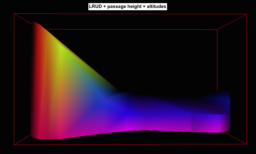
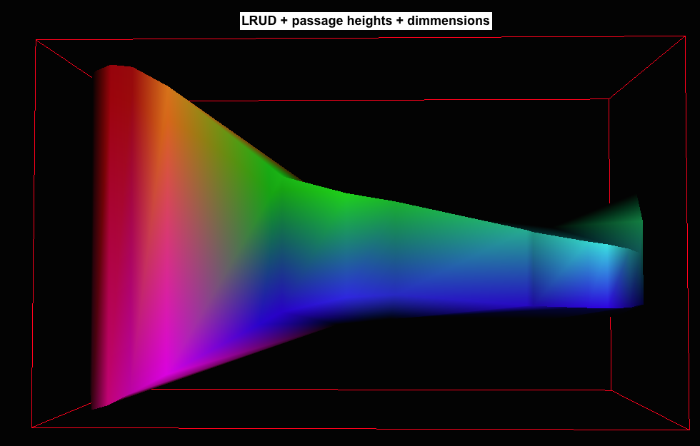
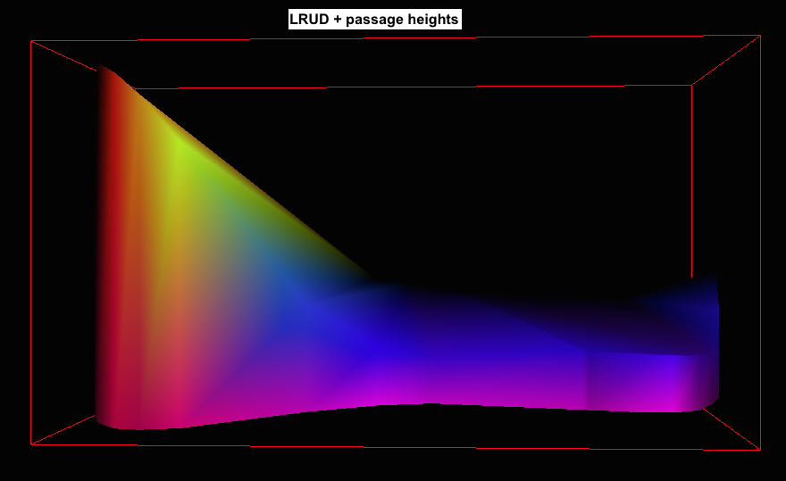
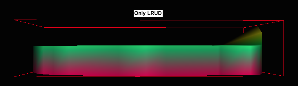
Thanks Martin, very informative. Phil
On 11 Dec 2016, at 21:49 PM, Martin Sluka via Therion <therion@speleo.sk> wrote:
I add four screen shots of very simple „cave“: <Snímek obrazovky 2016-12-11 v 21.33.58.png><Snímek obrazovky 2016-12-11 v 21.33.36.png><Snímek obrazovky 2016-12-11 v 21.33.05.png><Snímek obrazovky 2016-12-11 v 21.34.23.png>
fake_map_heights_alt <fake_map_heights_alt.pdf>
fake_map_heights_dim <fake_map_heights_dim.pdf>
fake_map_heights
<fake_map_heights.pdf> fake_map_no_heights
<fake_map_no_heights.pdf>
fake_no_map <fake_no_map.pdf> <Archiv.zip>
2. 12. 2016 v 10:48, Philippe Vernant via Therion <therion@speleo.sk>:
Thanks Martin. It already works quite nicely with the plan, looking forward to see the next release !
Best. Phil
On 02 Dec 2016, at 1:47 AM, Martin Sluka via Therion <therion@speleo.sk> wrote:
There is a problem, that those sentences are mostly wishes of authors than really working features.
I and many others I think are looking to next release which may work as described.
Martin
1. 12. 2016 v 21:58, Philippe Vernant via Therion <therion@speleo.sk>:
Hello,
I’m using and old map of a cave, a GIS and a code to compute the center line for Therion. Then I use the old map and this center line to redraw the cave and have the 3D view. This is working fine, but can I use the profiles also to have a better 3D rendering with variation of the height of the cave ? I see that in the manual it is written : "3D model is generated from 2D maps to get a realistic 3D model without entering too much data”. So I guess it will be useless to try to use the profile. Am I right ?
Thanks, Phil
_______________________________________________ Therion mailing list Therion@speleo.sk https://mailman.speleo.sk/listinfo/therion
_______________________________________________ Therion mailing list Therion@speleo.sk https://mailman.speleo.sk/listinfo/therion
_______________________________________________ Therion mailing list Therion@speleo.sk https://mailman.speleo.sk/listinfo/therion
_______________________________________________ Therion mailing list Therion@speleo.sk https://mailman.speleo.sk/listinfo/therion
Hi guys, I’m trying to merge some old survey data with new ones and I’d like to know the coordinates of some stations. this way I could compute the length, the azimuth and the dip angle between old and new stations to merge le file together. I’m trying to export the data in compass format, I know that I could get the coordinates in this file, but I have a message : therion: error -- thconfig [25] -- unknown format -- "compas" Any idea on how I could do that ? Thanks, Phil
OK my mistake, I could export the compass format. But if someone has a clever idea as how to do it easily without computing the difference between the two stations, I’d be happy to have the solution. Thanks, Phil
On 20 Dec 2016, at 17:43 PM, Philippe Vernant <phil.vernant@gmail.com> wrote:
Hi guys,
I’m trying to merge some old survey data with new ones and I’d like to know the coordinates of some stations. this way I could compute the length, the azimuth and the dip angle between old and new stations to merge le file together. I’m trying to export the data in compass format, I know that I could get the coordinates in this file, but I have a message :
therion: error -- thconfig [25] -- unknown format -- "compas"
Any idea on how I could do that ?
Thanks, Phil
What is source of your old data - maps? m.s.
20. 12. 2016 v 17:47, Philippe Vernant via Therion <therion@speleo.sk>:
OK my mistake, I could export the compass format. But if someone has a clever idea as how to do it easily without computing the difference between the two stations, I’d be happy to have the solution.
Thanks, Phil
On 20 Dec 2016, at 17:43 PM, Philippe Vernant <phil.vernant@gmail.com> wrote:
Hi guys,
I’m trying to merge some old survey data with new ones and I’d like to know the coordinates of some stations. this way I could compute the length, the azimuth and the dip angle between old and new stations to merge le file together. I’m trying to export the data in compass format, I know that I could get the coordinates in this file, but I have a message :
therion: error -- thconfig [25] -- unknown format -- "compas"
Any idea on how I could do that ?
Thanks, Phil
_______________________________________________ Therion mailing list Therion@speleo.sk https://mailman.speleo.sk/listinfo/therion
Several surveys and visual topo files, but not always the same stations … Phil
On 20 Dec 2016, at 19:47 PM, Martin Sluka via Therion <therion@speleo.sk> wrote:
What is source of your old data - maps?
m.s.
20. 12. 2016 v 17:47, Philippe Vernant via Therion <therion@speleo.sk>:
OK my mistake, I could export the compass format. But if someone has a clever idea as how to do it easily without computing the difference between the two stations, I’d be happy to have the solution.
Thanks, Phil
On 20 Dec 2016, at 17:43 PM, Philippe Vernant <phil.vernant@gmail.com> wrote:
Hi guys,
I’m trying to merge some old survey data with new ones and I’d like to know the coordinates of some stations. this way I could compute the length, the azimuth and the dip angle between old and new stations to merge le file together. I’m trying to export the data in compass format, I know that I could get the coordinates in this file, but I have a message :
therion: error -- thconfig [25] -- unknown format -- "compas"
Any idea on how I could do that ?
Thanks, Phil
_______________________________________________ Therion mailing list Therion@speleo.sk https://mailman.speleo.sk/listinfo/therion
_______________________________________________ Therion mailing list Therion@speleo.sk https://mailman.speleo.sk/listinfo/therion
20. 12. 2016 v 21:48, Philippe Vernant via Therion <therion@speleo.sk>:
Several surveys and visual topo files, but not always the same stations …
Check the page of Compass software - there is map to data converter. Maybe it will help. http://www.fountainware.com/compass/downloads/download.htm m.
Thanks Martin, Will do. Phil
On 20 Dec 2016, at 23:00 PM, Martin Sluka via Therion <therion@speleo.sk> wrote:
20. 12. 2016 v 21:48, Philippe Vernant via Therion <therion@speleo.sk>:
Several surveys and visual topo files, but not always the same stations …
Check the page of Compass software - there is map to data converter. Maybe it will help.
http://www.fountainware.com/compass/downloads/download.htm
m. _______________________________________________ Therion mailing list Therion@speleo.sk https://mailman.speleo.sk/listinfo/therion
Hello, and merry christmas! I currently try to correct some old surveys without altering the original data. The manual proposes the "revise" command to accomplish this, at least i interpreted it like this. The problem with the old data is, that the declination setting is wrong but i dont have write acces (archive). I now want to add a revise section so it remains obvious what the original data looked like. This does not work however, it seems that it is just ignored and produces the same aven-3d model... What am i doing wrong? Here comes some test data. My ultimate goal would be to have the revise section in a separate th-file where also all my maps/scras are referenced. -------------------------------------------------------------------------------------------------------- encoding UTF-8 survey test -title testsurvey centreline -id zug_1 date 2007.11.02 declination 0 degrees # bad declination here on purpose, should be "revise'd" later units length meters units bearing gradient degrees data normal from to length bearing gradient left right up down flags duplicate 1.AP1 1.A 23.25 292 -7 0.5 0.5 0.5 0.5 1.A 1.B 5.2 111 11 0.7 0.3 0 1 flags not duplicate 1.B 1.1 11.8 185 22 3 0 5 1 1.1 1.2 7.85 160 -30 2 2 5 1.5 1.2 1.3 16.1 160 90 0.8 0 5 0 1.3 1.4 19.8 233 81 0 0 0 0 1.4 1.5 7 40 10 0 0 0 0 1.5 1.6 21.8 140 70 0 1 0.5 0.5 endcentreline # correct declination setting # NOTE: This seems to not be functional.... neither of both work as expected revise zug_1 # declination 90 degrees # try one: adjust declination # calibrate compass 90 # try two: adjust compass calibration endrevise endsurvey test ------------------------------------------------------------------------------------------- Thank you in advance! Greetings, Beni

Hi Phil, cSurvey can also help with remastering of paper maps. Unfortunalty all documentation is in Italian but software is translated to English. http://csurvey.it/site/index.php/en/download Andrey
Вторник, 20 декабря 2016, 20:48 UTC от Philippe Vernant via Therion <therion@speleo.sk>:
Several surveys and visual topo files, but not always the same stations …
Phil
On 20 Dec 2016, at 19:47 PM, Martin Sluka via Therion < therion@speleo.sk > wrote:
What is source of your old data - maps?
m.s.
20. 12. 2016 v 17:47, Philippe Vernant via Therion < therion@speleo.sk >:
OK my mistake, I could export the compass format. But if someone has a clever idea as how to do it easily without computing the difference between the two stations, I’d be happy to have the solution.
Thanks, Phil
On 20 Dec 2016, at 17:43 PM, Philippe Vernant < phil.vernant@gmail.com > wrote:
Hi guys,
I’m trying to merge some old survey data with new ones and I’d like to know the coordinates of some stations. this way I could compute the length, the azimuth and the dip angle between old and new stations to merge le file together. I’m trying to export the data in compass format, I know that I could get the coordinates in this file, but I have a message :
therion: error -- thconfig [25] -- unknown format -- "compas"
Any idea on how I could do that ?
Thanks, Phil
_______________________________________________ Therion mailing list Therion@speleo.sk https://mailman.speleo.sk/listinfo/therion
_______________________________________________ Therion mailing list Therion@speleo.sk https://mailman.speleo.sk/listinfo/therion
_______________________________________________ Therion mailing list Therion@speleo.sk https://mailman.speleo.sk/listinfo/therion
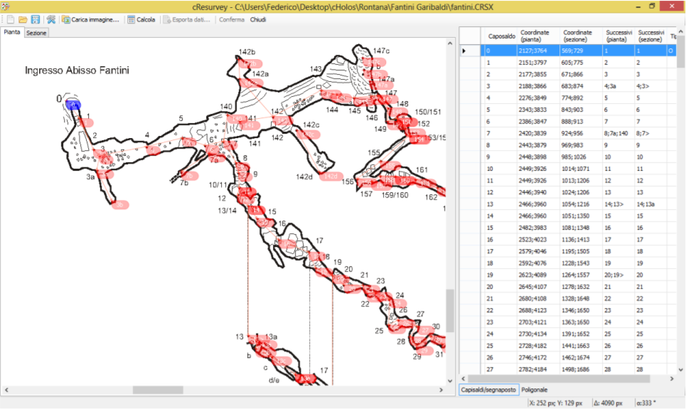
Hi Andrey, Thank you, I did not knew that software. Phil
On 20 Dec 2016, at 23:09 PM, андрей коженков via Therion <therion@speleo.sk> wrote:
Hi Phil,
cSurvey can also help with remastering of paper maps.
<image.png>
Unfortunalty all documentation is in Italian but software is translated to English. http://csurvey.it/site/index.php/en/download <http://csurvey.it/site/index.php/en/download>
Andrey
Вторник, 20 декабря 2016, 20:48 UTC от Philippe Vernant via Therion <therion@speleo.sk>:
Several surveys and visual topo files, but not always the same stations …
Phil
On 20 Dec 2016, at 19:47 PM, Martin Sluka via Therion <therion@speleo.sk <mailto:therion@speleo.sk>> wrote:
What is source of your old data - maps?
m.s.
20. 12. 2016 v 17:47, Philippe Vernant via Therion <therion@speleo.sk <mailto:therion@speleo.sk>>:
OK my mistake, I could export the compass format. But if someone has a clever idea as how to do it easily without computing the difference between the two stations, I’d be happy to have the solution.
Thanks, Phil
On 20 Dec 2016, at 17:43 PM, Philippe Vernant <phil.vernant@gmail.com <mailto:phil.vernant@gmail.com>> wrote:
Hi guys,
I’m trying to merge some old survey data with new ones and I’d like to know the coordinates of some stations. this way I could compute the length, the azimuth and the dip angle between old and new stations to merge le file together. I’m trying to export the data in compass format, I know that I could get the coordinates in this file, but I have a message :
therion: error -- thconfig [25] -- unknown format -- "compas"
Any idea on how I could do that ?
Thanks, Phil
_______________________________________________ Therion mailing list Therion@speleo.sk <mailto:Therion@speleo.sk> https://mailman.speleo.sk/listinfo/therion <https://mailman.speleo.sk/listinfo/therion>
_______________________________________________ Therion mailing list Therion@speleo.sk <mailto:Therion@speleo.sk> https://mailman.speleo.sk/listinfo/therion <https://mailman.speleo.sk/listinfo/therion>
_______________________________________________ Therion mailing list Therion@speleo.sk <mailto:Therion@speleo.sk> https://mailman.speleo.sk/listinfo/therion <https://mailman.speleo.sk/listinfo/therion>
_______________________________________________ Therion mailing list Therion@speleo.sk <mailto:Therion@speleo.sk> https://mailman.speleo.sk/listinfo/therion <https://mailman.speleo.sk/listinfo/therion>

Hi, I don´t know, if I have understood well what are you looking for, but for me the easiest way how to get xyz coordinates of some points in relative polygonal net (compass, clino, tape) is to set them as entrance in centerline (could be done very fast with all centerline in Excel): station 2 "2" entrance station 3 "3" entrance ... and thconfig has this part outside of layout: export cave-list -location on -o coordinates.html You get html list of station names and their coordinates. Pavel Dňa 2016-12-20 23:09 андрей коженков via Therion napísal(a):
Hi Phil,
cSurvey can also help with remastering of paper maps.
Unfortunalty all documentation is in Italian but software is translated to English. http://csurvey.it/site/index.php/en/download
Andrey
Вторник, 20 декабря 2016, 20:48 UTC от Philippe Vernant via Therion <therion@speleo.sk>:
Several surveys and visual topo files, but not always the same stations …
Phil
On 20 Dec 2016, at 19:47 PM, Martin Sluka via Therion <therion@speleo.sk> wrote:
What is source of your old data - maps?
m.s.
20. 12. 2016 v 17:47, Philippe Vernant via Therion <therion@speleo.sk>:
OK my mistake, I could export the compass format. But if someone has a clever idea as how to do it easily without computing the difference between the two stations, I’d be happy to have the solution.
Thanks, Phil
On 20 Dec 2016, at 17:43 PM, Philippe Vernant <phil.vernant@gmail.com> wrote:
Hi guys,
I’m trying to merge some old survey data with new ones and I’d like to know the coordinates of some stations. this way I could compute the length, the azimuth and the dip angle between old and new stations to merge le file together. I’m trying to export the data in compass format, I know that I could get the coordinates in this file, but I have a message :
therion: error -- thconfig [25] -- unknown format -- "compas"
Any idea on how I could do that ?
Thanks, Phil
_______________________________________________ Therion mailing list Therion@speleo.sk https://mailman.speleo.sk/listinfo/therion
_______________________________________________ Therion mailing list Therion@speleo.sk https://mailman.speleo.sk/listinfo/therion
_______________________________________________ Therion mailing list Therion@speleo.sk https://mailman.speleo.sk/listinfo/therion
Therion mailing list Therion@speleo.sk https://mailman.speleo.sk/listinfo/therion
Hi Pavel, I did work it out by extracting the coordinates from the .plt file, converting them from feet to meters and then computing the length, azimuth and distance between the 2 stations of the surveys that I needed to link. Thanks, Phil
On 21 Dec 2016, at 11:35 AM, Pavel Herich via Therion <therion@speleo.sk> wrote:
Hi, I don´t know, if I have understood well what are you looking for, but for me the easiest way how to get xyz coordinates of some points in relative polygonal net (compass, clino, tape) is to set them as entrance in centerline (could be done very fast with all centerline in Excel): station 2 "2" entrance station 3 "3" entrance ... and thconfig has this part outside of layout: export cave-list -location on -o coordinates.html
You get html list of station names and their coordinates. Pavel
Dňa 2016-12-20 23:09 андрей коженков via Therion napísal(a):
Hi Phil, cSurvey can also help with remastering of paper maps. Unfortunalty all documentation is in Italian but software is translated to English. http://csurvey.it/site/index.php/en/download Andrey
Вторник, 20 декабря 2016, 20:48 UTC от Philippe Vernant via Therion <therion@speleo.sk>: Several surveys and visual topo files, but not always the same stations … Phil
On 20 Dec 2016, at 19:47 PM, Martin Sluka via Therion <therion@speleo.sk> wrote: What is source of your old data - maps? m.s.
20. 12. 2016 v 17:47, Philippe Vernant via Therion <therion@speleo.sk>: OK my mistake, I could export the compass format. But if someone has a clever idea as how to do it easily without computing the difference between the two stations, I’d be happy to have the solution. Thanks, Phil
On 20 Dec 2016, at 17:43 PM, Philippe Vernant <phil.vernant@gmail.com> wrote: Hi guys, I’m trying to merge some old survey data with new ones and I’d like to know the coordinates of some stations. this way I could compute the length, the azimuth and the dip angle between old and new stations to merge le file together. I’m trying to export the data in compass format, I know that I could get the coordinates in this file, but I have a message : therion: error -- thconfig [25] -- unknown format -- "compas" Any idea on how I could do that ? Thanks, Phil
Therion mailing list Therion@speleo.sk https://mailman.speleo.sk/listinfo/therion
Therion mailing list Therion@speleo.sk https://mailman.speleo.sk/listinfo/therion
Therion mailing list Therion@speleo.sk https://mailman.speleo.sk/listinfo/therion
Therion mailing list Therion@speleo.sk https://mailman.speleo.sk/listinfo/therion
Therion mailing list Therion@speleo.sk https://mailman.speleo.sk/listinfo/therion
Anyway, you may use Survex and .3d file exported from Therion: 3dtopos - name of utulity 3dtopos — produce a .pos file from a .3d file Synopsis 3dtopos [options] {.3d file} [.pos file] Description 3dtopos takes a .3d file and produces a .pos file which contains a list of all the stations with coordinates (ordered x,y,z [East, North, Up]) and complete names. The stations are sorted such that numbers occur in the correct order (so “2” before “10”). 3dtopos even sorts numbers with a prefix and/or suffix, so you’d get: 040.sv8 040.sv8a 040.sv8b 040.sv8c 040.sv9 040.sv10 040.sv11 40_entrance_tag 40b_entrance_tag Survex 1.2.30 Manual 11 You can also export .pos files from aven in versions 1.2.19 and later.
For converting Compass survey data files into metric, you can use my Cave Converter program. http://wscc.darkgem.com/caveconverter/ You can read Compass data into the program, and export it as Survex format.
From this it is straight forward to copy and paste the data sections into Therion files. I am working on adding direct Therion export (and import) next.
Footleg On Wed, Dec 21, 2016 at 2:50 PM Martin Sluka via Therion <therion@speleo.sk> wrote:
Anyway, you may use Survex and .3d file exported from Therion:
3dtopos - name of utulity
3dtopos — produce a .pos file from a .3d file
Synopsis
3dtopos [options] {.3d file} [.pos file]
Description
3dtopos takes a .3d file and produces a .pos file which contains a list of all the stations with coordinates (ordered x,y,z [East, North, Up]) and complete names.
The stations are sorted such that numbers occur in the correct order (so “2” before “10”). 3dtopos even sorts numbers with a prefix and/or suffix, so you’d get:
040.sv8 040.sv8a 040.sv8b 040.sv8c 040.sv9 040.sv10 040.sv11 40_entrance_tag 40b_entrance_tag
Survex 1.2.30 Manual
11
You can also export .pos files from aven in versions 1.2.19 and later. _______________________________________________ Therion mailing list Therion@speleo.sk https://mailman.speleo.sk/listinfo/therion
Hi, Sorry for bothering you every day, today's question is : I have a toto.th file : survey toto -title “Toto" input toto_old.th input toto_new.th centerline equate 1.15@toto_old 1.3@toto_new endcenterline endsurvey Since I’m merging an old survey with a new one, I have stations from both surveys that are in the same scrap, in the toto-1p.th2 file I use: point 1271.69 1802.81 station -name 1.8@toto_old.toto But when I compile I have the following error : therion: error — toto-1p.th2 [10] -- survey does not exist -- toto_old.toto -- station does not exist -- 1.8@toto_old.toto What the heck am I missing ? Phil
Therion strictly uses „name spaces“. Where is command input toto-1p.th2? Martin
21. 12. 2016 v 13:40, Philippe Vernant via Therion <therion@speleo.sk>:
Hi,
Sorry for bothering you every day, today's question is : I have a toto.th file :
survey toto -title “Toto" input toto_old.th input toto_new.th
centerline equate 1.15@toto_old 1.3@toto_new endcenterline
endsurvey
Since I’m merging an old survey with a new one, I have stations from both surveys that are in the same scrap, in the toto-1p.th2 file I use:
point 1271.69 1802.81 station -name 1.8@toto_old.toto
But when I compile I have the following error :
therion: error — toto-1p.th2 [10] -- survey does not exist -- toto_old.toto -- station does not exist -- 1.8@toto_old.toto
What the heck am I missing ?
Phil _______________________________________________ Therion mailing list Therion@speleo.sk https://mailman.speleo.sk/listinfo/therion

Hi Phil, To complement Martin's question, the reference you use for your survey point in your scrap (1.8@toto_old.toto) is only valid if the toto-1p.th2 file containing the scrap is loaded outside the toto survey. By the way, I assume that you have a survey environment named toto_old in toto_old.th and similarly for toto_new. My personal preference would be to load the scraps within in the "toto" environment and to reference the station using -name 1.8@toto_old. Xavier Le 21-Dec-16 à 15:43, Martin Sluka via Therion a écrit :
Therion strictly uses „name spaces“.
Where is command input toto-1p.th2?
Martin
21. 12. 2016 v 13:40, Philippe Vernant via Therion <therion@speleo.sk>:
Hi,
Sorry for bothering you every day, today's question is : I have a toto.th file :
survey toto -title “Toto" input toto_old.th input toto_new.th
centerline equate 1.15@toto_old 1.3@toto_new endcenterline
endsurvey
Since I’m merging an old survey with a new one, I have stations from both surveys that are in the same scrap, in the toto-1p.th2 file I use:
point 1271.69 1802.81 station -name 1.8@toto_old.toto
But when I compile I have the following error :
therion: error — toto-1p.th2 [10] -- survey does not exist -- toto_old.toto -- station does not exist -- 1.8@toto_old.toto
What the heck am I missing ?
Phil _______________________________________________ Therion mailing list Therion@speleo.sk https://mailman.speleo.sk/listinfo/therion
Therion mailing list Therion@speleo.sk https://mailman.speleo.sk/listinfo/therion
--
------------------------- Xavier Pennec Senior Research Scientist / Directeur de recherche Asclepios project-team, INRIA Sophia-Antipolis 2004 Route des Lucioles, BP93 F-06902 Sophia-Antipolis Cedex, France +33 4 92 38 76 64 +33 6 78 35 16 90 http://www-sop.inria.fr/asclepios/ -------------------------------
Thanks Xavier, this is exactly what I did. Phil
On 21 Dec 2016, at 15:46 PM, Xavier Pennec via Therion <therion@speleo.sk> wrote:
Hi Phil,
To complement Martin's question, the reference you use for your survey point in your scrap (1.8@toto_old.toto) is only valid if the toto-1p.th2 file containing the scrap is loaded outside the toto survey. By the way, I assume that you have a survey environment named toto_old in toto_old.th and similarly for toto_new. My personal preference would be to load the scraps within in the "toto" environment and to reference the station using -name 1.8@toto_old.
Xavier
Le 21-Dec-16 à 15:43, Martin Sluka via Therion a écrit :
Therion strictly uses „name spaces“.
Where is command input toto-1p.th2?
Martin
21. 12. 2016 v 13:40, Philippe Vernant via Therion <therion@speleo.sk>:
Hi,
Sorry for bothering you every day, today's question is : I have a toto.th file :
survey toto -title “Toto" input toto_old.th input toto_new.th
centerline equate 1.15@toto_old 1.3@toto_new endcenterline
endsurvey
Since I’m merging an old survey with a new one, I have stations from both surveys that are in the same scrap, in the toto-1p.th2 file I use:
point 1271.69 1802.81 station -name 1.8@toto_old.toto
But when I compile I have the following error :
therion: error — toto-1p.th2 [10] -- survey does not exist -- toto_old.toto -- station does not exist -- 1.8@toto_old.toto
What the heck am I missing ?
Phil _______________________________________________ Therion mailing list Therion@speleo.sk https://mailman.speleo.sk/listinfo/therion
Therion mailing list Therion@speleo.sk https://mailman.speleo.sk/listinfo/therion
--
------------------------- Xavier Pennec Senior Research Scientist / Directeur de recherche Asclepios project-team, INRIA Sophia-Antipolis 2004 Route des Lucioles, BP93 F-06902 Sophia-Antipolis Cedex, France +33 4 92 38 76 64 +33 6 78 35 16 90 http://www-sop.inria.fr/asclepios/ -------------------------------
_______________________________________________ Therion mailing list Therion@speleo.sk https://mailman.speleo.sk/listinfo/therion
It is difficult to describe it without a picture. It all depends on level of survey and map you use. On first level you simply may use "input toto_old.th2 and use in map definition toto_old.map a scrap drawn in that file which may use station names directly - 1, 2, A, xx, scrap_1 point station 1 point station 2 ... endscrap The same for map toto_new.map (.map is not necessary, it is only helper to recognize maps more easy) map toto_old.map scrap_1 scrap_3 break scrap_2 …. endmap If you want to define map and use both (or more) scraps from toto_old.th2 and toto_new.th2 you just may write there in survey toto: input toto_old.th input toto_nex.th because both file includes particular th2 files yet. But in that case you have to define overall map as this: map toto.map map toto_old.map@toto_old map toto_new.map@toto_new endmap or map definition including only two scraps map toto.map scrap_1@toto_old scrap_1@toto_new endmap or other different map definition map toto.map scrap_3@toto_old toto_new.map@toto_new endmap If you want to use new scrap combined stations from both surveys you should use scrap scrap_1 point station 1@toto_pld point station 1@toto_new ….. endscrap But this scrap should be part of toto.th2 and you should write there input toto.th2 into toto.th file You may use informations only from one name space, not from several neighbors ones. I hope I wrote it correctly ;) m.s.
21. 12. 2016 v 21:16, Philippe Vernant via Therion <therion@speleo.sk>:
Thanks Xavier, this is exactly what I did.
Phil
On 21 Dec 2016, at 15:46 PM, Xavier Pennec via Therion <therion@speleo.sk> wrote:
Hi Phil,
To complement Martin's question, the reference you use for your survey point in your scrap (1.8@toto_old.toto) is only valid if the toto-1p.th2 file containing the scrap is loaded outside the toto survey. By the way, I assume that you have a survey environment named toto_old in toto_old.th and similarly for toto_new. My personal preference would be to load the scraps within in the "toto" environment and to reference the station using -name 1.8@toto_old.
Xavier
Le 21-Dec-16 à 15:43, Martin Sluka via Therion a écrit :
Therion strictly uses „name spaces“.
Where is command input toto-1p.th2?
Martin
21. 12. 2016 v 13:40, Philippe Vernant via Therion <therion@speleo.sk>:
Hi,
Sorry for bothering you every day, today's question is : I have a toto.th file :
survey toto -title “Toto" input toto_old.th input toto_new.th
centerline equate 1.15@toto_old 1.3@toto_new endcenterline
endsurvey
Since I’m merging an old survey with a new one, I have stations from both surveys that are in the same scrap, in the toto-1p.th2 file I use:
point 1271.69 1802.81 station -name 1.8@toto_old.toto
But when I compile I have the following error :
therion: error — toto-1p.th2 [10] -- survey does not exist -- toto_old.toto -- station does not exist -- 1.8@toto_old.toto
What the heck am I missing ?
Phil _______________________________________________ Therion mailing list Therion@speleo.sk https://mailman.speleo.sk/listinfo/therion
Therion mailing list Therion@speleo.sk https://mailman.speleo.sk/listinfo/therion
--
------------------------- Xavier Pennec Senior Research Scientist / Directeur de recherche Asclepios project-team, INRIA Sophia-Antipolis 2004 Route des Lucioles, BP93 F-06902 Sophia-Antipolis Cedex, France +33 4 92 38 76 64 +33 6 78 35 16 90 http://www-sop.inria.fr/asclepios/ -------------------------------
_______________________________________________ Therion mailing list Therion@speleo.sk https://mailman.speleo.sk/listinfo/therion
_______________________________________________ Therion mailing list Therion@speleo.sk https://mailman.speleo.sk/listinfo/therion
input toto-1p.th2 is either in toto_old.th or toto_new.th but it give the same error message. Thanks, Phil
On 21 Dec 2016, at 15:43 PM, Martin Sluka via Therion <therion@speleo.sk> wrote:
Therion strictly uses „name spaces“.
Where is command input toto-1p.th2?
Martin
21. 12. 2016 v 13:40, Philippe Vernant via Therion <therion@speleo.sk>:
Hi,
Sorry for bothering you every day, today's question is : I have a toto.th file :
survey toto -title “Toto" input toto_old.th input toto_new.th
centerline equate 1.15@toto_old 1.3@toto_new endcenterline
endsurvey
Since I’m merging an old survey with a new one, I have stations from both surveys that are in the same scrap, in the toto-1p.th2 file I use:
point 1271.69 1802.81 station -name 1.8@toto_old.toto
But when I compile I have the following error :
therion: error — toto-1p.th2 [10] -- survey does not exist -- toto_old.toto -- station does not exist -- 1.8@toto_old.toto
What the heck am I missing ?
Phil _______________________________________________ Therion mailing list Therion@speleo.sk https://mailman.speleo.sk/listinfo/therion
_______________________________________________ Therion mailing list Therion@speleo.sk https://mailman.speleo.sk/listinfo/therion
2016-09-27 15:38 GMT-03:00 Martin Sluka <martinsluka@mac.com>:
There is really a bug, because both symbols therion draws as raft.
Work around - define the user symbol raft_cone in your thconfig. Data are in attached zip file.
The workaround worked perfectly. Thanks. If you need any help/debug info/whatever to fix this, please let me know. Rodrigo
m.
On Sep 27, 2016, at 06:27 PM, Martin Sluka <martinsluka@mac.com> wrote:
what's happen when you manually remove those "-" from "raft-cone" in .th2 file?
point raft-cone -> point raftcone
m.
On Sep 27, 2016, at 04:57 PM, Rodrigo Severo <rodrigo@fabricadeideias.com> wrote:
2016-09-27 10:14 GMT-03:00 Rodrigo Severo <rodrigo@fabricadeideias.com>:
2016-09-27 8:41 GMT-03:00 Martin Sluka <martinsluka@mac.com>:
It could be. Just to delete manually hyphen in raft-cone in .th2 file and
compile it again.
Unfortunatelly not:
therion: error -- croqui4.th2 [57] -- unknown point type -- raftcone
What now?
I've just searched the therion executable with an hex editor. I found what seems to be the relation between point type name and the p_ type:
raft.p_raft.point raft-cone.p_raftcone.point
Everything seems to be fine. Except that's not working as expected.
Any ideias?
Rodrigo
On Sep 27, 2016, at 01:38 PM, Rodrigo Severo <rodrigo@fabricadeideias.com>
wrote:
2016-09-27 8:20 GMT-03:00 Rodrigo Severo <rodrigo@fabricadeideias.com>:
Could the problem be related to the fact that the point type written
on my th2 file is "raft-cone" with a hyphen and the p_ type is named
"raftcone" without a hyphen?
2016-09-27 3:03 GMT-03:00 Martin Sluka <martinsluka@mac.com>:
First of all, thanks for your help and attention.
There is the file thTrans.mp in the mpost directory of Therion.
In that file there are the rules which symbol to use for the final output.
Anyway it should work as you presume:
let p_scallop = p_scallop_UIS;
let p_flute = p_flute_UIS;
let p_raft = p_raft_NSS;
let p_raftcone = p_raftcone_NSS;
let p_spring = p_spring_SKBB;
let p_sink = p_sink_SKBB;
Check it, please.
Unfortunatelly I don`t have neither this file nor this directory on my
system. Did I mention that I`m using a Ubuntu package? ;)
Can`t I get this info from some file in the thTMPDIR?
I found this on the data.mp file:
root@prata15:~/Dropbox/EGB/exploracao poco
surubim/topografia/thTMPDIR# grep -irn raft .
./data.mp:1305:def p_raft_NSS (expr pos,theta,sc,al)=
./data.mp:1313:def p_raftcone_NSS (expr pos,theta,sc,al)=
./data.mp:4794:let p_raft = p_raft_NSS;
./data.mp:4795:let p_raftcone = p_raftcone_NSS;
./data.mp:4986:initsymbol("p_raft_NSS");
./data.mp:4987:initsymbol("p_raftcone_NSS");
./data.mp:5137:p_raft((-22.99,-140.49),0.0,1.00,(0,0));
./data.mp:5139:p_raft((-20.97,-127.92),0.0,1.00,(0,0));
./data.mp:5141:p_raft((-23.21,-110.27),0.0,1.00,(0,0));
./data.mp:5143:p_raft((-10.48,-105.85),0.0,1.00,(0,0));
.
.
.
There is this ¨:let p_raftcone = p_raftcone_NSS;¨ line that looks
promising but only p_raft is called, never p_raftcone
Ideias?
Martin s.
26. 9. 2016 v 23:30, Rodrigo Severo <rodrigo@fabricadeideias.com>:
Hi,
I'm producing PDFs of a map with raft cones but Therion is preparing a
PDF with raft (calcite raft) symbols instead.
I tried changing the points to raft but the rendering doesn't change.
I'm using Ubuntu Therion 5.3.16.
How can I further debug this issue?
Regards,
Rodrigo Severo
_______________________________________________
Therion mailing list
Therion@speleo.sk
https://mailman.speleo.sk/listinfo/therion
_______________________________________________
Therion mailing list
Therion@speleo.sk
https://mailman.speleo.sk/listinfo/therion
_______________________________________________
Therion mailing list
Therion@speleo.sk
https://mailman.speleo.sk/listinfo/therion
_______________________________________________
Therion mailing list
Therion@speleo.sk
https://mailman.speleo.sk/listinfo/therion
_______________________________________________ Therion mailing list Therion@speleo.sk https://mailman.speleo.sk/listinfo/therion
_______________________________________________ Therion mailing list Therion@speleo.sk https://mailman.speleo.sk/listinfo/therion
_______________________________________________ Therion mailing list Therion@speleo.sk https://mailman.speleo.sk/listinfo/therion
sorry, I missed your previous mail. Have you tried to run compiler with parameter -d (debug) m. On Sep 27, 2016, at 04:57 PM, Rodrigo Severo <rodrigo@fabricadeideias.com> wrote: 2016-09-27 10:14 GMT-03:00 Rodrigo Severo <rodrigo@fabricadeideias.com>: 2016-09-27 8:41 GMT-03:00 Martin Sluka <martinsluka@mac.com>: It could be. Just to delete manually hyphen in raft-cone in .th2 file and compile it again. Unfortunatelly not: therion: error -- croqui4.th2 [57] -- unknown point type -- raftcone What now? I've just searched the therion executable with an hex editor. I found what seems to be the relation between point type name and the p_ type: raft.p_raft.point raft-cone.p_raftcone.point Everything seems to be fine. Except that's not working as expected. Any ideias? Rodrigo On Sep 27, 2016, at 01:38 PM, Rodrigo Severo <rodrigo@fabricadeideias.com> wrote: 2016-09-27 8:20 GMT-03:00 Rodrigo Severo <rodrigo@fabricadeideias.com>: Could the problem be related to the fact that the point type written on my th2 file is "raft-cone" with a hyphen and the p_ type is named "raftcone" without a hyphen? 2016-09-27 3:03 GMT-03:00 Martin Sluka <martinsluka@mac.com>: First of all, thanks for your help and attention. There is the file thTrans.mp in the mpost directory of Therion. In that file there are the rules which symbol to use for the final output. Anyway it should work as you presume: let p_scallop = p_scallop_UIS; let p_flute = p_flute_UIS; let p_raft = p_raft_NSS; let p_raftcone = p_raftcone_NSS; let p_spring = p_spring_SKBB; let p_sink = p_sink_SKBB; Check it, please. Unfortunatelly I don`t have neither this file nor this directory on my system. Did I mention that I`m using a Ubuntu package? ;) Can`t I get this info from some file in the thTMPDIR? I found this on the data.mp file: root@prata15:~/Dropbox/EGB/exploracao poco surubim/topografia/thTMPDIR# grep -irn raft . ./data.mp:1305:def p_raft_NSS (expr pos,theta,sc,al)= ./data.mp:1313:def p_raftcone_NSS (expr pos,theta,sc,al)= ./data.mp:4794:let p_raft = p_raft_NSS; ./data.mp:4795:let p_raftcone = p_raftcone_NSS; ./data.mp:4986:initsymbol("p_raft_NSS"); ./data.mp:4987:initsymbol("p_raftcone_NSS"); ./data.mp:5137:p_raft((-22.99,-140.49),0.0,1.00,(0,0)); ./data.mp:5139:p_raft((-20.97,-127.92),0.0,1.00,(0,0)); ./data.mp:5141:p_raft((-23.21,-110.27),0.0,1.00,(0,0)); ./data.mp:5143:p_raft((-10.48,-105.85),0.0,1.00,(0,0)); . . . There is this ¨:let p_raftcone = p_raftcone_NSS;¨ line that looks promising but only p_raft is called, never p_raftcone Ideias? Martin s. 26. 9. 2016 v 23:30, Rodrigo Severo <rodrigo@fabricadeideias.com>: Hi, I'm producing PDFs of a map with raft cones but Therion is preparing a PDF with raft (calcite raft) symbols instead. I tried changing the points to raft but the rendering doesn't change. I'm using Ubuntu Therion 5.3.16. How can I further debug this issue? Regards, Rodrigo Severo _______________________________________________ Therion mailing list Therion@speleo.sk https://mailman.speleo.sk/listinfo/therion _______________________________________________ Therion mailing list Therion@speleo.sk https://mailman.speleo.sk/listinfo/therion _______________________________________________ Therion mailing list Therion@speleo.sk https://mailman.speleo.sk/listinfo/therion _______________________________________________ Therion mailing list Therion@speleo.sk https://mailman.speleo.sk/listinfo/therion _______________________________________________ Therion mailing list Therion@speleo.sk https://mailman.speleo.sk/listinfo/therion

On 2016-09-27 08:20 -0300, Rodrigo Severo wrote:
2016-09-27 3:03 GMT-03:00 Martin Sluka <martinsluka@mac.com>:
First of all, thanks for your help and attention.
There is the file thTrans.mp in the mpost directory of Therion.
In that file there are the rules which symbol to use for the final output.
Anyway it should work as you presume:
let p_scallop = p_scallop_UIS; let p_flute = p_flute_UIS; let p_raft = p_raft_NSS; let p_raftcone = p_raftcone_NSS; let p_spring = p_spring_SKBB; let p_sink = p_sink_SKBB;
Check it, please.
Unfortunatelly I don`t have neither this file nor this directory on my system. Did I mention that I`m using a Ubuntu package? ;)
Can`t I get this info from some file in the thTMPDIR?
I found this on the data.mp file:
root@prata15:~/Dropbox/EGB/exploracao poco surubim/topografia/thTMPDIR# grep -irn raft . ./data.mp:1305:def p_raft_NSS (expr pos,theta,sc,al)= ./data.mp:1313:def p_raftcone_NSS (expr pos,theta,sc,al)= ./data.mp:4794:let p_raft = p_raft_NSS; ./data.mp:4795:let p_raftcone = p_raftcone_NSS; ./data.mp:4986:initsymbol("p_raft_NSS"); ./data.mp:4987:initsymbol("p_raftcone_NSS"); ./data.mp:5137:p_raft((-22.99,-140.49),0.0,1.00,(0,0)); ./data.mp:5139:p_raft((-20.97,-127.92),0.0,1.00,(0,0)); ./data.mp:5141:p_raft((-23.21,-110.27),0.0,1.00,(0,0)); ./data.mp:5143:p_raft((-10.48,-105.85),0.0,1.00,(0,0));
So, this isn't going to help you much, becuase I don't understand it myself, but it's worth explaining. In the early days of Therion it did install various config files in the tex and metapost directories to get used when processing caves. However, whilst this worked fine on Linux, it was a pain for Windows/Mac people (as they have no packaging). So therion changed to 'inject' the config files automagicially into tex and metapost as needed. (So that's probably why you see this stuff in the tmpdir, but not elsewhere). I preferred it the old way as it made this sort of hackery easier (and was more obvious what was going on), but patching it back was work that didn't seem necessary and might lead to bugs unless I understood all that stuff much better than I do. It's still on the 'would be nice' list. I expect it's possible to put a file somsewhere to override all these things, but I don't know what or where. So, not a solution, but may be useful background. Wookey -- Principal hats: Linaro, Debian, Wookware, ARM http://wookware.org/
On 2016-09-27 10:30 -0300, Rodrigo Severo wrote:
2016-09-27 10:24 GMT-03:00 Wookey <wookey@wookware.org>:
So, not a solution, but may be useful background.
Yeah. Not a solution but useful background nonetheless.
So, for a bit more detail (as I'm wondering myself). In the source the mpost dir contains thArea.mp, thLine.mp, thtrans.mp etc thTrans.mp contains all the mappings from label to actual national symbol, including let p_raft = p_raft_NSS; all those files are concatenated by a script 'genmpost.pl' into thmpost.cxx. (SYMBOLS.txt, thsymbolsets.h, thsymbolsets.cxx are also created) thmpost.cxx is a 160K C++ file that essentially defines one huge string that is all the metapost config files. And that's what gets used (rather than just reading in the file(s) at runtime like a sensible arrangment would). I really would like to undo all this nonsense one day, but it's not actually broken, and presumably can't actually be thrown away because the Windows/Mac builds need it, so the incentives are not large. Wookey -- Principal hats: Linaro, Debian, Wookware, ARM http://wookware.org/
participants (10)
-
 Benedikt Hallinger
-
 Bruce Mutton
-
 Footleg
-
 Martin Sluka
-
 Pavel Herich
-
 Philippe Vernant
-
 Rodrigo Severo
-
 Wookey
-
 Xavier Pennec
-
 андрей коженков