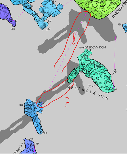
Thanks Martin I believe the map connection on the intermediate offset map is pointing, incorrectly, to its grandparent map, and not to its parent map. The -8 -8 map connection line should point up to the right at 45 degrees, from station 26 to station 25. While the intermediate map-connection is wrong, the first and last map-connections and all of the map offsets themselves are correctly made. One more question. I presume you have strict separation of surveys and maps in this dataset, as demonstrated here https://therion.speleo.sk/wiki/faq#how_to_arrange_the_maps and https://therion.speleo.sk/wiki/s_m ? Regards Bruce From: Therion <therion-bounces@speleo.sk> On Behalf Of Martin Sluka via Therion Sent: Friday, 24 March 2023 02:55 To: List for Therion users <therion@speleo.sk> Cc: Martin Sluka <martinsluka@mac.com> Subject: Re: [Therion] 2 Map-connection issue - Going to four levels - Offset tests SAMD-ITF-IS example I’m sorry, this is correct output with [-8 -8m ]: