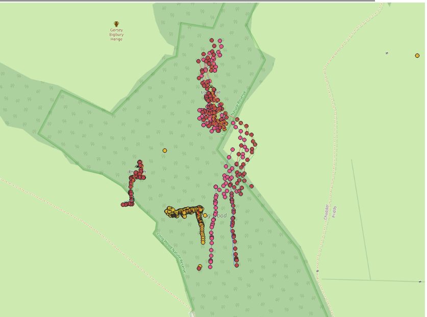
Hi all Not strictly a Therion question, but the answer is likely to be in the data entry or the interpretation of data in Therion. I'm slowly incorporating QGIS into my workflow, and trying to automate it. As such I'm using a modified version of the survex 3d importer https://github.com/AndrewAkinson/qgis3-survex-import_amend So that items can be easily switched on and off I'm going down the line of importing the 3d files by cave rather than the generated one for the whole catchment For now I'm doing it with the data in http://www.cave-registry.org.uk/svn/CheddarCatchment/ Currently I'm working on the Longwood Valley area as Longwood Valley Sink has been recently discovered. The directories I'm using RRift/ (3d needs to be generated from survex) LongwoodValleySink/ Longwood/ (Fake data with calibrate compass -90!) Toothache/ (single leg) In each of these directories the .th file generates a survex 3d file Also in the the root there is a LongwoodValley.thcfg which has the above caves (plus maybe Charterhouse, GB, TynningsGS and Reads depending on how I left it) In the diagram attached (hopefully this list does attachments!) The Dark purple dots are the import of the 3d file that has Rhino, Longwood, LongwoodValley Sink and Toothache together. The light pink, yellow dots are the individual imports (and entrances from the MCRA database.) Also included is an overlay of a scree shot from aven, which agrees with the group import. The question is why is Longwood different when imported as a 3d on its own compared with as a group? They are both using the same data! Andrew