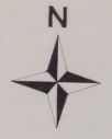
Hi all I'm wondering a bit about the results from the variable \cavedepth. May be it's not correct this way or I do have a different understanding and someone can explain to me why it is this way. I'm drawing a map (with scraps, points, walls etc) containing just a sidepassage of the entire cavesystem. Concerining the survey data I'm using "data diving ..." within centerline. The result from \cavedepth is now the maximum difference between the shallowest and deepest point of that part of the cave. E.g.: If I have surveypoints in this part of the cave from -15m to -20m the result in the header using \cavedepth is -5m. What I did expect to get from \cavedepth was the maximum depth of this part of the cave, so -20m. Because this is the relevant info to cavedivers. Is there any way to get this result without using the override from \cavedepth? I would like to use the automatic calculation of course but also want to get the maximum depth under water. 2nd question: I would like to use a northarrow as you can see in the attached file. Does anyone have some code for that? Thanks for your help. cheers, Torsten