On 20.4.2009, at 16:04, Footleg wrote:
Just returned from Matienzo exedition in Spain using a DistoX with PocketTopo on a Windows Mobile PDA. I found it to be a very powerful and time saving way to survey. Sketching underground is still the rate limiting step, but being able to extract the data (into Survex in my case) and get a scale survey printed out within minutes after the trip was superb.
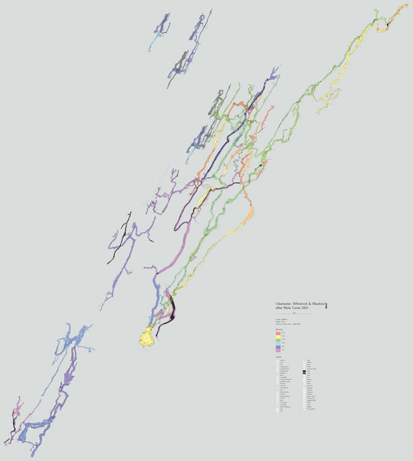
Just an example of real using of Therion - Dave Clucas drawn more than 24 km of new explored passages on Mulu 2009 expedition. The attached file illustrated what was finished at the day of end of expedition. Footleg, I know, I wrote it before, but just try the import to therion from data file exported from PocketTopo. Both to data editor and map editor. Martin