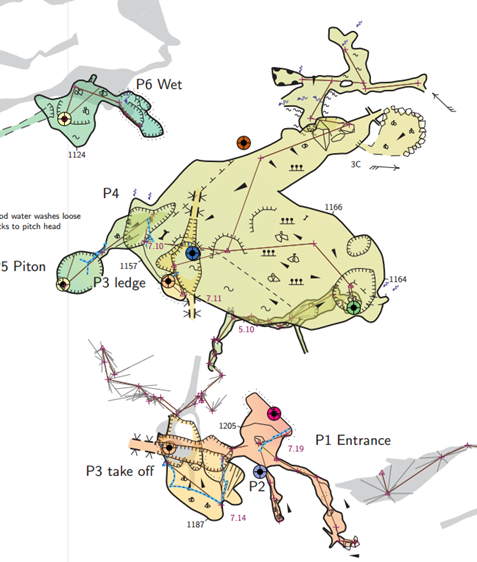
2. Connexions lines for offseted scraps:
My project covers a 4 kms cave that I have splitted into 4 sub-projects (called networks), I work in each network and gather them to get final export, usually I use connexion point in the scrap.
- Network 1 is above Network 2, therefore in the final presentation I offset Network 2
- Network 2 includes itself offseted areas which appear well when I work on export of Network 2 only.
When I compile the global project all connexion's doted lines inside network 2 appears then linked to the shadow of the network 2 offseted from the Network 1 instead of staying linked to the Network 2 >representation, result is awful with dotted lines crossing everywhere and ending in the shadow area.
Any ideas to maintain local connexion dotted line where they were at the beginning?
Thanks in advance
David
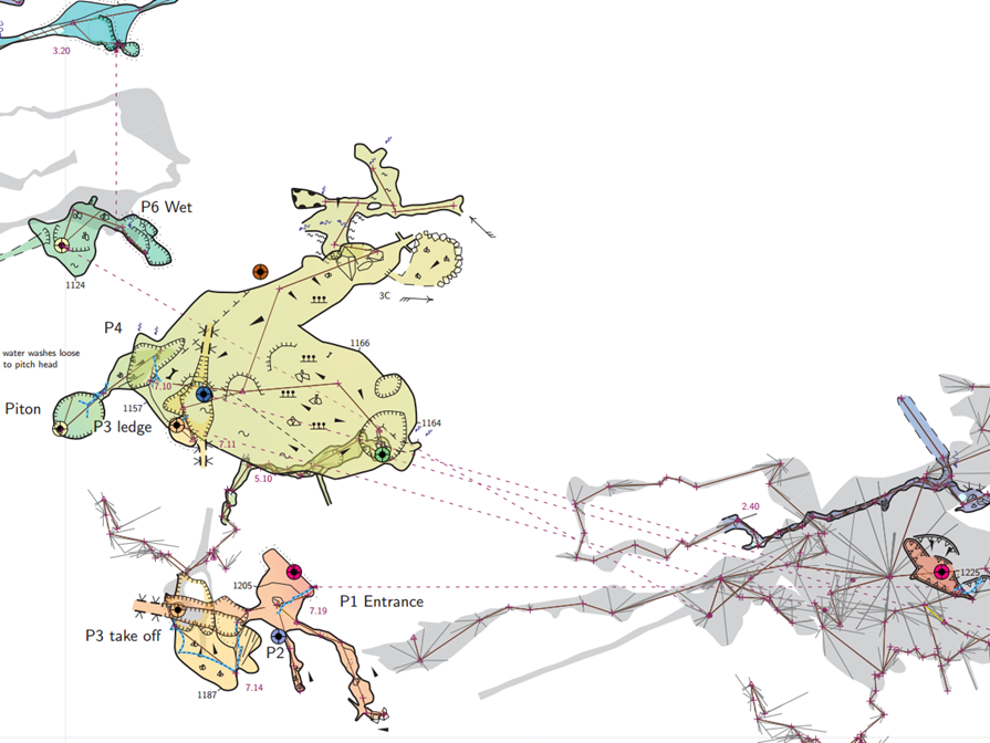
David, Tarquin I think David is experiencing the problem that sent me in the direction of ICCaving Migovec project point connection symbols. I think Tarquin’s explanation and approach, https://therion.speleo.sk/wiki/mapconnectors, like the Therion Book example only goes two levels deep, ie offset of offset. I have attempted to go three levels, offset of offset of offset, and the map-connections that worked for two level suddenly flip to originate from the main map. Below I show the image that I provided in my last email, and for comparison the same image with point (line) map-connection shown. It is a vertical shaft system with sufficient horizontal development at some levels to warrant plan views as well as elevation views. If I stick to two levels of offset, the map-connectors are recti-linear going from map to submap to submap (rectilinear). If I go to three or more levels they flip to going from the map selected for export to the respective submaps (radial), as is shown in the above image. I tried to explain the problem and some of the experimentation I have tried here https://github.com/therion/therion/issues/412 My explanation is tedious and hard to follow I am afraid. Still unsure if I am doing something wrong, or if there is some work around I can use. I could keep to two levels offset, but doing that results in a map that is hard to follow. For now the IC Caving Migovec approach seems best, but I would prefer to be able to make judicious use of both at the same time. Bruce