Export EE as .3D and ignore "survey does not exist"

Hello, I have two questions: 1) Is it possible to export an extended elevation as a 3D file (like survex does)? For the purpose of 'debugging' the extends etc. 2) Is it possible to ignore "survey does not exist" errors? I.e. I have a file with all the extend commands in and I just want the relevant ones to be applied, even if I am just looking at a small section. Thanks for any help, Rhys

1) Is it possible to export an extended elevation as a 3D file (like survex does)? For the purpose of 'debugging' the extends etc.
I doubt this is entirely possible. There are some kinds of extend options that Therion supports but Survex does not, such as "extend vertical". So I don't think you could turn it into a Survex-style 3D if you use those options. I usually export it to PDF to see how it renders. You could also export it as a Therion XVI (since that's what you will end up using anyway) and import that into a .th2 to see how it looks.
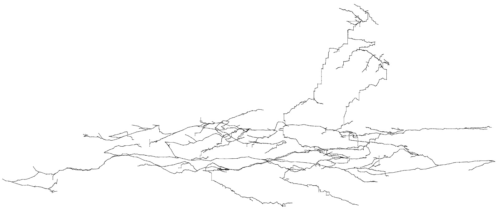
Thanks for the info. I have been using a PDF output but its a bit tricky to see everything. The 3D view of the EE was nice because it handled large systems and preserved the station names. I am attempting to recreate the EE centerline of a ~ 20km section of a cave system which I have now done by adding passages one by one: [image: image.png] When things weren't working things would overlap and it became impossible to identify the stations. I wanted the center line done separate to drawing so I can 'crowd source' the drawing with other members of my expedition but they obviously need the center line completed to draw arbitrary bits of cave. My questions are probably stupid because this is a stupid thing to do 😁. I have another question but I will ask it in another thread. I also means I do not need an answer to question 2 about ignoring errors. On Sun, 1 Mar 2020 at 21:34, Tarquin Wilton-Jones via Therion < therion@speleo.sk> wrote:
1) Is it possible to export an extended elevation as a 3D file (like survex does)? For the purpose of 'debugging' the extends etc.
I doubt this is entirely possible. There are some kinds of extend options that Therion supports but Survex does not, such as "extend vertical". So I don't think you could turn it into a Survex-style 3D if you use those options.
I usually export it to PDF to see how it renders.
You could also export it as a Therion XVI (since that's what you will end up using anyway) and import that into a .th2 to see how it looks. _______________________________________________ Therion mailing list Therion@speleo.sk https://mailman.speleo.sk/listinfo/therion

On Sun, Mar 01, 2020 at 09:34:32PM +0000, Tarquin Wilton-Jones via Therion wrote:
1) Is it possible to export an extended elevation as a 3D file (like survex does)? For the purpose of 'debugging' the extends etc.
I doubt this is entirely possible. There are some kinds of extend options that Therion supports but Survex does not, such as "extend vertical". So I don't think you could turn it into a Survex-style 3D if you use those options.
An "extended elevation" .3d file is really just a normal .3d file with a flag set (as of v8 of the .3d format there's an explicit flag, while for older versions it's done by checking for a title ending " (extended)"). If this flag is present, aven limits the view to be an elevation looking North or South. The Survex extend program folds the centreline to lie in an East-West vertical plane through the origin, with splays rotated along with the centre-line they're adjacent to but allowed to stick out of this plane. There's no explicit representation of the extend operations which were applied, only of the results, so "extend vertical" shouldn't be a problem. I can't think of an extend-like feature which couldn't be easily fitted into this "2D+" representation. Cheers, Olly
participants (3)
-
 Olly Betts
-
 Rhys Tyers
-
 Tarquin Wilton-Jones