Build a map with all centerline and partial walls

I am looking at this entry in the Wiki: https://therion.speleo.sk/wiki/tips#showing_centreline_for_parts_of_a_cave_a... My understanding it that this requires making two sets of centerline data, then creating a survey for each set. One of the data sets is for that part of the cave which has walls/scraps and the other is for the remainder of the cave. The thconfig file is set up with only one survey/endsurvey section. I think this also would have to change into two sections. Is this correct? The cave I want to do this for has all centerline data in one big file. It would be a huge pain to separate that into two files. Even more of a pain would be moving the data as sketching is completed. Thanks! -- =============== Bill Gee

It means you want only centerline for all the data set and walls for only part of a cave. Correct? Define map which will contain only survey data. Define other map, which will contain only sraps or maps from scraps for that part of the cave you want. Define map, which will include both maps defined above. Select this map in thconfig Add to layout: symbol-hide group all symbol-show line wall symbol-show group centerline (or symbol-show line centerline) It should work M. Odesláno z iPhonu
25. 11. 2024 v 14:03, Bill Gee <bgee@campercaver.net>:
I am looking at this entry in the Wiki:
https://therion.speleo.sk/wiki/tips#showing_centreline_for_parts_of_a_cave_a...
My understanding it that this requires making two sets of centerline data, then creating a survey for each set. One of the data sets is for that part of the cave which has walls/scraps and the other is for the remainder of the cave.
The thconfig file is set up with only one survey/endsurvey section. I think this also would have to change into two sections.
Is this correct?
The cave I want to do this for has all centerline data in one big file. It would be a huge pain to separate that into two files. Even more of a pain would be moving the data as sketching is completed.
Thanks! -- =============== Bill Gee
_______________________________________________ Therion mailing list Therion@speleo.sk https://mailman.speleo.sk/listinfo/therion
Actually, I would like full detail where it exists and centerline only where it does not. Martin's hints give me an idea how to get this. It will take a day or two for me to set it up and test. I also want maps where only the drawn stuff is shown. I think what I need to do is leave those parts of *.th2 and thconfig alone, and add new stuff as noted by Martin. One additional question regarding the "select" statement location ... I think I need to put it in thconfig just before the layout and export lines that creates the file, like this: ====================== thconfig ============ select MainPlan layout basics ... endlayout (more layout sections) export map -proj plan -layout ChosenLayout -o Outputfile (several more "export map" commands to get Loch, Aven, KML etc files) select FullMap layout FullMapLayout ... endlayout export map -proj plan -layout FullMapLayout -o AnotherOutputFile ====================== Is this about right? Another way I might do it is to create entirely new thconfig and *.th2 files just for this map, then use a "system" call in the main thconfig to launch another instance of therion with the alternate thconfig as a command line option. =============== Bill Gee On 11/25/24 08:38, Martin Sluka via Therion wrote:
It means you want only centerline for all the data set and walls for only part of a cave. Correct?
Define map which will contain only survey data. Define other map, which will contain only sraps or maps from scraps for that part of the cave you want. Define map, which will include both maps defined above. Select this map in thconfig Add to layout: symbol-hide group all symbol-show line wall symbol-show group centerline (or symbol-show line centerline)
It should work
M.
Odesláno z iPhonu
25. 11. 2024 v 14:03, Bill Gee <bgee@campercaver.net>:
I am looking at this entry in the Wiki:
https://therion.speleo.sk/wiki/tips#showing_centreline_for_parts_of_a_cave_a...
My understanding it that this requires making two sets of centerline data, then creating a survey for each set. One of the data sets is for that part of the cave which has walls/scraps and the other is for the remainder of the cave.
The thconfig file is set up with only one survey/endsurvey section. I think this also would have to change into two sections.
Is this correct?
The cave I want to do this for has all centerline data in one big file. It would be a huge pain to separate that into two files. Even more of a pain would be moving the data as sketching is completed.
Thanks! -- =============== Bill Gee
_______________________________________________ Therion mailing list Therion@speleo.sk https://mailman.speleo.sk/listinfo/therion
Therion mailing list Therion@speleo.sk https://mailman.speleo.sk/listinfo/therion
select command will select the specific map definition. Without select therion will collect all maps it will find in data set. There should be the command source first - which define which .th file to use. Martin
25. 11. 2024 v 16:31, Bill Gee <bgee@campercaver.net>:
One additional question regarding the "select" statement location ... I think I need to put it in thconfig just before the layout and export lines that creates the file
Thank you all for your suggestions and hints. I have figured out how to make this work - Mostly! Take a look at this map: https://campercaver.net/MiscFiles/CaveSpringCave-All.pdf This is very close to what I want. The only problem is more of an annoyance. It appears that adding the centerline as a survey makes Therion process the LRUDs to come up with a pseudo-wall. I would like that to go away. I tried adding "hide-symbol line wall" to the layout, but that made all of the walls go away. In the thconfig file I changed the "source" line to the new .th file, added a symbol-hide line for cross-sections and changed the name of the output file on the export line. I also changed the "select" line to reference MainPlan-All. Here is how I set up the .th file: ======================== map MainPlan-All MainPlan MainCenterLine endmap # Create the main map to include all submaps map MainPlan -title "CaveSpringCave (SHN-017) - Plan View" -projection plan # X and Y upper level X-Survey@CaveSpringCave Y-Survey@CaveSpringCave # Main passages MainPassages@CaveSpringCave # Lower stream passage A-Entrance@CaveSpringCave A-Survey@CaveSpringCave # T-Survey - Small side passage off upper trunk T-Survey@CaveSpringCave endmap survey MainCenterLine centreline # Define the units that will be used. units compass degrees units clino degrees units length feet units depth feet units tape feet units altitude feet units dimensions feet # A separate file contains all of the survey data. Use multiple files as needed input CaveSpringCave-Surveydata.txt endcentreline endsurvey survey CaveSpringCave -title "Cave Spring Cave" centreline # Define the units that will be used. units compass degrees units clino degrees units length feet units depth feet units tape feet units altitude feet units dimensions feet # A separate file contains all of the survey data. Use multiple files as needed input CaveSpringCave-Surveydata.txt endcentreline # Lower stream passage A survey input 20161107/CaveSpringCave-LowerEntrance.th2 input 20221013/CaveSpringCave-A3-A7.th2 input 20221013/CaveSpringCave-A7-A17.th2 [much more omitted ...] ============================== =============== Bill Gee On 11/25/24 09:31, Bill Gee wrote:
Actually, I would like full detail where it exists and centerline only where it does not. Martin's hints give me an idea how to get this. It will take a day or two for me to set it up and test.
I also want maps where only the drawn stuff is shown. I think what I need to do is leave those parts of *.th2 and thconfig alone, and add new stuff as noted by Martin.
One additional question regarding the "select" statement location ... I think I need to put it in thconfig just before the layout and export lines that creates the file, like this:
====================== thconfig ============ select MainPlan
layout basics ... endlayout
(more layout sections)
export map -proj plan -layout ChosenLayout -o Outputfile
(several more "export map" commands to get Loch, Aven, KML etc files)
select FullMap
layout FullMapLayout ... endlayout
export map -proj plan -layout FullMapLayout -o AnotherOutputFile ======================
Is this about right?
Another way I might do it is to create entirely new thconfig and *.th2 files just for this map, then use a "system" call in the main thconfig to launch another instance of therion with the alternate thconfig as a command line option.
=============== Bill Gee
On 11/25/24 08:38, Martin Sluka via Therion wrote:
It means you want only centerline for all the data set and walls for only part of a cave. Correct?
Define map which will contain only survey data. Define other map, which will contain only sraps or maps from scraps for that part of the cave you want. Define map, which will include both maps defined above. Select this map in thconfig Add to layout: symbol-hide group all symbol-show line wall symbol-show group centerline (or symbol-show line centerline)
It should work
M.
Odesláno z iPhonu
25. 11. 2024 v 14:03, Bill Gee <bgee@campercaver.net>:
I am looking at this entry in the Wiki:
https://therion.speleo.sk/wiki/ tips#showing_centreline_for_parts_of_a_cave_and_passage_walls_for_others
My understanding it that this requires making two sets of centerline data, then creating a survey for each set. One of the data sets is for that part of the cave which has walls/scraps and the other is for the remainder of the cave.
The thconfig file is set up with only one survey/endsurvey section. I think this also would have to change into two sections.
Is this correct?
The cave I want to do this for has all centerline data in one big file. It would be a huge pain to separate that into two files. Even more of a pain would be moving the data as sketching is completed.
Thanks! -- =============== Bill Gee
_______________________________________________ Therion mailing list Therion@speleo.sk https://mailman.speleo.sk/listinfo/therion
Therion mailing list Therion@speleo.sk https://mailman.speleo.sk/listinfo/therion
_______________________________________________ Therion mailing list Therion@speleo.sk https://mailman.speleo.sk/listinfo/therion

This should help a bit: data normal from to tape compass clino ignoreall #ignore all lrud data in centerline 14P 15P 7.91 345 2.5 1.6 0.2 1.5 0.3 15P 16P 5.4 25 -3 0 1.5 1.2 2 ... Pavel Dňa 2024-11-26 16:46 Bill Gee napísal(a):
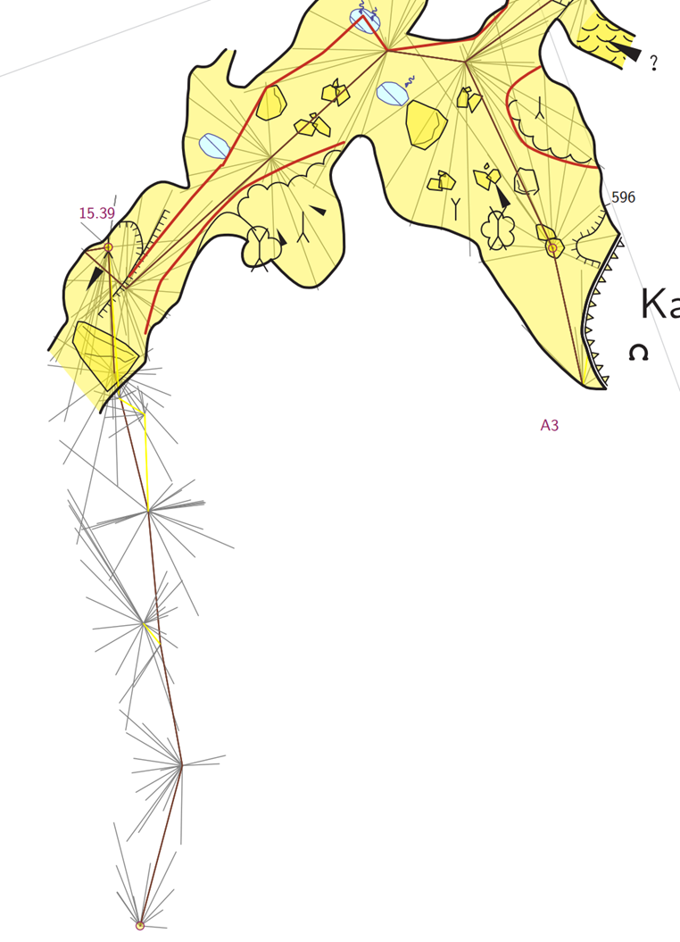
Thank you all for your suggestions and hints. I have figured out how to make this work - Mostly!
Take a look at this map:
https://campercaver.net/MiscFiles/CaveSpringCave-All.pdf
This is very close to what I want. The only problem is more of an annoyance. It appears that adding the centerline as a survey makes Therion process the LRUDs to come up with a pseudo-wall. I would like that to go away. I tried adding "hide-symbol line wall" to the layout, but that made all of the walls go away.
In the thconfig file I changed the "source" line to the new .th file, added a symbol-hide line for cross-sections and changed the name of the output file on the export line. I also changed the "select" line to reference MainPlan-All.
Here is how I set up the .th file:
======================== map MainPlan-All MainPlan MainCenterLine endmap
# Create the main map to include all submaps map MainPlan -title "CaveSpringCave (SHN-017) - Plan View" -projection plan
# X and Y upper level X-Survey@CaveSpringCave Y-Survey@CaveSpringCave
# Main passages MainPassages@CaveSpringCave
# Lower stream passage A-Entrance@CaveSpringCave A-Survey@CaveSpringCave
# T-Survey - Small side passage off upper trunk T-Survey@CaveSpringCave endmap
survey MainCenterLine centreline
# Define the units that will be used. units compass degrees units clino degrees units length feet units depth feet units tape feet units altitude feet units dimensions feet
# A separate file contains all of the survey data. Use multiple files as needed input CaveSpringCave-Surveydata.txt
endcentreline endsurvey
survey CaveSpringCave -title "Cave Spring Cave"
centreline
# Define the units that will be used. units compass degrees units clino degrees units length feet units depth feet units tape feet units altitude feet units dimensions feet
# A separate file contains all of the survey data. Use multiple files as needed input CaveSpringCave-Surveydata.txt
endcentreline
# Lower stream passage A survey input 20161107/CaveSpringCave-LowerEntrance.th2 input 20221013/CaveSpringCave-A3-A7.th2 input 20221013/CaveSpringCave-A7-A17.th2 [much more omitted ...]
==============================
=============== Bill Gee
On 11/25/24 09:31, Bill Gee wrote:
Actually, I would like full detail where it exists and centerline only where it does not. Martin's hints give me an idea how to get this. It will take a day or two for me to set it up and test.
I also want maps where only the drawn stuff is shown. I think what I need to do is leave those parts of *.th2 and thconfig alone, and add new stuff as noted by Martin.
One additional question regarding the "select" statement location ... I think I need to put it in thconfig just before the layout and export lines that creates the file, like this:
====================== thconfig ============ select MainPlan
layout basics ... endlayout
(more layout sections)
export map -proj plan -layout ChosenLayout -o Outputfile
(several more "export map" commands to get Loch, Aven, KML etc files)
select FullMap
layout FullMapLayout ... endlayout
export map -proj plan -layout FullMapLayout -o AnotherOutputFile ======================
Is this about right?
Another way I might do it is to create entirely new thconfig and *.th2 files just for this map, then use a "system" call in the main thconfig to launch another instance of therion with the alternate thconfig as a command line option.
=============== Bill Gee
On 11/25/24 08:38, Martin Sluka via Therion wrote:
It means you want only centerline for all the data set and walls for only part of a cave. Correct?
Define map which will contain only survey data. Define other map, which will contain only sraps or maps from scraps for that part of the cave you want. Define map, which will include both maps defined above. Select this map in thconfig Add to layout: symbol-hide group all symbol-show line wall symbol-show group centerline (or symbol-show line centerline)
It should work
M.
Odesláno z iPhonu
25. 11. 2024 v 14:03, Bill Gee <bgee@campercaver.net>:
I am looking at this entry in the Wiki:
https://therion.speleo.sk/wiki/ tips#showing_centreline_for_parts_of_a_cave_and_passage_walls_for_others
My understanding it that this requires making two sets of centerline data, then creating a survey for each set. One of the data sets is for that part of the cave which has walls/scraps and the other is for the remainder of the cave.
The thconfig file is set up with only one survey/endsurvey section. I think this also would have to change into two sections.
Is this correct?
The cave I want to do this for has all centerline data in one big file. It would be a huge pain to separate that into two files. Even more of a pain would be moving the data as sketching is completed.
Thanks! -- =============== Bill Gee
_______________________________________________ Therion mailing list Therion@speleo.sk https://mailman.speleo.sk/listinfo/therion
Therion mailing list Therion@speleo.sk https://mailman.speleo.sk/listinfo/therion
_______________________________________________ Therion mailing list Therion@speleo.sk https://mailman.speleo.sk/listinfo/therion
_______________________________________________ Therion mailing list Therion@speleo.sk https://mailman.speleo.sk/listinfo/therion
Hi Pavel - It might - but then I have to keep two copies of the centerline data. Might not be so bad now, but as more is added, I have to make sure both data sets are in sync. =============== Bill Gee On 11/26/24 09:56, Pavel Herich wrote:
This should help a bit:
data normal from to tape compass clino ignoreall #ignore all lrud data in centerline 14P 15P 7.91 345 2.5 1.6 0.2 1.5 0.3 15P 16P 5.4 25 -3 0 1.5 1.2 2 ...
Pavel
Dňa 2024-11-26 16:46 Bill Gee napísal(a):
Thank you all for your suggestions and hints. I have figured out how to make this work - Mostly!
Take a look at this map:
https://campercaver.net/MiscFiles/CaveSpringCave-All.pdf
This is very close to what I want. The only problem is more of an annoyance. It appears that adding the centerline as a survey makes Therion process the LRUDs to come up with a pseudo-wall. I would like that to go away. I tried adding "hide-symbol line wall" to the layout, but that made all of the walls go away.
In the thconfig file I changed the "source" line to the new .th file, added a symbol-hide line for cross-sections and changed the name of the output file on the export line. I also changed the "select" line to reference MainPlan-All.
Here is how I set up the .th file:
======================== map MainPlan-All MainPlan MainCenterLine endmap
# Create the main map to include all submaps map MainPlan -title "CaveSpringCave (SHN-017) - Plan View" -projection plan
# X and Y upper level X-Survey@CaveSpringCave Y-Survey@CaveSpringCave
# Main passages MainPassages@CaveSpringCave
# Lower stream passage A-Entrance@CaveSpringCave A-Survey@CaveSpringCave
# T-Survey - Small side passage off upper trunk T-Survey@CaveSpringCave endmap
survey MainCenterLine centreline
# Define the units that will be used. units compass degrees units clino degrees units length feet units depth feet units tape feet units altitude feet units dimensions feet
# A separate file contains all of the survey data. Use multiple files as needed input CaveSpringCave-Surveydata.txt
endcentreline endsurvey
survey CaveSpringCave -title "Cave Spring Cave"
centreline
# Define the units that will be used. units compass degrees units clino degrees units length feet units depth feet units tape feet units altitude feet units dimensions feet
# A separate file contains all of the survey data. Use multiple files as needed input CaveSpringCave-Surveydata.txt
endcentreline
# Lower stream passage A survey input 20161107/CaveSpringCave-LowerEntrance.th2 input 20221013/CaveSpringCave-A3-A7.th2 input 20221013/CaveSpringCave-A7-A17.th2 [much more omitted ...]
==============================
=============== Bill Gee
On 11/25/24 09:31, Bill Gee wrote:
Actually, I would like full detail where it exists and centerline only where it does not. Martin's hints give me an idea how to get this. It will take a day or two for me to set it up and test.
I also want maps where only the drawn stuff is shown. I think what I need to do is leave those parts of *.th2 and thconfig alone, and add new stuff as noted by Martin.
One additional question regarding the "select" statement location ... I think I need to put it in thconfig just before the layout and export lines that creates the file, like this:
====================== thconfig ============ select MainPlan
layout basics ... endlayout
(more layout sections)
export map -proj plan -layout ChosenLayout -o Outputfile
(several more "export map" commands to get Loch, Aven, KML etc files)
select FullMap
layout FullMapLayout ... endlayout
export map -proj plan -layout FullMapLayout -o AnotherOutputFile ======================
Is this about right?
Another way I might do it is to create entirely new thconfig and *.th2 files just for this map, then use a "system" call in the main thconfig to launch another instance of therion with the alternate thconfig as a command line option.
=============== Bill Gee
On 11/25/24 08:38, Martin Sluka via Therion wrote:
It means you want only centerline for all the data set and walls for only part of a cave. Correct?
Define map which will contain only survey data. Define other map, which will contain only sraps or maps from scraps for that part of the cave you want. Define map, which will include both maps defined above. Select this map in thconfig Add to layout: symbol-hide group all symbol-show line wall symbol-show group centerline (or symbol-show line centerline)
It should work
M.
Odesláno z iPhonu
25. 11. 2024 v 14:03, Bill Gee <bgee@campercaver.net>:
I am looking at this entry in the Wiki:
https://therion.speleo.sk/wiki/ tips#showing_centreline_for_parts_of_a_cave_and_passage_walls_for_others
My understanding it that this requires making two sets of centerline data, then creating a survey for each set. One of the data sets is for that part of the cave which has walls/scraps and the other is for the remainder of the cave.
The thconfig file is set up with only one survey/endsurvey section. I think this also would have to change into two sections.
Is this correct?
The cave I want to do this for has all centerline data in one big file. It would be a huge pain to separate that into two files. Even more of a pain would be moving the data as sketching is completed.
Thanks! -- =============== Bill Gee
_______________________________________________ Therion mailing list Therion@speleo.sk https://mailman.speleo.sk/listinfo/therion
Therion mailing list Therion@speleo.sk https://mailman.speleo.sk/listinfo/therion
_______________________________________________ Therion mailing list Therion@speleo.sk https://mailman.speleo.sk/listinfo/therion
_______________________________________________ Therion mailing list Therion@speleo.sk https://mailman.speleo.sk/listinfo/therion
Therion mailing list Therion@speleo.sk https://mailman.speleo.sk/listinfo/therion
So you should generate another/duplicate scraps with different names only with stations for part of map only with centerline and create map definition with them. Martin Odesláno z iPhonu
26. 11. 2024 v 17:02, Bill Gee <bgee@campercaver.net>:
Hi Pavel -
It might - but then I have to keep two copies of the centerline data. Might not be so bad now, but as more is added, I have to make sure both data sets are in sync.
=============== Bill Gee
On 11/26/24 09:56, Pavel Herich wrote: This should help a bit: data normal from to tape compass clino ignoreall #ignore all lrud data in centerline 14P 15P 7.91 345 2.5 1.6 0.2 1.5 0.3 15P 16P 5.4 25 -3 0 1.5 1.2 2 ... Pavel Dňa 2024-11-26 16:46 Bill Gee napísal(a):
Thank you all for your suggestions and hints. I have figured out how to make this work - Mostly!
Take a look at this map:
https://campercaver.net/MiscFiles/CaveSpringCave-All.pdf
This is very close to what I want. The only problem is more of an annoyance. It appears that adding the centerline as a survey makes Therion process the LRUDs to come up with a pseudo-wall. I would like that to go away. I tried adding "hide-symbol line wall" to the layout, but that made all of the walls go away.
In the thconfig file I changed the "source" line to the new .th file, added a symbol-hide line for cross-sections and changed the name of the output file on the export line. I also changed the "select" line to reference MainPlan-All.
Here is how I set up the .th file:
======================== map MainPlan-All MainPlan MainCenterLine endmap
# Create the main map to include all submaps map MainPlan -title "CaveSpringCave (SHN-017) - Plan View" -projection plan
# X and Y upper level X-Survey@CaveSpringCave Y-Survey@CaveSpringCave
# Main passages MainPassages@CaveSpringCave
# Lower stream passage A-Entrance@CaveSpringCave A-Survey@CaveSpringCave
# T-Survey - Small side passage off upper trunk T-Survey@CaveSpringCave endmap
survey MainCenterLine centreline
# Define the units that will be used. units compass degrees units clino degrees units length feet units depth feet units tape feet units altitude feet units dimensions feet
# A separate file contains all of the survey data. Use multiple files as needed input CaveSpringCave-Surveydata.txt
endcentreline endsurvey
survey CaveSpringCave -title "Cave Spring Cave"
centreline
# Define the units that will be used. units compass degrees units clino degrees units length feet units depth feet units tape feet units altitude feet units dimensions feet
# A separate file contains all of the survey data. Use multiple files as needed input CaveSpringCave-Surveydata.txt
endcentreline
# Lower stream passage A survey input 20161107/CaveSpringCave-LowerEntrance.th2 input 20221013/CaveSpringCave-A3-A7.th2 input 20221013/CaveSpringCave-A7-A17.th2 [much more omitted ...]
==============================
=============== Bill Gee
On 11/25/24 09:31, Bill Gee wrote:
Actually, I would like full detail where it exists and centerline only where it does not. Martin's hints give me an idea how to get this. It will take a day or two for me to set it up and test.
I also want maps where only the drawn stuff is shown. I think what I need to do is leave those parts of *.th2 and thconfig alone, and add new stuff as noted by Martin.
One additional question regarding the "select" statement location ... I think I need to put it in thconfig just before the layout and export lines that creates the file, like this:
====================== thconfig ============ select MainPlan
layout basics ... endlayout
(more layout sections)
export map -proj plan -layout ChosenLayout -o Outputfile
(several more "export map" commands to get Loch, Aven, KML etc files)
select FullMap
layout FullMapLayout ... endlayout
export map -proj plan -layout FullMapLayout -o AnotherOutputFile ======================
Is this about right?
Another way I might do it is to create entirely new thconfig and *.th2 files just for this map, then use a "system" call in the main thconfig to launch another instance of therion with the alternate thconfig as a command line option.
=============== Bill Gee
On 11/25/24 08:38, Martin Sluka via Therion wrote:
It means you want only centerline for all the data set and walls for only part of a cave. Correct?
Define map which will contain only survey data. Define other map, which will contain only sraps or maps from scraps for that part of the cave you want. Define map, which will include both maps defined above. Select this map in thconfig Add to layout: symbol-hide group all symbol-show line wall symbol-show group centerline (or symbol-show line centerline)
It should work
M.
Odesláno z iPhonu
25. 11. 2024 v 14:03, Bill Gee <bgee@campercaver.net>:
I am looking at this entry in the Wiki:
https://therion.speleo.sk/wiki/ tips#showing_centreline_for_parts_of_a_cave_and_passage_walls_for_others
My understanding it that this requires making two sets of centerline data, then creating a survey for each set. One of the data sets is for that part of the cave which has walls/scraps and the other is for the remainder of the cave.
The thconfig file is set up with only one survey/endsurvey section. I think this also would have to change into two sections.
Is this correct?
The cave I want to do this for has all centerline data in one big file. It would be a huge pain to separate that into two files. Even more of a pain would be moving the data as sketching is completed.
Thanks! -- =============== Bill Gee
_______________________________________________ Therion mailing list Therion@speleo.sk https://mailman.speleo.sk/listinfo/therion
Therion mailing list Therion@speleo.sk https://mailman.speleo.sk/listinfo/therion
_______________________________________________ Therion mailing list Therion@speleo.sk https://mailman.speleo.sk/listinfo/therion
_______________________________________________ Therion mailing list Therion@speleo.sk https://mailman.speleo.sk/listinfo/therion
Therion mailing list Therion@speleo.sk https://mailman.speleo.sk/listinfo/therion
_______________________________________________ Therion mailing list Therion@speleo.sk https://mailman.speleo.sk/listinfo/therion
I agree, the question is, do You need them? Just to create a xvi file I suppose. Because you need remove just right-left column, lox could look even better without these two. Or you can have two headers in centerline, and just switch them in case with Search and Replace? #data normal from to tape compass clino up down right left data normal from to tape compass clino up down ignoreall P. Dňa 2024-11-26 17:02 Bill Gee napísal(a):
Hi Pavel -
It might - but then I have to keep two copies of the centerline data. Might not be so bad now, but as more is added, I have to make sure both data sets are in sync.
=============== Bill Gee
On 11/26/24 09:56, Pavel Herich wrote:
This should help a bit:
data normal from to tape compass clino ignoreall #ignore all lrud data in centerline 14P 15P 7.91 345 2.5 1.6 0.2 1.5 0.3 15P 16P 5.4 25 -3 0 1.5 1.2 2 ...
Pavel
Dňa 2024-11-26 16:46 Bill Gee napísal(a):
Thank you all for your suggestions and hints. I have figured out how to make this work - Mostly!
Take a look at this map:
https://campercaver.net/MiscFiles/CaveSpringCave-All.pdf
This is very close to what I want. The only problem is more of an annoyance. It appears that adding the centerline as a survey makes Therion process the LRUDs to come up with a pseudo-wall. I would like that to go away. I tried adding "hide-symbol line wall" to the layout, but that made all of the walls go away.
In the thconfig file I changed the "source" line to the new .th file, added a symbol-hide line for cross-sections and changed the name of the output file on the export line. I also changed the "select" line to reference MainPlan-All.
Here is how I set up the .th file:
======================== map MainPlan-All MainPlan MainCenterLine endmap
# Create the main map to include all submaps map MainPlan -title "CaveSpringCave (SHN-017) - Plan View" -projection plan
# X and Y upper level X-Survey@CaveSpringCave Y-Survey@CaveSpringCave
# Main passages MainPassages@CaveSpringCave
# Lower stream passage A-Entrance@CaveSpringCave A-Survey@CaveSpringCave
# T-Survey - Small side passage off upper trunk T-Survey@CaveSpringCave endmap
survey MainCenterLine centreline
# Define the units that will be used. units compass degrees units clino degrees units length feet units depth feet units tape feet units altitude feet units dimensions feet
# A separate file contains all of the survey data. Use multiple files as needed input CaveSpringCave-Surveydata.txt
endcentreline endsurvey
survey CaveSpringCave -title "Cave Spring Cave"
centreline
# Define the units that will be used. units compass degrees units clino degrees units length feet units depth feet units tape feet units altitude feet units dimensions feet
# A separate file contains all of the survey data. Use multiple files as needed input CaveSpringCave-Surveydata.txt
endcentreline
# Lower stream passage A survey input 20161107/CaveSpringCave-LowerEntrance.th2 input 20221013/CaveSpringCave-A3-A7.th2 input 20221013/CaveSpringCave-A7-A17.th2 [much more omitted ...]
==============================
=============== Bill Gee
On 11/25/24 09:31, Bill Gee wrote:
Actually, I would like full detail where it exists and centerline only where it does not. Martin's hints give me an idea how to get this. It will take a day or two for me to set it up and test.
I also want maps where only the drawn stuff is shown. I think what I need to do is leave those parts of *.th2 and thconfig alone, and add new stuff as noted by Martin.
One additional question regarding the "select" statement location ... I think I need to put it in thconfig just before the layout and export lines that creates the file, like this:
====================== thconfig ============ select MainPlan
layout basics ... endlayout
(more layout sections)
export map -proj plan -layout ChosenLayout -o Outputfile
(several more "export map" commands to get Loch, Aven, KML etc files)
select FullMap
layout FullMapLayout ... endlayout
export map -proj plan -layout FullMapLayout -o AnotherOutputFile ======================
Is this about right?
Another way I might do it is to create entirely new thconfig and *.th2 files just for this map, then use a "system" call in the main thconfig to launch another instance of therion with the alternate thconfig as a command line option.
=============== Bill Gee
On 11/25/24 08:38, Martin Sluka via Therion wrote:
It means you want only centerline for all the data set and walls for only part of a cave. Correct?
Define map which will contain only survey data. Define other map, which will contain only sraps or maps from scraps for that part of the cave you want. Define map, which will include both maps defined above. Select this map in thconfig Add to layout: symbol-hide group all symbol-show line wall symbol-show group centerline (or symbol-show line centerline)
It should work
M.
Odesláno z iPhonu
25. 11. 2024 v 14:03, Bill Gee <bgee@campercaver.net>:
I am looking at this entry in the Wiki:
https://therion.speleo.sk/wiki/ tips#showing_centreline_for_parts_of_a_cave_and_passage_walls_for_others
My understanding it that this requires making two sets of centerline data, then creating a survey for each set. One of the data sets is for that part of the cave which has walls/scraps and the other is for the remainder of the cave.
The thconfig file is set up with only one survey/endsurvey section. I think this also would have to change into two sections.
Is this correct?
The cave I want to do this for has all centerline data in one big file. It would be a huge pain to separate that into two files. Even more of a pain would be moving the data as sketching is completed.
Thanks! -- =============== Bill Gee
_______________________________________________ Therion mailing list Therion@speleo.sk https://mailman.speleo.sk/listinfo/therion
Therion mailing list Therion@speleo.sk https://mailman.speleo.sk/listinfo/therion
_______________________________________________ Therion mailing list Therion@speleo.sk https://mailman.speleo.sk/listinfo/therion
_______________________________________________ Therion mailing list Therion@speleo.sk https://mailman.speleo.sk/listinfo/therion
Therion mailing list Therion@speleo.sk https://mailman.speleo.sk/listinfo/therion
_______________________________________________ Therion mailing list Therion@speleo.sk https://mailman.speleo.sk/listinfo/therion
Hmmm... Pavel raises a very good point! What use is LRUD data? I collect it but make no use of it when sketching and even less when working in Therion. In this case - Since all the centerline data is in one file, it was a very easy test. I added "ignoreall" in the appropriate place in the "data" line. It works very well. The spurious walls are now gone. The map looks exactly the way I want. Since Loch does not work for me, I do not have a way to see what this does to the .lox files. =============== Bill Gee On 11/26/24 10:18, Pavel Herich wrote:
I agree, the question is, do You need them? Just to create a xvi file I suppose. Because you need remove just right-left column, lox could look even better without these two.
Or you can have two headers in centerline, and just switch them in case with Search and Replace?
#data normal from to tape compass clino up down right left data normal from to tape compass clino up down ignoreall
P.
Dňa 2024-11-26 17:02 Bill Gee napísal(a):
Hi Pavel -
It might - but then I have to keep two copies of the centerline data. Might not be so bad now, but as more is added, I have to make sure both data sets are in sync.
=============== Bill Gee
On 11/26/24 09:56, Pavel Herich wrote:
This should help a bit:
data normal from to tape compass clino ignoreall #ignore all lrud data in centerline 14P 15P 7.91 345 2.5 1.6 0.2 1.5 0.3 15P 16P 5.4 25 -3 0 1.5 1.2 2 ...
Pavel
Dňa 2024-11-26 16:46 Bill Gee napísal(a):
Thank you all for your suggestions and hints. I have figured out how to make this work - Mostly!
Take a look at this map:
https://campercaver.net/MiscFiles/CaveSpringCave-All.pdf
This is very close to what I want. The only problem is more of an annoyance. It appears that adding the centerline as a survey makes Therion process the LRUDs to come up with a pseudo-wall. I would like that to go away. I tried adding "hide-symbol line wall" to the layout, but that made all of the walls go away.
In the thconfig file I changed the "source" line to the new .th file, added a symbol-hide line for cross-sections and changed the name of the output file on the export line. I also changed the "select" line to reference MainPlan-All.
Here is how I set up the .th file:
======================== map MainPlan-All MainPlan MainCenterLine endmap
# Create the main map to include all submaps map MainPlan -title "CaveSpringCave (SHN-017) - Plan View" - projection plan
# X and Y upper level X-Survey@CaveSpringCave Y-Survey@CaveSpringCave
# Main passages MainPassages@CaveSpringCave
# Lower stream passage A-Entrance@CaveSpringCave A-Survey@CaveSpringCave
# T-Survey - Small side passage off upper trunk T-Survey@CaveSpringCave endmap
survey MainCenterLine centreline
# Define the units that will be used. units compass degrees units clino degrees units length feet units depth feet units tape feet units altitude feet units dimensions feet
# A separate file contains all of the survey data. Use multiple files as needed input CaveSpringCave-Surveydata.txt
endcentreline endsurvey
survey CaveSpringCave -title "Cave Spring Cave"
centreline
# Define the units that will be used. units compass degrees units clino degrees units length feet units depth feet units tape feet units altitude feet units dimensions feet
# A separate file contains all of the survey data. Use multiple files as needed input CaveSpringCave-Surveydata.txt
endcentreline
# Lower stream passage A survey input 20161107/CaveSpringCave-LowerEntrance.th2 input 20221013/CaveSpringCave-A3-A7.th2 input 20221013/CaveSpringCave-A7-A17.th2 [much more omitted ...]
==============================
=============== Bill Gee
On 11/25/24 09:31, Bill Gee wrote:
Actually, I would like full detail where it exists and centerline only where it does not. Martin's hints give me an idea how to get this. It will take a day or two for me to set it up and test.
I also want maps where only the drawn stuff is shown. I think what I need to do is leave those parts of *.th2 and thconfig alone, and add new stuff as noted by Martin.
One additional question regarding the "select" statement location ... I think I need to put it in thconfig just before the layout and export lines that creates the file, like this:
====================== thconfig ============ select MainPlan
layout basics ... endlayout
(more layout sections)
export map -proj plan -layout ChosenLayout -o Outputfile
(several more "export map" commands to get Loch, Aven, KML etc files)
select FullMap
layout FullMapLayout ... endlayout
export map -proj plan -layout FullMapLayout -o AnotherOutputFile ======================
Is this about right?
Another way I might do it is to create entirely new thconfig and *.th2 files just for this map, then use a "system" call in the main thconfig to launch another instance of therion with the alternate thconfig as a command line option.
=============== Bill Gee
On 11/25/24 08:38, Martin Sluka via Therion wrote:
It means you want only centerline for all the data set and walls for only part of a cave. Correct?
Define map which will contain only survey data. Define other map, which will contain only sraps or maps from scraps for that part of the cave you want. Define map, which will include both maps defined above. Select this map in thconfig Add to layout: symbol-hide group all symbol-show line wall symbol-show group centerline (or symbol-show line centerline)
It should work
M.
Odesláno z iPhonu
> 25. 11. 2024 v 14:03, Bill Gee <bgee@campercaver.net>: > > I am looking at this entry in the Wiki: > > https://therion.speleo.sk/wiki/ > tips#showing_centreline_for_parts_of_a_cave_and_passage_walls_for_others > > My understanding it that this requires making two sets of > centerline data, then creating a survey for each set. One of the > data sets is for that part of the cave which has walls/scraps and > the other is for the remainder of the cave. > > The thconfig file is set up with only one survey/endsurvey > section. I think this also would have to change into two sections. > > Is this correct? > > The cave I want to do this for has all centerline data in one big > file. It would be a huge pain to separate that into two files. > Even more of a pain would be moving the data as sketching is > completed. > > Thanks! > -- =============== > Bill Gee > > _______________________________________________ > Therion mailing list > Therion@speleo.sk > https://mailman.speleo.sk/listinfo/therion _______________________________________________ Therion mailing list Therion@speleo.sk https://mailman.speleo.sk/listinfo/therion
_______________________________________________ Therion mailing list Therion@speleo.sk https://mailman.speleo.sk/listinfo/therion
_______________________________________________ Therion mailing list Therion@speleo.sk https://mailman.speleo.sk/listinfo/therion
Therion mailing list Therion@speleo.sk https://mailman.speleo.sk/listinfo/therion
_______________________________________________ Therion mailing list Therion@speleo.sk https://mailman.speleo.sk/listinfo/therion
Therion mailing list Therion@speleo.sk https://mailman.speleo.sk/listinfo/therion

It appears that adding the centerline as a survey makes Therion process the LRUDs to come up with a pseudo-wall. I would like that to go away. I tried adding "hide-symbol line wall" to the layout, but that made all of the walls go away.
From the Therion Book...
walls <auto/on/off> Turn on/off passage shape generation from LRUD data for subsequent shots. If set auto, passage is generated only if there is no scrap referencing given centreline Add 'walls off' to your survey object. This will affect the look of your pdf and lox model. It will probably improve the lox model as Pavel suggests. Alternatively you could make colour map-fg = colour map-bg to hide the 'problem'. My other hint, if using a DistoX, would be to use splays rather than LRUD, then at least this type of problem is less visually conflicted. I concede that this would not be great if field notes are taken on paper. Bruce
Nice! That was a quick test, and it worked. Thanks! Now I know two ways to make it work. :-) =============== Bill Gee On 11/26/24 12:12, Bruce Mutton wrote:
It appears that adding the centerline as a survey makes Therion process the LRUDs to come up with a pseudo-wall. I would like that to go away. I tried adding "hide-symbol line wall" to the layout, but that made all of the walls go away.
From the Therion Book...
walls <auto/on/off> Turn on/off passage shape generation from LRUD data for subsequent shots. If set auto, passage is generated only if there is no scrap referencing given centreline
Add 'walls off' to your survey object. This will affect the look of your pdf and lox model. It will probably improve the lox model as Pavel suggests.
Alternatively you could make colour map-fg = colour map-bg to hide the 'problem'.
My other hint, if using a DistoX, would be to use splays rather than LRUD, then at least this type of problem is less visually conflicted. I concede that this would not be great if field notes are taken on paper.
Bruce
_______________________________________________ Therion mailing list Therion@speleo.sk https://mailman.speleo.sk/listinfo/therion
Anyway you may create scraps and add only station to them. Later you may continue editing. Martin Odesláno z iPhonu
26. 11. 2024 v 19:13, Bruce Mutton <bruce@tomo.co.nz>:
It appears that adding the centerline as a survey makes Therion process the LRUDs to come up with a pseudo-wall. I would like that to go away. I tried adding "hide-symbol line wall" to the layout, but that made all of the walls go away.
From the Therion Book...
walls <auto/on/off> Turn on/off passage shape generation from LRUD data for subsequent shots. If set auto, passage is generated only if there is no scrap referencing given centreline
Add 'walls off' to your survey object. This will affect the look of your pdf and lox model. It will probably improve the lox model as Pavel suggests. Alternatively you could make colour map-fg = colour map-bg to hide the 'problem'.
My other hint, if using a DistoX, would be to use splays rather than LRUD, then at least this type of problem is less visually conflicted. I concede that this would not be great if field notes are taken on paper. <image003.png> Bruce
_______________________________________________ Therion mailing list Therion@speleo.sk https://mailman.speleo.sk/listinfo/therion
I thought of doing that, then decided not to. It would be fairly easy to create a basic sketch, scan it and then generate scraps. However, when the passage finally is sketched for real I would have to start all over. That is more than I want to keep track of. The solution of "walls off" in the centerline/endcenterline group is exactly what I wanted. Having thought about it overnight, it occurs to me that having the LRUD displayed might actually be a Good Thing! It points out two things - The LRUD data does not match the sketch, and there are probably some errors in the LRUD data. I see several places where a very large triangle sticks out in to open space. Looking at the data for one of those survey legs, I see a left=34.0 in the notes. It probably should be 3.40. The original notes are very clear about 34.0. Clearly an item to go back and double-check. =============== Bill Gee On 11/26/24 23:37, Martin Sluka via Therion wrote:
Anyway you may create scraps and add only station to them. Later you may continue editing.
Martin
Odesláno z iPhonu
26. 11. 2024 v 19:13, Bruce Mutton <bruce@tomo.co.nz>:
It appears that adding the centerline as a survey makes Therion process the LRUDs to come up with a pseudo-wall. I would like that to go away. I tried adding "hide-symbol line wall" to the layout, but that made all of the walls go away.
From the Therion Book...
walls <auto/on/off> Turn on/off passage shape generation from LRUD data for subsequent shots. If set auto, passage is generated only if there is no scrap referencing given centreline
Add 'walls off' to your survey object. This will affect the look of your pdf and lox model. It will probably improve the lox model as Pavel suggests.
Alternatively you could make colour map-fg = colour map-bg to hide the 'problem'.
My other hint, if using a DistoX, would be to use splays rather than LRUD, then at least this type of problem is less visually conflicted. I concede that this would not be great if field notes are taken on paper.
<image003.png>
Bruce
_______________________________________________ Therion mailing list Therion@speleo.sk https://mailman.speleo.sk/listinfo/therion
_______________________________________________ Therion mailing list Therion@speleo.sk https://mailman.speleo.sk/listinfo/therion
Therion will move stations to they coordinates anyway. Another solution is to use xvi file as sketch. M. Odesláno z iPhonu
27. 11. 2024 v 14:40, Bill Gee <bgee@campercaver.net>:
I thought of doing that, then decided not to. It would be fairly easy to create a basic sketch, scan it and then generate scraps. However, when the passage finally is sketched for real I would have to start all over. That is more than I want to keep track of.
The solution of "walls off" in the centerline/endcenterline group is exactly what I wanted.
Having thought about it overnight, it occurs to me that having the LRUD displayed might actually be a Good Thing! It points out two things - The LRUD data does not match the sketch, and there are probably some errors in the LRUD data.
I see several places where a very large triangle sticks out in to open space. Looking at the data for one of those survey legs, I see a left=34.0 in the notes. It probably should be 3.40. The original notes are very clear about 34.0. Clearly an item to go back and double-check.
=============== Bill Gee
On 11/26/24 23:37, Martin Sluka via Therion wrote: Anyway you may create scraps and add only station to them. Later you may continue editing. Martin Odesláno z iPhonu
26. 11. 2024 v 19:13, Bruce Mutton <bruce@tomo.co.nz>:
It appears that adding the centerline as a survey makes Therion process the LRUDs to come up with a pseudo-wall. I would like that to go away. I tried adding "hide-symbol line wall" to the layout, but that made all of the walls go away.
From the Therion Book...
walls <auto/on/off> Turn on/off passage shape generation from LRUD data for subsequent shots. If set auto, passage is generated only if there is no scrap referencing given centreline
Add 'walls off' to your survey object. This will affect the look of your pdf and lox model. It will probably improve the lox model as Pavel suggests.
Alternatively you could make colour map-fg = colour map-bg to hide the 'problem'.
My other hint, if using a DistoX, would be to use splays rather than LRUD, then at least this type of problem is less visually conflicted. I concede that this would not be great if field notes are taken on paper.
<image003.png>
Bruce
_______________________________________________ Therion mailing list Therion@speleo.sk https://mailman.speleo.sk/listinfo/therion
Therion mailing list Therion@speleo.sk https://mailman.speleo.sk/listinfo/therion
_______________________________________________ Therion mailing list Therion@speleo.sk https://mailman.speleo.sk/listinfo/therion
export map -o name.xvi In map editor: backgroud sketch -> import that .xvi file. M. Odesláno z iPhonu
27. 11. 2024 v 15:17, Martin Sluka <martinsluka@mac.com>:
Therion will move stations to they coordinates anyway. Another solution is to use xvi file as sketch.
M.
Odesláno z iPhonu
27. 11. 2024 v 14:40, Bill Gee <bgee@campercaver.net>:
I thought of doing that, then decided not to. It would be fairly easy to create a basic sketch, scan it and then generate scraps. However, when the passage finally is sketched for real I would have to start all over. That is more than I want to keep track of.
The solution of "walls off" in the centerline/endcenterline group is exactly what I wanted.
Having thought about it overnight, it occurs to me that having the LRUD displayed might actually be a Good Thing! It points out two things - The LRUD data does not match the sketch, and there are probably some errors in the LRUD data.
I see several places where a very large triangle sticks out in to open space. Looking at the data for one of those survey legs, I see a left=34.0 in the notes. It probably should be 3.40. The original notes are very clear about 34.0. Clearly an item to go back and double-check.
=============== Bill Gee
On 11/26/24 23:37, Martin Sluka via Therion wrote: Anyway you may create scraps and add only station to them. Later you may continue editing. Martin Odesláno z iPhonu 26. 11. 2024 v 19:13, Bruce Mutton <bruce@tomo.co.nz>:
It appears that adding the centerline as a survey makes Therion process the LRUDs to come up with a pseudo-wall. I would like that to go away. I tried adding "hide-symbol line wall" to the layout, but that made all of the walls go away.
From the Therion Book...
walls <auto/on/off> Turn on/off passage shape generation from LRUD data for subsequent shots. If set auto, passage is generated only if there is no scrap referencing given centreline
Add 'walls off' to your survey object. This will affect the look of your pdf and lox model. It will probably improve the lox model as Pavel suggests.
Alternatively you could make colour map-fg = colour map-bg to hide the 'problem'.
My other hint, if using a DistoX, would be to use splays rather than LRUD, then at least this type of problem is less visually conflicted. I concede that this would not be great if field notes are taken on paper.
<image003.png>
Bruce
_______________________________________________ Therion mailing list Therion@speleo.sk https://mailman.speleo.sk/listinfo/therion
Therion mailing list Therion@speleo.sk https://mailman.speleo.sk/listinfo/therion
_______________________________________________ Therion mailing list Therion@speleo.sk https://mailman.speleo.sk/listinfo/therion

Hello, 25.11.2024 20:03, Bill Gee пишет:
My understanding it that this requires making two sets of centerline data, then creating a survey for each set. One of the data sets is for that part of the cave which has walls/scraps and the other is for the remainder of the cave.
The thconfig file is set up with only one survey/endsurvey section. I think this also would have to change into two sections.
Is this correct?
No. Usually each results of real survey trip is added to cave centerline as a separate block of `survey...endsurvey`, and then it can be displayed on a map either with walls or as a centerline. The map may contain both surveys and other maps.
The cave I want to do this for has all centerline data in one big file. It would be a huge pain to separate that into two files. Even more of a pain would be moving the data as sketching is completed.
In this case there will be only one "survey" of whole cave. For maps covered with scraps (walls) only partially I use the following method ============= input cave.th # your centerline as is map my_centerline survey1.cave survey2.cave # OR (if no subsurveys exists) cave endmap input map1.th2 input map2.th2 map my_whole_map map1 map2 endmap map my_whole_map_WIP my_whole_map break my_centerline endmap ============= -- WBR, Vasily
participants (5)
-
 Bill Gee
-
 Bruce Mutton
-
 Martin Sluka
-
 Pavel Herich
-
 Vasily Vl. Suhachev