Getting Scraps into the plans and elevations

A breakthrough, thanks to Ben "Create point station, and name it with a station name within your survey (note that this is -name and not -id)." My simple misunderstanding and error was to try to make scrap survey station -id match survey centreline station numbers. Very counterintuitive, due to the interface not having a dedicated -name input box, and the object display area listing -id's but not -names. I guess that's why we help each other! At the risk of asking the same questions as recently answered posts. 1. Why does my centreline disappear beyond the extent of the scrap plotted? Whether I process just SurveyN.th or TheWholeCaveWithManySurveysINDEX.th I only get my first ever little scrap. I'd like to see it in context with my centreline with passage shading in the same output document. Loch seems to modify the passage with scraps while retaining all the passage with only centreline and LRUD data. I get the feeling I need to include the survey within the map command somehow, but no luck. 2. What is wrong with the following .th2 syntax created by the map editor interface? point 419.25 -243.0 label -orientation 0.0 Greenlink Entrance It triggers an error "-- unknown option - Greenlink" when I had hoped that it would plot the text on the drawing. If I comment out the line it works fine, just no labels! 3. I do like the way the .lox model follows the walls drawn on the scrap! Will it do the same if I create elevation scraps? Or only if I create extended elevation scraps? I have attached a complete self contained set of files that I using to experiment with these concepts. Regards Bruce
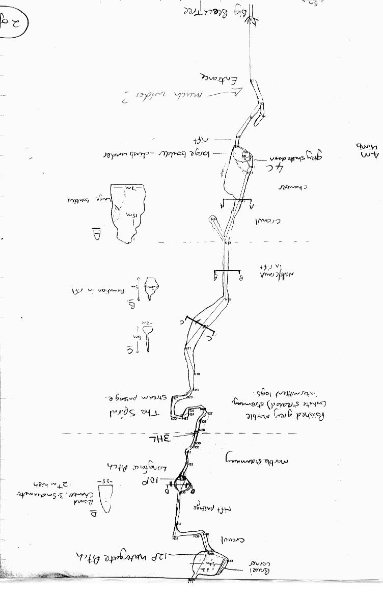
Earlier I wrote; I managed to answer my own question! 2. What is wrong with the following .th2 syntax created by the map editor interface? point 419.25 -243.0 label -orientation 0.0 Greenlink Entrance The solution is to add -text and quote marks as below. point 507.75 -154.75 label -orientation 0.0 -text "Greenlink Entrance" Bruce

Quoting Bruce Mutton <bruce.mutton@paradise.net.nz>:
1. Why does my centreline disappear beyond the extent of the scrap plotted? Whether I process just SurveyN.th or TheWholeCaveWithManySurveysINDEX.th I only get my first ever little scrap. I'd like to see it in context with my centreline with passage shading in the same output document. Loch seems to modify the passage with scraps while retaining all the passage with only centreline and LRUD data.
It is not exactly like this. I think loch displays both - the centerline and 3D scraps I think. It is only in the TODO list, doing it like you suggested.
I get the feeling I need to include the survey within the map command somehow, but no luck.
Yes, it is exactlu like this. The reason is simple - there is no algorithm in therion yet that detects for which centerline parts there exists scraps. Therefore therion: 1. Try to search for scraps - if they are found, they are displayed. In this case centerline is ignored. 2. If no scraps are found, centerline is displayed. To create such map, just add following code ... source # additional source data map all_map # map that contains centerline and scrap map TestMap@n # the map with scraps n # survey centerline data below scraps endmap # end of map endsource # end of additional source data select all_map # select this all_map for output ... after ... source surveyN.th in your configuration file. You may create this map also in SurveyN.th file after "endsurvey n" command. Only selection of output map needs to be done in configuration file.
3. I do like the way the .lox model follows the walls drawn on the scrap! Will it do the same if I create elevation scraps? Or only if I create extended elevation scraps?
Unfortunately this is not yet implemented - only plan scraps are taken into account when generating 3D model. This feature is already a long time in the TODO list :( Regards, S.
Thanks Stacho, "> 1. Why does my centreline disappear beyond the extent of the scrap plotted?
Whether I process just SurveyN.th or TheWholeCaveWithManySurveysINDEX.th I only get my first ever little scrap. I'd like to see it in context with my centreline with passage shading in the same output document. Loch seems to modify the passage with scraps while retaining all the passage with only centreline and LRUD data.
It is not exactly like this. I think loch displays both - the centerline and 3D scraps I think. It is only in the TODO list, doing it like you suggested." Yes you are right, it does display both, I noticed this where my sketch deviated significantly from the passage. I got two passages viewed with Loch. Its OK, good for detecting errors. Bruce
Thanks Stacho I'm sure you are getting sick of my incessant questions by now, very sorry... This post is a bit longer than I would have hoped. You quoted " To create such map, just add following code ... source # additional source data map all_map # map that contains centerline and scrap map TestMap@n # the map with scraps n # survey centerline data below scraps endmap # end of map endsource # end of additional source data select all_map # select this all_map for output ... after ... source surveyN.th in your configuration file. You may create this map also in SurveyN.th file after "endsurvey n" command. Only selection of output map needs to be done in configuration file. " I tried this both ways you described with just a single surveyN.th, and it works fine. (Refer thconfig--SingleSurveyTest.thc attached) I notice that if the .th2 file reference is outside the 'survey n endsurvey n' block of code, each survey station -name in the .th2 file requires a @n suffix. That's OK, but not feasible to keep changing them if the .th2 file reference needs to keep moving. But I can not get it to work with my nice tidy hierarchy setup with INDEX.th files that works when I only have centreline data and no scrap data. (Refer thconfig-Greenlink.thc attached) I ran Stellios' files and I get the following non fatal message warning -- thconfig-ders-model [21] -- object not found -- "map_ders" which relates to Therion not being able to 'see' map_ders @dersios (which does not exist) Still, quite a nice plan Stellios, better than my efforts so far!) Whereas I get a fatal error, error -- thconfig-Greenlink.thc [21] -- object does not exist -- GreenlinkEntPlan_s1 or similar which relates to Therion not being able to 'see' the scrap GreenlinkEntPlan_s1 (or the map, as the case may be) when referenced via an INDEX.th file but works perfectly fine while referenced more directly. Of the two thconfig files in the attached directories, the SingleSurvey one works fine, and the Greenlink (whole cave) one does not. You will see by the commented lines the sorts of things I have tried to resolve this. So, I am struggling to find a 'data layout template' that allows me to work independently on low level detailed surveys and top level system data that will in this case eventually contain three caves each with many surveys. I have it working for centreline data at survey, cave and system levels, but a single scrap has brought it tumbling down. Is the hierarchy in my data OK? It seems to match the recommendations in the Wiki. Is there a(nother) simple error I'm making? How to resolve this problem? Thanks for your patience. Despite appearances I feel I am making progress Bruce

On 17.11.2007, at 4:12, Bruce Mutton wrote:
in your configuration file. You may create this map also in SurveyN.th file after "endsurvey n" command. Only selection of output map needs to be done in configuration file.
I think you made things more complicated than necessary: You already defined your map in th file so way to define it again in thconfig? I just tried simple thconfig: xxxxxxxxxxxx source surveyN.th export map -o testMS.pdf xxxxxxxxxxxxxx and it produced nice map - you may see it attached. Martin
Thanks Martin, Stacho, Ben, for your comments. Your assistance much appreciated. I have located my problem, simply an issue of the scope of namespaces. (The correct definition of a map object can be found in the Map Editor by double clicking on the object in the map tree pane on the side of the application window. - This inserts a select command in the thconfig file, so you may want to delete this to preserve the status of the thconfig file) In case anyone is trying to solve a similar problem, I've attached the previously submitted files, but with the errors corrected. So now I have a simple, scalable, file structure to easily plot a single survey, a cave composed of many surveys, or a system composed of many caves, at least that's what I'm hoping. (I've left the system data out of the attachment) Bruce
Thanks for the comments Martin. They helped me resolve some minor confusions. I have been using an Output folder, but remove it for posting to the forum, as Therion does not create non-existent folders. (This avoids forum members having to figure out what the error is) Bruce -----Original Message----- From: therion-bounces@speleo.sk [mailto:therion-bounces@speleo.sk] On Behalf Of Martin Sluka Sent: Sunday, 18 November 2007 10:27 p.m. To: therion@speleo.sk Subject: Re: [Therion] Getting Scraps into the plans and elevations On 18.11.2007, at 9:07, Bruce Mutton wrote:
for your comments.
Bruce, check the attached thconfig file with my comments. I only add the folder for outputs to your structure. Martin
participants (3)
-
 Bruce Mutton
-
 Martin Sluka
-
 Stacho Mudrak