Surface profile in elevation maps

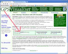
Martin, Picking points from GoogleEarth works very well. Thank you for the suggestion. I found a very useful tool here : http://www.gpsvisualizer.com/elevation By simply importing the .kml file of the cave centreline data (lat-long), this online tool will create a list of coordinates including the ground altitude at each point from one of it's datasets. Very easy to use and copy-paste the data back into therion as fixed stations. I imagine it would be easy to extract a full DTM surface grid using this tool. Bruce, Your suggestion worked great. It is a little odd when used in extended projection, but seems correct in elevation projection. I do have a bit of a problem in exporting to pdf, and this may be me missing something more fundamental in how survey/maps are structured and therion builds up the plot : When I just plot centreline data, I can see cave centreline and the new ground surface centreline for the complete cave length. When I include a single cave scrap, I no longer see any centreline data outside this single scrap. Is there a way to over-ride this behaviour or alternatively how should I structure my survey/map objects to avoid this? Thanks to all for your help, Steve

Steve I'll add the gpsvisualizer to the Therion wiki, as it looks like a good way to get a smoothed ground profile over a cave centreline. Just so I'm clear, did you just upload your therion generated kml file here? If you want to make a terrain model, then TerrainTool is the way to go http://therion.speleo.sk/wiki/doku.php/contrib:terrainmodelling Therions default pdf outputs
I do have a bit of a problem in exporting to pdf, and this may be me
missing something more fundamental in how survey/maps are structured and therion builds up the plot :
When I just plot centreline data, I can see cave centreline and the new
ground surface centreline for the complete cave length. If you do not explicitly select a survey or map (ie you only have source data) and the source does not reference any scraps, then default the entire centreline is plotted. As you observed above.
When I include a single cave scrap, I no longer see any centreline data outside this
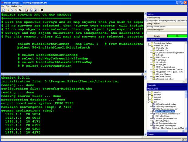
single scrap. Is there a way to over-ride this behaviour or alternatively how should I structure my survey/map objects to avoid this? And as soon as the source references scraps, then only the scraps (and all of them) are exported. To gain control over what is output, you have to select surveys or maps to be exported. The easiest way is to select is to use the Xtherion compiler window. You can only do this after you have successfully compiled. Open the Surveys or Maps window on the righthand side, and double-click the survey or map you want to select. Xtherion adds the select statement to your thconfig file. A little more explanation in the thconfig templates on http://therion.speleo.sk/wiki/doku.php/templates and in the Therion Book pg 56. Bruce
participants (2)
-
 Bruce
-
 Steve Clark