
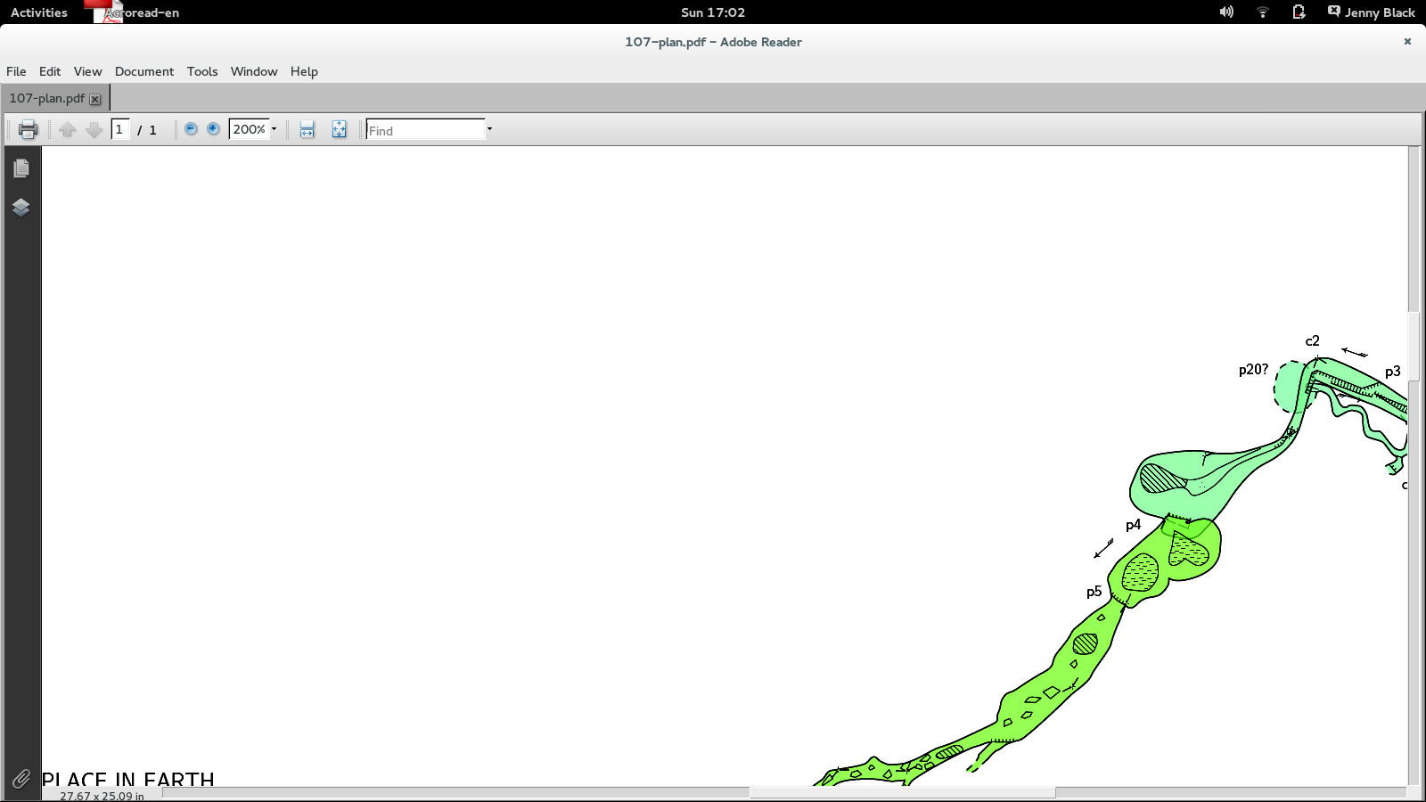
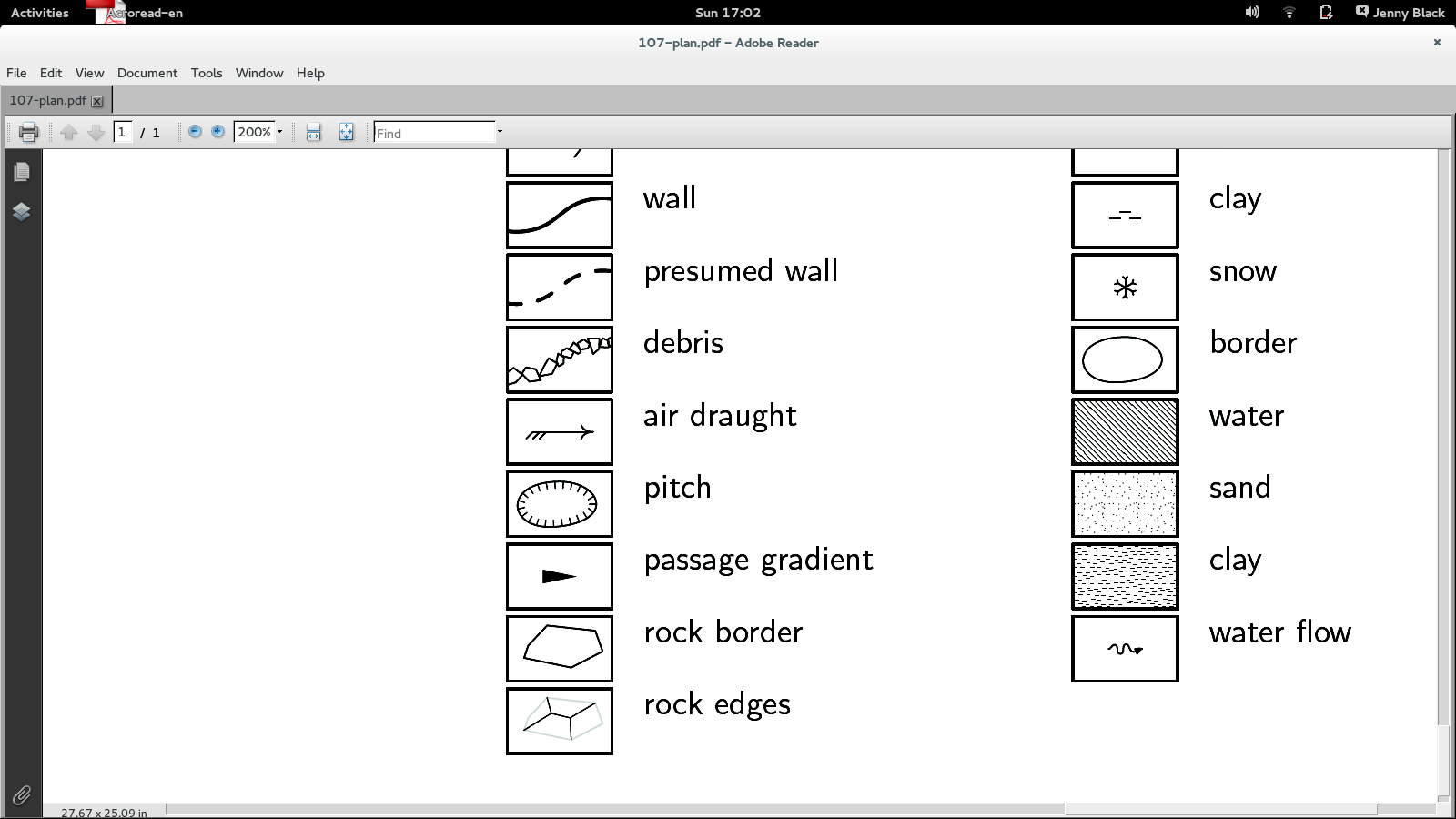
Hi, I've notice that the area symbols look to be drawn at a different scale on my map than in the legend. I've attached two screenshots - look at the water (the lines are not the same distance apart) an the clay. This appears to happen only if I use base-scale, the attached images are with: scale 1 500 base-scale 1 200 but if I remove the base-scale line the symbols are the same in the legend and map. Am I using the base-scale option incorrectly, is there some way to tell it to apply that to the legend symbols as well as the map symbols? Or is it a bug? In case it makes a difference, I am using some custom symbols defined in my thconfig file (I found these from previous postings on this list, thank you!) Thanks, Jenny

Hi Jenny, me and Martin, we have tried to reproduce your error with different patterns based on base-scale setting but without success. Are you able to isolate it to some small sample, that we can investigate? Thanks, S. On 22 June 2014 07:19, Jenny Black <jenelopy@gmail.com> wrote:
Hi,
I've notice that the area symbols look to be drawn at a different scale on my map than in the legend. I've attached two screenshots - look at the water (the lines are not the same distance apart) an the clay.
This appears to happen only if I use base-scale, the attached images are with: scale 1 500 base-scale 1 200
but if I remove the base-scale line the symbols are the same in the legend and map. Am I using the base-scale option incorrectly, is there some way to tell it to apply that to the legend symbols as well as the map symbols? Or is it a bug?
In case it makes a difference, I am using some custom symbols defined in my thconfig file (I found these from previous postings on this list, thank you!)
Thanks, Jenny
_______________________________________________ Therion mailing list Therion@speleo.sk http://mailman.speleo.sk/mailman/listinfo/therion
Hi Stacho, me and Martin, we have tried to reproduce your error with different
patterns based on base-scale setting but without success. Are you able to isolate it to some small sample, that we can investigate?
Thanks for looking at my problem. The fact you cant reproduce it probably means I am doing something stupid, sorry. I've made a small example set that shows the problem. Have I missed something critical form the thconig file? Thanks, Jenny

Hi Jenny I quite like that mud fill pattern. I'm not convinced that the 107-plan.pdf has water or clay symbols that differ in scale bewteen the legend and the map. The spacing of the water lines scales the same on my screen, and the clay looks slightly different, but perhaps within what might be expected for 0.2u randomisation? I'd like to try to run those files with more extreme difference between scale and base-scale (say 5x or 10x instead of 2.5x), but the all.3d file is missing, so cannot. Bruce _____ From: therion-bounces@speleo.sk [mailto:therion-bounces@speleo.sk] On Behalf Of Jenny Black Sent: Thursday, 26 June 2014 5:13 p.m. To: List for Therion users Subject: Re: [Therion] Symbol different in legend to survey Hi Stacho, me and Martin, we have tried to reproduce your error with different patterns based on base-scale setting but without success. Are you able to isolate it to some small sample, that we can investigate? Thanks for looking at my problem. The fact you cant reproduce it probably means I am doing something stupid, sorry. I've made a small example set that shows the problem. Have I missed something critical form the thconig file? Thanks, Jenny
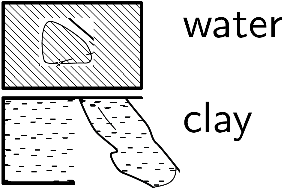
Hi Jenny, this is magnification from your PDF file. Legend and map. To me, symbols look to be in the same scale. I am probably getting something wrong. S. On 26 June 2014 07:12, Jenny Black <jenelopy@gmail.com> wrote:
Hi Stacho,
me and Martin, we have tried to reproduce your error with different
patterns based on base-scale setting but without success. Are you able to isolate it to some small sample, that we can investigate?
Thanks for looking at my problem. The fact you cant reproduce it probably means I am doing something stupid, sorry.
I've made a small example set that shows the problem. Have I missed something critical form the thconig file?
Thanks, Jenny
_______________________________________________ Therion mailing list Therion@speleo.sk http://mailman.speleo.sk/mailman/listinfo/therion
Hi, Sorry, I should have replied sooner. You are both right of course, the symbols are the same size. It was an optical illusion due to the shape of some of the area fills in the original survey ( http://expo.survex.com/expoimages/surveys/107-plan-2013-draft3.pdf), and once I could see it there I convinced myself it was true in the cut down example as well. Sorry to have wasted your time! Thanks, Jenny On 26 June 2014 20:28, Stacho Mudrak <lists@group-s.sk> wrote:
Hi Jenny,
this is magnification from your PDF file. Legend and map. To me, symbols look to be in the same scale. I am probably getting something wrong.
S.

Nice drawing Jenny. You appear to be using similar tricks to me to try to join scraps along curved pitch lines so that in colour by altitude the colour boundaries are hidden along drawn boundaries in the cave. I've been meaning to write a wiki page about how I do this. Nice to see I am not the only one. Footleg On 9 July 2014 06:47, Jenny Black <jenelopy@gmail.com> wrote:
Hi,
Sorry, I should have replied sooner. You are both right of course, the symbols are the same size. It was an optical illusion due to the shape of some of the area fills in the original survey (http://expo.survex.com/expoimages/surveys/107-plan-2013-draft3.pdf), and once I could see it there I convinced myself it was true in the cut down example as well. Sorry to have wasted your time!
Thanks, Jenny
On 26 June 2014 20:28, Stacho Mudrak <lists@group-s.sk> wrote:
Hi Jenny,
this is magnification from your PDF file. Legend and map. To me, symbols look to be in the same scale. I am probably getting something wrong.
S.
_______________________________________________ Therion mailing list Therion@speleo.sk http://mailman.speleo.sk/mailman/listinfo/therion
participants (4)
-
 Bruce
-
 Footleg
-
 Jenny Black
-
 Stacho Mudrak