9 Nov
2022
9 Nov
'22
5:20 p.m.
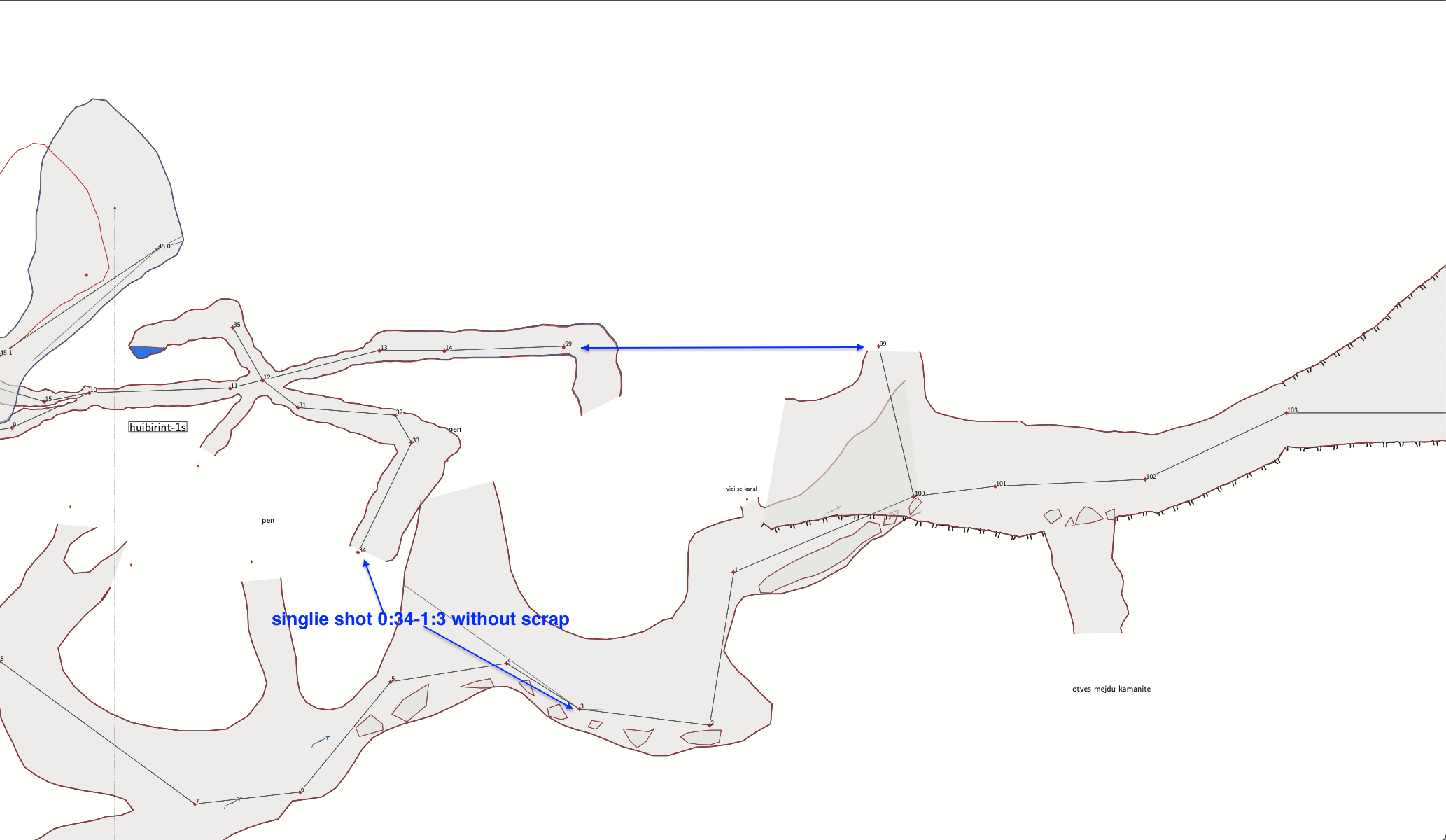
Hi I am asking for help with extend elevation of a section in a map I am drawing. I have 3 surveys that join in a loop. I want to extend from the place where I have rope but it will not work. On the picture this is station 99. I tried with: extend ignore 33 34 @map1, (I get error “Number is too large.. .some numbers” when compiling) extend ignore 0 1 @mapConnections (does nothing) extend start 99 @map2 (does nothing) equates are: 99@map1 99@map2, 0@map3 100@map2 34@map1 0@mapConenction 1@mapConnection 3@map3 Could somebody please point me what is the correct order of extend commands so the drawing can continue from station 99, not 34? Thanks, Efi