3 Jul
2016
3 Jul
'16
12:20 p.m.
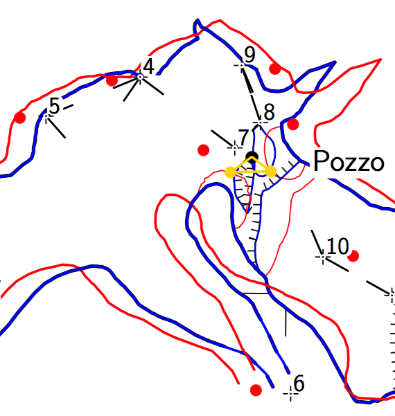
Hello, here's a picture I got by cropping a plan map made by Therion with the option "debug all" in the layout. I noticed a strange yellow symbol and also Therion "distorted" my drawings. I can't figure out why. Could someone please clarify me? The station order is 4-7-8-9-10 and 4-5-6 (station 4 is a common point between two paths). My original drawings are in red, the final results are in blue. I wouldn't expect any distortion because I drew directly on real survey data (I used DistoX and Topodroid). Also, I can't figure out what the two small red lines connected by the yellow one are. I didn't draw them.. Any hint? Thanks, Marco [image: Inline image 1]