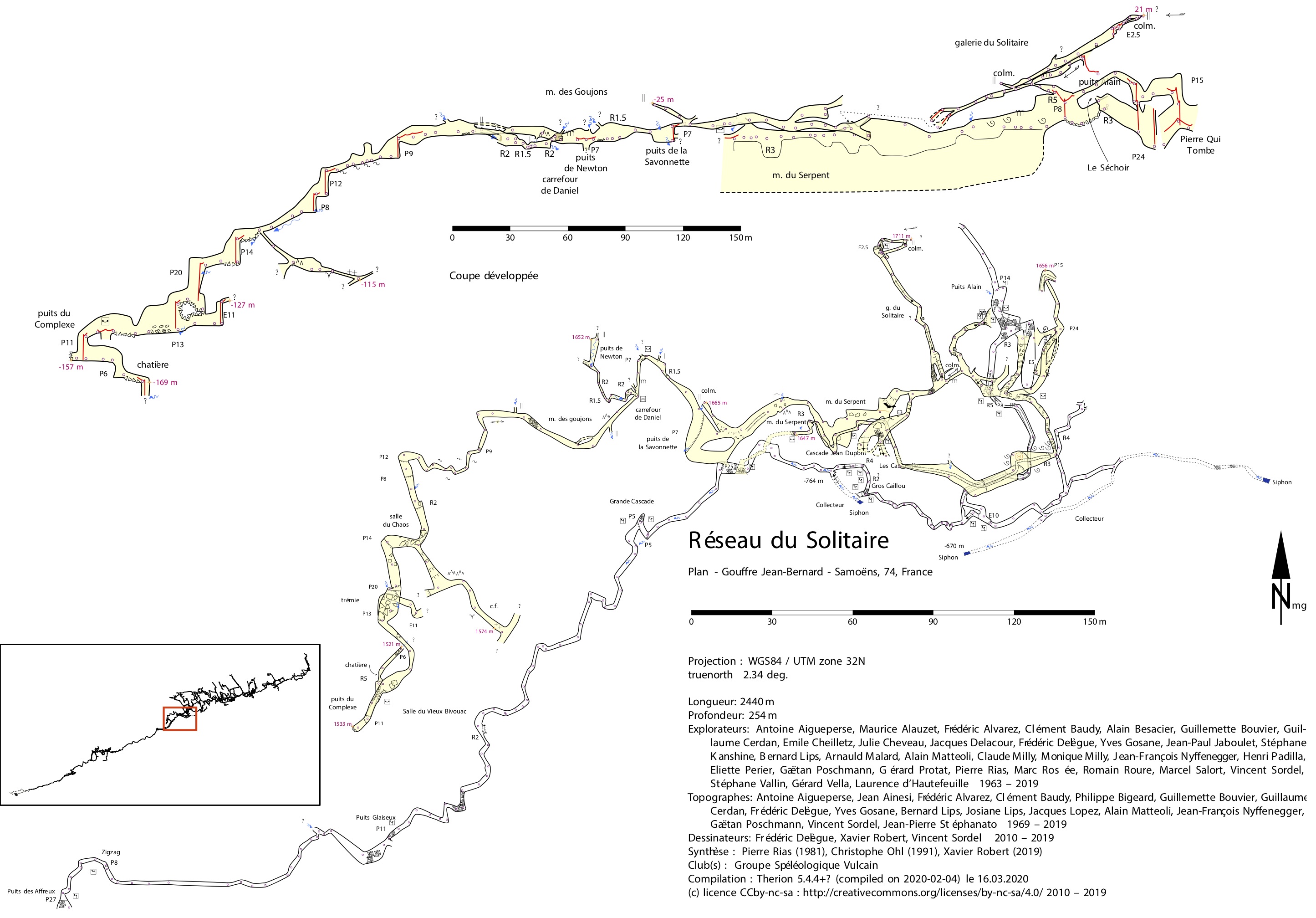
Dear all, I do not know if this is a request for a new feature, or if this can easily be solved with the present-day options of Therion. With my caving club, I am working on relatively big caves (>10/20 km), and I am currently in charge of the survey synthesis. Almost each year, we add new explored passages to the general map, and we annually publish the crops on the passages newly explored/mapped in our caving club journal. To print the crops of the parts I am interesting for publishing, I am using selections with maps definitions. Nothing new until there. Recently, I had a request from some cavers: For these crops, they asked me to add to the map an inset with the general view of the cave (plan and/or extended elevation) and the location of the crop. Two Illustrator example are in attachement. With Therion I could do that (this is more or less what I have done for the attached Solitaire example): 1. by plotting the whole cave at very small scale (with the options symbol-hide group all / symbol-hide special north-arrow / symbol-hide special scale-bar / symbol-show line wall and all the statistics to off or empty) , 2. by adding a box manually on this first pdf with illustrator, where I want it and 3. by using the "map-image" command to add this tuned pdf on the final map of the crop. However, it will be a pain to do it manually each time I need to print a new part of the cave network. Thus, do you know if there is an easy way to do it with a semi-automatic method based on the map selection? I imagine that this should be possible as there are almost similar features for the Atlas mode (with the box \navbox). Can we transpose it to plan or extended views ? Otherwise a possible idea could be to add a new command for layout blocks like : map-box <x> <y> <n/s/e/w/ne/nw/se/sw/center> <scale/size> with for example: * <x> <y> : same definition as map-header or map-image * <n/s/e/w/ne/nw/se/sw/center> : same definition as map-header or map-image * <scale> : scale (in % of the page size? scale of the general map to use, like the base-scale or scale commands?) or size (in cm like for the width of the legend box?) of the box that contains the general map with the map-selection location In fact, that would be great! Infortunately, I am not a good coder... But do you thing this is easy to implement? Cheers, Xavier