Sketches on doesn't work / legacy survey

Hello cavers, currently I try to work with some legacy survey which are the original survey data and the final map with scale bar but without marked stations. My intention is to geo-reference the existing map (i.e. attaching the entrance location to the UTM grid) and use it in a cave atlas of the area. I don't want to redraw the whole map in Therion. I followed the directions given in the therion wiki and entered the survey data and the resulting model in Loch looks fine and plausible. After that I created a scrap with the scanned map (projection plan) and scaled it using the scale bar and the scaling tool of Xtherion map editor. I marked the location of the first survey station at the cave entrance and in the layout section of my thconfig I turned on sketch export. Unfortunately it doesn't work. The generated pdf only contains the map header (with wrong length and depth statistics btw!) and a short part of the first survey shot. I expect the whole scanned background image to be visible and in scale in the pdf. Honestly said I never got the "sketches on" working with any of my old and new maps. What I am doing wrong? Any pointer to the right direction is highly appreciated. Best regards and thanks in advance, Roger

Hello Roger, Define at least one more station in the th2 – file. Therion will the scale the map automatically if there are >2 stations, no need to do manual scaling then. If that doesn’t work, provide also the jpg and the thconfig file, and I can have a look. Regards, Michael. Von: Therion [mailto:therion-bounces@speleo.sk] Im Auftrag von Roger Schuster Gesendet: Montag, 13. April 2020 11:21 An: therion@speleo.sk Betreff: [Therion] Sketches on doesn't work / legacy survey Hello cavers, currently I try to work with some legacy survey which are the original survey data and the final map with scale bar but without marked stations. My intention is to geo-reference the existing map (i.e. attaching the entrance location to the UTM grid) and use it in a cave atlas of the area. I don't want to redraw the whole map in Therion. I followed the directions given in the therion wiki and entered the survey data and the resulting model in Loch looks fine and plausible. After that I created a scrap with the scanned map (projection plan) and scaled it using the scale bar and the scaling tool of Xtherion map editor. I marked the location of the first survey station at the cave entrance and in the layout section of my thconfig I turned on sketch export. Unfortunately it doesn't work. The generated pdf only contains the map header (with wrong length and depth statistics btw!) and a short part of the first survey shot. I expect the whole scanned background image to be visible and in scale in the pdf. Honestly said I never got the "sketches on" working with any of my old and new maps. What I am doing wrong? Any pointer to the right direction is highly appreciated. Best regards and thanks in advance, Roger

Roger You have not included the file hoehle.jpg so I cannot test the compilation including the sketch. I have not had problems getting sketches to plot in pdfs. Your scrap only has one point in it, so that would be my first place to look. I suspect you need at least two station points to orient the sketch to the scrap – at least that is how I have always done it. I also suggest plotting the survey centreline while you are going through the debugging process – I couldn’t make that work in your example just now – brain fade. Bruce From: Therion <therion-bounces@speleo.sk> On Behalf Of Roger Schuster Sent: Monday, 13 April 2020 21:21 To: therion@speleo.sk Subject: [Therion] Sketches on doesn't work / legacy survey Hello cavers, currently I try to work with some legacy survey which are the original survey data and the final map with scale bar but without marked stations. My intention is to geo-reference the existing map (i.e. attaching the entrance location to the UTM grid) and use it in a cave atlas of the area. I don't want to redraw the whole map in Therion. I followed the directions given in the therion wiki and entered the survey data and the resulting model in Loch looks fine and plausible. After that I created a scrap with the scanned map (projection plan) and scaled it using the scale bar and the scaling tool of Xtherion map editor. I marked the location of the first survey station at the cave entrance and in the layout section of my thconfig I turned on sketch export. Unfortunately it doesn't work. The generated pdf only contains the map header (with wrong length and depth statistics btw!) and a short part of the first survey shot. I expect the whole scanned background image to be visible and in scale in the pdf. Honestly said I never got the "sketches on" working with any of my old and new maps. What I am doing wrong? Any pointer to the right direction is highly appreciated. Best regards and thanks in advance, Roger

13. 4. 2020 v 11:20, Roger Schuster <roger@r-schuster.de>:
After that I created a scrap with the scanned map (projection plan) and scaled it using the scale bar and the scaling tool of Xtherion map editor.
I’m afraid it will work only for "projection none" as for sections. For plan you should use minimally two stations because Therion georeferences each scrap according those stations. Martin
Hello all, thank you for your answers. Projection none doesn't work - all survey lines will appear on the pdf but not the scanned map. So I tried projection plan again and marked a second station and this did the trick. The background is now on the output as I expected. One problem I need to solve: The stations aren't marked on the map so I've to guess where they are... My estimation shouldn't be too far off to prevent unwanted distortions of the map. Thanks again for your support! Roger ------ Originalnachricht ------ Von: "Martin Sluka via Therion" <therion@speleo.sk> An: "List for Therion users" <therion@speleo.sk> Cc: "Martin Sluka" <martinsluka@mac.com> Gesendet: 13.04.2020 12:28:40 Betreff: Re: [Therion] Sketches on doesn't work / legacy survey
13. 4. 2020 v 11:20, Roger Schuster <roger@r-schuster.de>:
After that I created a scrap with the scanned map (projection plan) and scaled it using the scale bar and the scaling tool of Xtherion map editor.
I’m afraid it will work only for "projection none" as for sections.
For plan you should use minimally two stations because Therion georeferences each scrap according those stations.
Martin

You can use the debug function to see how bad is the distortion and change the position of the station accordingly until you are happy with the result. On Mon, Apr 13, 2020, 2:52 PM Roger Schuster <roger@r-schuster.de> wrote:
Hello all,
thank you for your answers. Projection none doesn't work - all survey lines will appear on the pdf but not the scanned map. So I tried projection plan again and marked a second station and this did the trick. The background is now on the output as I expected. One problem I need to solve: The stations aren't marked on the map so I've to guess where they are... My estimation shouldn't be too far off to prevent unwanted distortions of the map.
Thanks again for your support!
Roger
------ Originalnachricht ------ Von: "Martin Sluka via Therion" <therion@speleo.sk> An: "List for Therion users" <therion@speleo.sk> Cc: "Martin Sluka" <martinsluka@mac.com> Gesendet: 13.04.2020 12:28:40 Betreff: Re: [Therion] Sketches on doesn't work / legacy survey
13. 4. 2020 v 11:20, Roger Schuster <roger@r-schuster.de>:
After that I created a scrap with the scanned map (projection plan) and scaled it using the scale bar and the scaling tool of Xtherion map editor.
I’m afraid it will work only for "projection none" as for sections.
For plan you should use minimally two stations because Therion georeferences each scrap according those stations.
Martin
_______________________________________________ Therion mailing list Therion@speleo.sk https://mailman.speleo.sk/listinfo/therion
Hello again, finally I got it working and if I compare the output of Therion with the original map on paper there is only a tiny bit of distortion. Both maps match quite nicely. There are just two things I don't understand: There is a white, trapezoid gap on the map which isn't on the background image (of course). I guess it has something to do with the morphing - is there a way to get rid of this artifact? I also noticed that length and depth statistics in the map header (registers \cavelength and \cavedepth) are wrong while in the log file it's right. The values in the registers obviously depend on which stations / surveys are marked and to get the same values as in the log at least one station of each survey has to be marked (unfortunately each mark results in a more or less ugly white trapezoid as mentioned above). This is the reason why I decided to override the registers in code tex-map. Unfortunately I can't post the map here because of copyright reasons. Best regards, Roger ------ Originalnachricht ------ Von: "עמרי גסטר" <omrigas@gmail.com> An: "List for Therion users" <therion@speleo.sk> Gesendet: 13.04.2020 14:06:17 Betreff: Re: [Therion] Sketches on doesn't work / legacy survey
You can use the debug function to see how bad is the distortion and change the position of the station accordingly until you are happy with the result.
On Mon, Apr 13, 2020, 2:52 PM Roger Schuster <roger@r-schuster.de> wrote:
Hello all,
thank you for your answers. Projection none doesn't work - all survey lines will appear on the pdf but not the scanned map. So I tried projection plan again and marked a second station and this did the trick. The background is now on the output as I expected. One problem I need to solve: The stations aren't marked on the map so I've to guess where they are... My estimation shouldn't be too far off to prevent unwanted distortions of the map.
Thanks again for your support!
Roger
------ Originalnachricht ------ Von: "Martin Sluka via Therion" <therion@speleo.sk> An: "List for Therion users" <therion@speleo.sk> Cc: "Martin Sluka" <martinsluka@mac.com> Gesendet: 13.04.2020 12:28:40 Betreff: Re: [Therion] Sketches on doesn't work / legacy survey
13. 4. 2020 v 11:20, Roger Schuster <roger@r-schuster.de>:
After that I created a scrap with the scanned map (projection plan) and scaled it using the scale bar and the scaling tool of Xtherion map editor.
I’m afraid it will work only for "projection none" as for sections.
For plan you should use minimally two stations because Therion georeferences each scrap according those stations.
Martin
_______________________________________________ Therion mailing list Therion@speleo.sk https://mailman.speleo.sk/listinfo/therion

Hi Roger I'm not sure about your problem with the "artifacts" but try "symbol-hide point station" in your layout definition for the map. (maybe also "symbol-hide line survey") Just a guess... cheers, Torsten
Roger Schuster <roger@r-schuster.de> hat am 13. April 2020 um 19:00 geschrieben:
Hello again,
finally I got it working and if I compare the output of Therion with the original map on paper there is only a tiny bit of distortion. Both maps match quite nicely. There are just two things I don't understand:
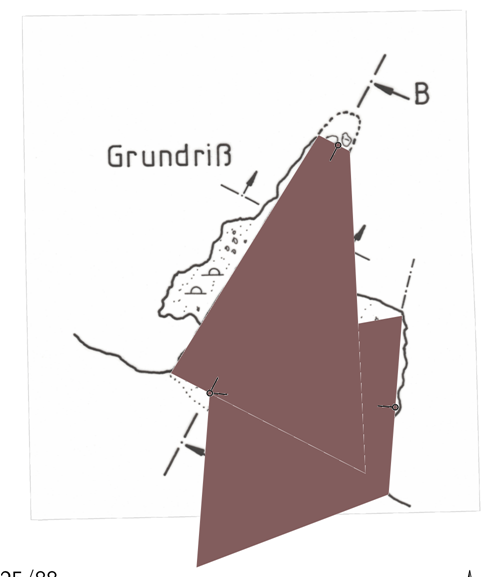
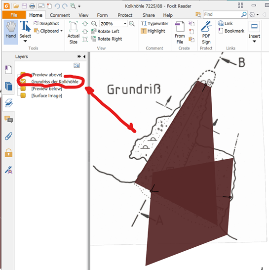
There is a white, trapezoid gap on the map which isn't on the background image (of course). I guess it has something to do with the morphing - is there a way to get rid of this artifact?
I also noticed that length and depth statistics in the map header (registers \cavelength and \cavedepth) are wrong while in the log file it's right. The values in the registers obviously depend on which stations / surveys are marked and to get the same values as in the log at least one station of each survey has to be marked (unfortunately each mark results in a more or less ugly white trapezoid as mentioned above). This is the reason why I decided to override the registers in code tex-map.
Unfortunately I can't post the map here because of copyright reasons.
Best regards,
Roger
------ Originalnachricht ------ Von: "עמרי גסטר" < omrigas@gmail.com mailto:omrigas@gmail.com > An: "List for Therion users" < therion@speleo.sk mailto:therion@speleo.sk > Gesendet: 13.04.2020 14:06:17 Betreff: Re: [Therion] Sketches on doesn't work / legacy survey
> > You can use the debug function to see how bad is the distortion and change the position of the station accordingly until you are happy with the result.
On Mon, Apr 13, 2020, 2:52 PM Roger Schuster < roger@r-schuster.de mailto:roger@r-schuster.de > wrote:
> > > Hello all,
thank you for your answers. Projection none doesn't work - all survey lines will appear on the pdf but not the scanned map. So I tried projection plan again and marked a second station and this did the trick. The background is now on the output as I expected. One problem I need to solve: The stations aren't marked on the map so I've to guess where they are... My estimation shouldn't be too far off to prevent unwanted distortions of the map.
Thanks again for your support!
Roger
------ Originalnachricht ------ Von: "Martin Sluka via Therion" < therion@speleo.sk mailto:therion@speleo.sk > An: "List for Therion users" < therion@speleo.sk mailto:therion@speleo.sk > Cc: "Martin Sluka" < martinsluka@mac.com mailto:martinsluka@mac.com > Gesendet: 13.04.2020 12:28:40 Betreff: Re: [Therion] Sketches on doesn't work / legacy survey
> > > >
> > > > > 13. 4. 2020 v 11:20, Roger Schuster < roger@r-schuster.de mailto:roger@r-schuster.de >:
After that I created a scrap with the scanned map (projection plan) and scaled it using the scale bar and the scaling tool of Xtherion map editor.
> > > >
I’m afraid it will work only for "projection none" as for sections.
For plan you should use minimally two stations because Therion georeferences each scrap according those stations.
Martin
> > > _______________________________________________
Therion mailing list Therion@speleo.sk mailto:Therion@speleo.sk https://mailman.speleo.sk/listinfo/therion
> >
>
_______________________________________________ Therion mailing list Therion@speleo.sk https://mailman.speleo.sk/listinfo/therion
May you send just screenshot of that problem you described? Martin Odesláno z iPhonu 14. 4. 2020 v 8:50, Torsten Schnitter via Therion <therion@speleo.sk>:
Hi Roger
I'm not sure about your problem with the "artifacts" but try "symbol-hide point station" in your layout definition for the map. (maybe also "symbol-hide line survey")
Just a guess...
cheers, Torsten
Roger Schuster <roger@r-schuster.de> hat am 13. April 2020 um 19:00 geschrieben:
Hello again,
finally I got it working and if I compare the output of Therion with the original map on paper there is only a tiny bit of distortion. Both maps match quite nicely. There are just two things I don't understand:
There is a white, trapezoid gap on the map which isn't on the background image (of course). I guess it has something to do with the morphing - is there a way to get rid of this artifact?
I also noticed that length and depth statistics in the map header (registers \cavelength and \cavedepth) are wrong while in the log file it's right. The values in the registers obviously depend on which stations / surveys are marked and to get the same values as in the log at least one station of each survey has to be marked (unfortunately each mark results in a more or less ugly white trapezoid as mentioned above). This is the reason why I decided to override the registers in code tex-map.
Unfortunately I can't post the map here because of copyright reasons.
Best regards,
Roger
------ Originalnachricht ------ Von: "עמרי גסטר" < omrigas@gmail.com> An: "List for Therion users" < therion@speleo.sk> Gesendet: 13.04.2020 14:06:17 Betreff: Re: [Therion] Sketches on doesn't work / legacy survey
You can use the debug function to see how bad is the distortion and change the position of the station accordingly until you are happy with the result.
On Mon, Apr 13, 2020, 2:52 PM Roger Schuster < roger@r-schuster.de> wrote: Hello all,
thank you for your answers. Projection none doesn't work - all survey lines will appear on the pdf but not the scanned map. So I tried projection plan again and marked a second station and this did the trick. The background is now on the output as I expected. One problem I need to solve: The stations aren't marked on the map so I've to guess where they are... My estimation shouldn't be too far off to prevent unwanted distortions of the map.
Thanks again for your support!
Roger
------ Originalnachricht ------ Von: "Martin Sluka via Therion" < therion@speleo.sk> An: "List for Therion users" < therion@speleo.sk> Cc: "Martin Sluka" < martinsluka@mac.com> Gesendet: 13.04.2020 12:28:40 Betreff: Re: [Therion] Sketches on doesn't work / legacy survey
13. 4. 2020 v 11:20, Roger Schuster < roger@r-schuster.de>:
After that I created a scrap with the scanned map (projection plan) and scaled it using the scale bar and the scaling tool of Xtherion map editor.
I’m afraid it will work only for "projection none" as for sections.
For plan you should use minimally two stations because Therion georeferences each scrap according those stations.
Martin
_______________________________________________ Therion mailing list Therion@speleo.sk https://mailman.speleo.sk/listinfo/therion
_______________________________________________ Therion mailing list Therion@speleo.sk https://mailman.speleo.sk/listinfo/therion
_______________________________________________ Therion mailing list Therion@speleo.sk https://mailman.speleo.sk/listinfo/therion
Hi cavers, symbol-hide doesn't change anything. Here is a screen shot of the white, trapezoid "artifact": As said I marked two stations (-visibility off) at opposite ends of the cave on the map getting this white "things". When I use color map-fg the trapezoid is filled in the given foreground color. I use Therion 5.4.4 btw. Regards, Roger ------ Originalnachricht ------ Von: "Torsten Schnitter via Therion" <therion@speleo.sk> An: "List for Therion users" <therion@speleo.sk> Cc: "Torsten Schnitter" <torsten.schnitter@netcologne.de> Gesendet: 14.04.2020 08:50:24 Betreff: Re: [Therion] Sketches on doesn't work / legacy survey
Hi Roger
I'm not sure about your problem with the "artifacts" but try "symbol-hide point station" in your layout definition for the map. (maybe also "symbol-hide line survey")
Just a guess...
cheers, Torsten
Roger Schuster <roger@r-schuster.de> hat am 13. April 2020 um 19:00 geschrieben:
Hello again,
finally I got it working and if I compare the output of Therion with the original map on paper there is only a tiny bit of distortion. Both maps match quite nicely. There are just two things I don't understand:
There is a white, trapezoid gap on the map which isn't on the background image (of course). I guess it has something to do with the morphing - is there a way to get rid of this artifact?
I also noticed that length and depth statistics in the map header (registers \cavelength and \cavedepth) are wrong while in the log file it's right. The values in the registers obviously depend on which stations / surveys are marked and to get the same values as in the log at least one station of each survey has to be marked (unfortunately each mark results in a more or less ugly white trapezoid as mentioned above). This is the reason why I decided to override the registers in code tex-map.
Unfortunately I can't post the map here because of copyright reasons.
Best regards,
Roger
------ Originalnachricht ------ Von: "עמרי גסטר" < omrigas@gmail.com> An: "List for Therion users" < therion@speleo.sk> Gesendet: 13.04.2020 14:06:17 Betreff: Re: [Therion] Sketches on doesn't work / legacy survey
You can use the debug function to see how bad is the distortion and change the position of the station accordingly until you are happy with the result.
On Mon, Apr 13, 2020, 2:52 PM Roger Schuster < roger@r-schuster.de> wrote:
Hello all,
thank you for your answers. Projection none doesn't work - all survey lines will appear on the pdf but not the scanned map. So I tried projection plan again and marked a second station and this did the trick. The background is now on the output as I expected. One problem I need to solve: The stations aren't marked on the map so I've to guess where they are... My estimation shouldn't be too far off to prevent unwanted distortions of the map.
Thanks again for your support!
Roger
------ Originalnachricht ------ Von: "Martin Sluka via Therion" < therion@speleo.sk> An: "List for Therion users" < therion@speleo.sk> Cc: "Martin Sluka" < martinsluka@mac.com> Gesendet: 13.04.2020 12:28:40 Betreff: Re: [Therion] Sketches on doesn't work / legacy survey
13. 4. 2020 v 11:20, Roger Schuster < roger@r-schuster.de>:
After that I created a scrap with the scanned map (projection plan) and scaled it using the scale bar and the scaling tool of Xtherion map editor.
I’m afraid it will work only for "projection none" as for sections.
For plan you should use minimally two stations because Therion georeferences each scrap according those stations.
Martin
_______________________________________________ Therion mailing list Therion@speleo.sk https://mailman.speleo.sk/listinfo/therion
_______________________________________________ Therion mailing list Therion@speleo.sk https://mailman.speleo.sk/listinfo/therion
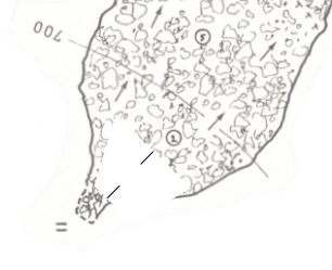

Hi, I may be wrong, but it looks like if you plot the centerline ? In your thconfig, if you add "symbol-hide line centerline", does it solve your problem ? Cheers, Xavier De: "Roger Schuster" <roger@r-schuster.de> À: "List for Therion users" <therion@speleo.sk> Envoyé: Mardi 14 Avril 2020 13:31:25 Objet: Re: [Therion] Sketches on doesn't work / legacy survey Hi cavers, symbol-hide doesn't change anything. Here is a screen shot of the white, trapezoid "artifact": As said I marked two stations (-visibility off) at opposite ends of the cave on the map getting this white "things". When I use color map-fg the trapezoid is filled in the given foreground color. I use Therion 5.4.4 btw. Regards, Roger ------ Originalnachricht ------ Von: "Torsten Schnitter via Therion" < [ mailto:therion@speleo.sk | therion@speleo.sk ] > An: "List for Therion users" < [ mailto:therion@speleo.sk | therion@speleo.sk ] > Cc: "Torsten Schnitter" < [ mailto:torsten.schnitter@netcologne.de | torsten.schnitter@netcologne.de ] > Gesendet: 14.04.2020 08:50:24 Betreff: Re: [Therion] Sketches on doesn't work / legacy survey Hi Roger I'm not sure about your problem with the "artifacts" but try "symbol-hide point station" in your layout definition for the map. (maybe also "symbol-hide line survey") Just a guess... cheers, Torsten BQ_BEGIN Roger Schuster < [ mailto:roger@r-schuster.de | roger@r-schuster.de ] > hat am 13. April 2020 um 19:00 geschrieben: Hello again, finally I got it working and if I compare the output of Therion with the original map on paper there is only a tiny bit of distortion. Both maps match quite nicely. There are just two things I don't understand: There is a white, trapezoid gap on the map which isn't on the background image (of course). I guess it has something to do with the morphing - is there a way to get rid of this artifact? I also noticed that length and depth statistics in the map header (registers \cavelength and \cavedepth) are wrong while in the log file it's right. The values in the registers obviously depend on which stations / surveys are marked and to get the same values as in the log at least one station of each survey has to be marked (unfortunately each mark results in a more or less ugly white trapezoid as mentioned above). This is the reason why I decided to override the registers in code tex-map. Unfortunately I can't post the map here because of copyright reasons. Best regards, Roger ------ Originalnachricht ------ Von: "עמרי גסטר" < [ mailto:omrigas@gmail.com | omrigas@gmail.com ] > An: "List for Therion users" < [ mailto:therion@speleo.sk | therion@speleo.sk ] > Gesendet: 13.04.2020 14:06:17 Betreff: Re: [Therion] Sketches on doesn't work / legacy survey BQ_BEGIN You can use the debug function to see how bad is the distortion and change the position of the station accordingly until you are happy with the result. On Mon, Apr 13, 2020, 2:52 PM Roger Schuster < [ mailto:roger@r-schuster.de | roger@r-schuster.de ] > wrote: BQ_BEGIN Hello all, thank you for your answers. Projection none doesn't work - all survey lines will appear on the pdf but not the scanned map. So I tried projection plan again and marked a second station and this did the trick. The background is now on the output as I expected. One problem I need to solve: The stations aren't marked on the map so I've to guess where they are... My estimation shouldn't be too far off to prevent unwanted distortions of the map. Thanks again for your support! Roger ------ Originalnachricht ------ Von: "Martin Sluka via Therion" < [ mailto:therion@speleo.sk | therion@speleo.sk ] > An: "List for Therion users" < [ mailto:therion@speleo.sk | therion@speleo.sk ] > Cc: "Martin Sluka" < [ mailto:martinsluka@mac.com | martinsluka@mac.com ] > Gesendet: 13.04.2020 12:28:40 Betreff: Re: [Therion] Sketches on doesn't work / legacy survey BQ_BEGIN BQ_BEGIN 13. 4. 2020 v 11:20, Roger Schuster < [ mailto:roger@r-schuster.de | roger@r-schuster.de ] >: After that I created a scrap with the scanned map (projection plan) and scaled it using the scale bar and the scaling tool of Xtherion map editor. I’m afraid it will work only for "projection none" as for sections. For plan you should use minimally two stations because Therion georeferences each scrap according those stations. Martin BQ_END _______________________________________________ Therion mailing list [ mailto:Therion@speleo.sk | Therion@speleo.sk ] [ https://mailman.speleo.sk/listinfo/therion | https://mailman.speleo.sk/listinfo/therion ] BQ_END BQ_END BQ_END BQ_BEGIN _______________________________________________ Therion mailing list [ mailto:Therion@speleo.sk | Therion@speleo.sk ] [ https://mailman.speleo.sk/listinfo/therion | https://mailman.speleo.sk/listinfo/therion ] BQ_END BQ_END _______________________________________________ Therion mailing list Therion@speleo.sk https://mailman.speleo.sk/listinfo/therion
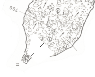
Hi, this results in the following error: symbol-hide line centerline: error -- thconfig [12] -- thconfig [12] -- unknown symbol specification -- line centerline Roger ------ Originalnachricht ------ Von: "Xavier Robert" <xavier.robert@univ-grenoble-alpes.fr> An: "List for Therion users" <therion@speleo.sk> Gesendet: 14.04.2020 20:45:38 Betreff: Re: [Therion] Sketches on doesn't work / legacy survey
Hi,
I may be wrong, but it looks like if you plot the centerline ?
In your thconfig, if you add "symbol-hide line centerline", does it solve your problem ?
Cheers,
Xavier
-------------------------------------------------------------------------------- De: "Roger Schuster" <roger@r-schuster.de> À: "List for Therion users" <therion@speleo.sk> Envoyé: Mardi 14 Avril 2020 13:31:25 Objet: Re: [Therion] Sketches on doesn't work / legacy survey
Hi cavers,
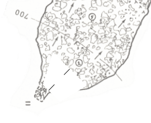
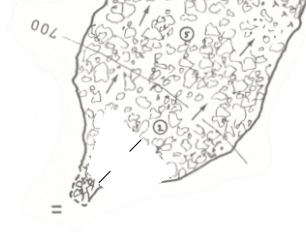
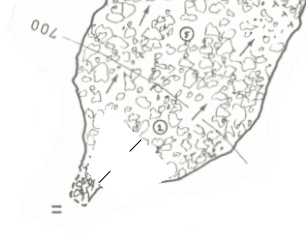
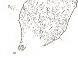
symbol-hide doesn't change anything. Here is a screen shot of the white, trapezoid "artifact":
As said I marked two stations (-visibility off) at opposite ends of the cave on the map getting this white "things". When I use color map-fg the trapezoid is filled in the given foreground color. I use Therion 5.4.4 btw.
Regards,
Roger
------ Originalnachricht ------ Von: "Torsten Schnitter via Therion" <therion@speleo.sk> An: "List for Therion users" <therion@speleo.sk> Cc: "Torsten Schnitter" <torsten.schnitter@netcologne.de> Gesendet: 14.04.2020 08:50:24 Betreff: Re: [Therion] Sketches on doesn't work / legacy survey
Hi Roger
I'm not sure about your problem with the "artifacts" but try "symbol-hide point station" in your layout definition for the map. (maybe also "symbol-hide line survey")
Just a guess...
cheers, Torsten
Roger Schuster <roger@r-schuster.de> hat am 13. April 2020 um 19:00 geschrieben:
Hello again,
finally I got it working and if I compare the output of Therion with the original map on paper there is only a tiny bit of distortion. Both maps match quite nicely. There are just two things I don't understand:
There is a white, trapezoid gap on the map which isn't on the background image (of course). I guess it has something to do with the morphing - is there a way to get rid of this artifact?
I also noticed that length and depth statistics in the map header (registers \cavelength and \cavedepth) are wrong while in the log file it's right. The values in the registers obviously depend on which stations / surveys are marked and to get the same values as in the log at least one station of each survey has to be marked (unfortunately each mark results in a more or less ugly white trapezoid as mentioned above). This is the reason why I decided to override the registers in code tex-map.
Unfortunately I can't post the map here because of copyright reasons.
Best regards,
Roger
------ Originalnachricht ------ Von: "עמרי גסטר" < omrigas@gmail.com> An: "List for Therion users" < therion@speleo.sk> Gesendet: 13.04.2020 14:06:17 Betreff: Re: [Therion] Sketches on doesn't work / legacy survey
You can use the debug function to see how bad is the distortion and change the position of the station accordingly until you are happy with the result.
On Mon, Apr 13, 2020, 2:52 PM Roger Schuster < roger@r-schuster.de> wrote:
Hello all,
thank you for your answers. Projection none doesn't work - all survey lines will appear on the pdf but not the scanned map. So I tried projection plan again and marked a second station and this did the trick. The background is now on the output as I expected. One problem I need to solve: The stations aren't marked on the map so I've to guess where they are... My estimation shouldn't be too far off to prevent unwanted distortions of the map.
Thanks again for your support!
Roger
------ Originalnachricht ------ Von: "Martin Sluka via Therion" < therion@speleo.sk> An: "List for Therion users" < therion@speleo.sk> Cc: "Martin Sluka" < martinsluka@mac.com> Gesendet: 13.04.2020 12:28:40 Betreff: Re: [Therion] Sketches on doesn't work / legacy survey
>13. 4. 2020 v 11:20, Roger Schuster < roger@r-schuster.de>: > >After that I created a scrap with the scanned map (projection >plan) and scaled it using the scale bar and the scaling tool of >Xtherion map editor.
I’m afraid it will work only for "projection none" as for sections.
For plan you should use minimally two stations because Therion georeferences each scrap according those stations.
Martin
_______________________________________________ Therion mailing list Therion@speleo.sk https://mailman.speleo.sk/listinfo/therion
_______________________________________________ Therion mailing list Therion@speleo.sk https://mailman.speleo.sk/listinfo/therion
_______________________________________________ Therion mailing list Therion@speleo.sk https://mailman.speleo.sk/listinfo/therion
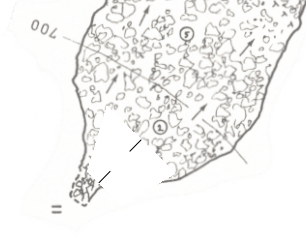
Try this spelling - centreline From: Therion <therion-bounces@speleo.sk> On Behalf Of Roger Schuster Sent: Wednesday, 15 April 2020 07:37 To: List for Therion users <therion@speleo.sk> Subject: Re: [Therion] Sketches on doesn't work / legacy survey Hi, this results in the following error: symbol-hide line centerline: error -- thconfig [12] -- thconfig [12] -- unknown symbol specification -- line centerline Roger ------ Originalnachricht ------ Von: "Xavier Robert" <xavier.robert@univ-grenoble-alpes.fr <mailto:xavier.robert@univ-grenoble-alpes.fr> > An: "List for Therion users" <therion@speleo.sk <mailto:therion@speleo.sk> > Gesendet: 14.04.2020 20:45:38 Betreff: Re: [Therion] Sketches on doesn't work / legacy survey Hi, I may be wrong, but it looks like if you plot the centerline ? In your thconfig, if you add "symbol-hide line centerline", does it solve your problem ? Cheers, Xavier _____ De: "Roger Schuster" <roger@r-schuster.de <mailto:roger@r-schuster.de> > À: "List for Therion users" <therion@speleo.sk <mailto:therion@speleo.sk> > Envoyé: Mardi 14 Avril 2020 13:31:25 Objet: Re: [Therion] Sketches on doesn't work / legacy survey Hi cavers, symbol-hide doesn't change anything. Here is a screen shot of the white, trapezoid "artifact": As said I marked two stations (-visibility off) at opposite ends of the cave on the map getting this white "things". When I use color map-fg the trapezoid is filled in the given foreground color. I use Therion 5.4.4 btw. Regards, Roger ------ Originalnachricht ------ Von: "Torsten Schnitter via Therion" <therion@speleo.sk <mailto:therion@speleo.sk> > An: "List for Therion users" <therion@speleo.sk <mailto:therion@speleo.sk> > Cc: "Torsten Schnitter" <torsten.schnitter@netcologne.de <mailto:torsten.schnitter@netcologne.de> > Gesendet: 14.04.2020 08:50:24 Betreff: Re: [Therion] Sketches on doesn't work / legacy survey Hi Roger I'm not sure about your problem with the "artifacts" but try "symbol-hide point station" in your layout definition for the map. (maybe also "symbol-hide line survey") Just a guess... cheers, Torsten Roger Schuster <roger@r-schuster.de <mailto:roger@r-schuster.de> > hat am 13. April 2020 um 19:00 geschrieben: Hello again, finally I got it working and if I compare the output of Therion with the original map on paper there is only a tiny bit of distortion. Both maps match quite nicely. There are just two things I don't understand: There is a white, trapezoid gap on the map which isn't on the background image (of course). I guess it has something to do with the morphing - is there a way to get rid of this artifact? I also noticed that length and depth statistics in the map header (registers \cavelength and \cavedepth) are wrong while in the log file it's right. The values in the registers obviously depend on which stations / surveys are marked and to get the same values as in the log at least one station of each survey has to be marked (unfortunately each mark results in a more or less ugly white trapezoid as mentioned above). This is the reason why I decided to override the registers in code tex-map. Unfortunately I can't post the map here because of copyright reasons. Best regards, Roger ------ Originalnachricht ------ Von: "עמרי גסטר" < omrigas@gmail.com <mailto:omrigas@gmail.com> > An: "List for Therion users" < therion@speleo.sk <mailto:therion@speleo.sk> > Gesendet: 13.04.2020 14:06:17 Betreff: Re: [Therion] Sketches on doesn't work / legacy survey You can use the debug function to see how bad is the distortion and change the position of the station accordingly until you are happy with the result. On Mon, Apr 13, 2020, 2:52 PM Roger Schuster < roger@r-schuster.de <mailto:roger@r-schuster.de> > wrote: Hello all, thank you for your answers. Projection none doesn't work - all survey lines will appear on the pdf but not the scanned map. So I tried projection plan again and marked a second station and this did the trick. The background is now on the output as I expected. One problem I need to solve: The stations aren't marked on the map so I've to guess where they are... My estimation shouldn't be too far off to prevent unwanted distortions of the map. Thanks again for your support! Roger ------ Originalnachricht ------ Von: "Martin Sluka via Therion" < therion@speleo.sk <mailto:therion@speleo.sk> > An: "List for Therion users" < therion@speleo.sk <mailto:therion@speleo.sk> > Cc: "Martin Sluka" < martinsluka@mac.com <mailto:martinsluka@mac.com> > Gesendet: 13.04.2020 12:28:40 Betreff: Re: [Therion] Sketches on doesn't work / legacy survey 13. 4. 2020 v 11:20, Roger Schuster < roger@r-schuster.de <mailto:roger@r-schuster.de> >: After that I created a scrap with the scanned map (projection plan) and scaled it using the scale bar and the scaling tool of Xtherion map editor. I’m afraid it will work only for "projection none" as for sections. For plan you should use minimally two stations because Therion georeferences each scrap according those stations. Martin _______________________________________________ Therion mailing list Therion@speleo.sk <mailto:Therion@speleo.sk> https://mailman.speleo.sk/listinfo/therion _______________________________________________ Therion mailing list Therion@speleo.sk <mailto:Therion@speleo.sk> https://mailman.speleo.sk/listinfo/therion _______________________________________________ Therion mailing list Therion@speleo.sk <mailto:Therion@speleo.sk> https://mailman.speleo.sk/listinfo/therion
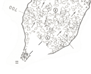
Oups, sorry, I have answer without searching in my thconfigs... The right command is symbol-hide line survey Cheers Xavier De: "Roger Schuster" <roger@r-schuster.de> À: "List for Therion users" <therion@speleo.sk> Envoyé: Mardi 14 Avril 2020 14:36:31 Objet: Re: [Therion] Sketches on doesn't work / legacy survey Hi, this results in the following error: symbol-hide line centerline: error -- thconfig [12] -- thconfig [12] -- unknown symbol specification -- line centerline Roger ------ Originalnachricht ------ Von: "Xavier Robert" < [ mailto:xavier.robert@univ-grenoble-alpes.fr | xavier.robert@univ-grenoble-alpes.fr ] > An: "List for Therion users" < [ mailto:therion@speleo.sk | therion@speleo.sk ] > Gesendet: 14.04.2020 20:45:38 Betreff: Re: [Therion] Sketches on doesn't work / legacy survey Hi, I may be wrong, but it looks like if you plot the centerline ? In your thconfig, if you add "symbol-hide line centerline", does it solve your problem ? Cheers, Xavier De: "Roger Schuster" < [ mailto:roger@r-schuster.de | roger@r-schuster.de ] > À: "List for Therion users" < [ mailto:therion@speleo.sk | therion@speleo.sk ] > Envoyé: Mardi 14 Avril 2020 13:31:25 Objet: Re: [Therion] Sketches on doesn't work / legacy survey Hi cavers, symbol-hide doesn't change anything. Here is a screen shot of the white, trapezoid "artifact": As said I marked two stations (-visibility off) at opposite ends of the cave on the map getting this white "things". When I use color map-fg the trapezoid is filled in the given foreground color. I use Therion 5.4.4 btw. Regards, Roger ------ Originalnachricht ------ Von: "Torsten Schnitter via Therion" < [ mailto:therion@speleo.sk | therion@speleo.sk ] > An: "List for Therion users" < [ mailto:therion@speleo.sk | therion@speleo.sk ] > Cc: "Torsten Schnitter" < [ mailto:torsten.schnitter@netcologne.de | torsten.schnitter@netcologne.de ] > Gesendet: 14.04.2020 08:50:24 Betreff: Re: [Therion] Sketches on doesn't work / legacy survey BQ_BEGIN Hi Roger I'm not sure about your problem with the "artifacts" but try "symbol-hide point station" in your layout definition for the map. (maybe also "symbol-hide line survey") Just a guess... cheers, Torsten BQ_BEGIN Roger Schuster < [ mailto:roger@r-schuster.de | roger@r-schuster.de ] > hat am 13. April 2020 um 19:00 geschrieben: Hello again, finally I got it working and if I compare the output of Therion with the original map on paper there is only a tiny bit of distortion. Both maps match quite nicely. There are just two things I don't understand: There is a white, trapezoid gap on the map which isn't on the background image (of course). I guess it has something to do with the morphing - is there a way to get rid of this artifact? I also noticed that length and depth statistics in the map header (registers \cavelength and \cavedepth) are wrong while in the log file it's right. The values in the registers obviously depend on which stations / surveys are marked and to get the same values as in the log at least one station of each survey has to be marked (unfortunately each mark results in a more or less ugly white trapezoid as mentioned above). This is the reason why I decided to override the registers in code tex-map. Unfortunately I can't post the map here because of copyright reasons. Best regards, Roger ------ Originalnachricht ------ Von: "עמרי גסטר" < [ mailto:omrigas@gmail.com | omrigas@gmail.com ] > An: "List for Therion users" < [ mailto:therion@speleo.sk | therion@speleo.sk ] > Gesendet: 13.04.2020 14:06:17 Betreff: Re: [Therion] Sketches on doesn't work / legacy survey BQ_BEGIN You can use the debug function to see how bad is the distortion and change the position of the station accordingly until you are happy with the result. On Mon, Apr 13, 2020, 2:52 PM Roger Schuster < [ mailto:roger@r-schuster.de | roger@r-schuster.de ] > wrote: BQ_BEGIN Hello all, thank you for your answers. Projection none doesn't work - all survey lines will appear on the pdf but not the scanned map. So I tried projection plan again and marked a second station and this did the trick. The background is now on the output as I expected. One problem I need to solve: The stations aren't marked on the map so I've to guess where they are... My estimation shouldn't be too far off to prevent unwanted distortions of the map. Thanks again for your support! Roger ------ Originalnachricht ------ Von: "Martin Sluka via Therion" < [ mailto:therion@speleo.sk | therion@speleo.sk ] > An: "List for Therion users" < [ mailto:therion@speleo.sk | therion@speleo.sk ] > Cc: "Martin Sluka" < [ mailto:martinsluka@mac.com | martinsluka@mac.com ] > Gesendet: 13.04.2020 12:28:40 Betreff: Re: [Therion] Sketches on doesn't work / legacy survey BQ_BEGIN BQ_BEGIN 13. 4. 2020 v 11:20, Roger Schuster < [ mailto:roger@r-schuster.de | roger@r-schuster.de ] >: After that I created a scrap with the scanned map (projection plan) and scaled it using the scale bar and the scaling tool of Xtherion map editor. I’m afraid it will work only for "projection none" as for sections. For plan you should use minimally two stations because Therion georeferences each scrap according those stations. Martin BQ_END _______________________________________________ Therion mailing list [ mailto:Therion@speleo.sk | Therion@speleo.sk ] [ https://mailman.speleo.sk/listinfo/therion | https://mailman.speleo.sk/listinfo/therion ] BQ_END BQ_END BQ_END BQ_BEGIN _______________________________________________ Therion mailing list [ mailto:Therion@speleo.sk | Therion@speleo.sk ] [ https://mailman.speleo.sk/listinfo/therion | https://mailman.speleo.sk/listinfo/therion ] BQ_END BQ_END _______________________________________________ Therion mailing list [ mailto:Therion@speleo.sk | Therion@speleo.sk ] [ https://mailman.speleo.sk/listinfo/therion | https://mailman.speleo.sk/listinfo/therion ] BQ_END _______________________________________________ Therion mailing list Therion@speleo.sk https://mailman.speleo.sk/listinfo/therion
I tried this already and it results in an even more strange error. A very long error message starting with: **data.tex (./data.tex (./th_enc.tex) (./th_texts.tex) (./th_resources.tex (c:/Program Files (x86)/Therion/texmf/tex/glyphtounicode.tex)) (./th_fontdef.tex{c:/Program Files (x86)/Therion/texmf/fonts/pdftex.map}) (./th_formdef.tex) (./th_pagedef.tex ! Missing number, treated as zero. <to be read again> i l.2 \hsize=-i nfbp A number should have been here; I inserted `0'. (If you can't figure out why I needed to see a number, look up `weird error' in the index to The TeXbook.) Roger ------ Originalnachricht ------ Von: "Xavier Robert" <xavier.robert@univ-grenoble-alpes.fr> An: "List for Therion users" <therion@speleo.sk> Gesendet: 14.04.2020 21:44:22 Betreff: Re: [Therion] Sketches on doesn't work / legacy survey
Oups, sorry, I have answer without searching in my thconfigs... The right command is
symbol-hide line survey
Cheers
Xavier
-------------------------------------------------------------------------------- De: "Roger Schuster" <roger@r-schuster.de> À: "List for Therion users" <therion@speleo.sk> Envoyé: Mardi 14 Avril 2020 14:36:31 Objet: Re: [Therion] Sketches on doesn't work / legacy survey
Hi,
this results in the following error:
symbol-hide line centerline: error -- thconfig [12] -- thconfig [12] -- unknown symbol specification -- line centerline
Roger
------ Originalnachricht ------ Von: "Xavier Robert" <xavier.robert@univ-grenoble-alpes.fr> An: "List for Therion users" <therion@speleo.sk> Gesendet: 14.04.2020 20:45:38 Betreff: Re: [Therion] Sketches on doesn't work / legacy survey
Hi,
I may be wrong, but it looks like if you plot the centerline ?
In your thconfig, if you add "symbol-hide line centerline", does it solve your problem ?
Cheers,
Xavier
-------------------------------------------------------------------------------- De: "Roger Schuster" <roger@r-schuster.de> À: "List for Therion users" <therion@speleo.sk> Envoyé: Mardi 14 Avril 2020 13:31:25 Objet: Re: [Therion] Sketches on doesn't work / legacy survey
Hi cavers,
symbol-hide doesn't change anything. Here is a screen shot of the white, trapezoid "artifact":
As said I marked two stations (-visibility off) at opposite ends of the cave on the map getting this white "things". When I use color map-fg the trapezoid is filled in the given foreground color. I use Therion 5.4.4 btw.
Regards,
Roger
------ Originalnachricht ------ Von: "Torsten Schnitter via Therion" <therion@speleo.sk> An: "List for Therion users" <therion@speleo.sk> Cc: "Torsten Schnitter" <torsten.schnitter@netcologne.de> Gesendet: 14.04.2020 08:50:24 Betreff: Re: [Therion] Sketches on doesn't work / legacy survey
Hi Roger
I'm not sure about your problem with the "artifacts" but try "symbol-hide point station" in your layout definition for the map. (maybe also "symbol-hide line survey")
Just a guess...
cheers, Torsten
Roger Schuster <roger@r-schuster.de> hat am 13. April 2020 um 19:00 geschrieben:
Hello again,
finally I got it working and if I compare the output of Therion with the original map on paper there is only a tiny bit of distortion. Both maps match quite nicely. There are just two things I don't understand:
There is a white, trapezoid gap on the map which isn't on the background image (of course). I guess it has something to do with the morphing - is there a way to get rid of this artifact?
I also noticed that length and depth statistics in the map header (registers \cavelength and \cavedepth) are wrong while in the log file it's right. The values in the registers obviously depend on which stations / surveys are marked and to get the same values as in the log at least one station of each survey has to be marked (unfortunately each mark results in a more or less ugly white trapezoid as mentioned above). This is the reason why I decided to override the registers in code tex-map.
Unfortunately I can't post the map here because of copyright reasons.
Best regards,
Roger
------ Originalnachricht ------ Von: "עמרי גסטר" < omrigas@gmail.com> An: "List for Therion users" < therion@speleo.sk> Gesendet: 13.04.2020 14:06:17 Betreff: Re: [Therion] Sketches on doesn't work / legacy survey
You can use the debug function to see how bad is the distortion and change the position of the station accordingly until you are happy with the result.
On Mon, Apr 13, 2020, 2:52 PM Roger Schuster < roger@r-schuster.de> wrote:
Hello all,
thank you for your answers. Projection none doesn't work - all survey lines will appear on the pdf but not the scanned map. So I tried projection plan again and marked a second station and this did the trick. The background is now on the output as I expected. One problem I need to solve: The stations aren't marked on the map so I've to guess where they are... My estimation shouldn't be too far off to prevent unwanted distortions of the map.
Thanks again for your support!
Roger
------ Originalnachricht ------ Von: "Martin Sluka via Therion" < therion@speleo.sk> An: "List for Therion users" < therion@speleo.sk> Cc: "Martin Sluka" < martinsluka@mac.com> Gesendet: 13.04.2020 12:28:40 Betreff: Re: [Therion] Sketches on doesn't work / legacy survey
> > >>13. 4. 2020 v 11:20, Roger Schuster < roger@r-schuster.de>: >> >>After that I created a scrap with the scanned map (projection >>plan) and scaled it using the scale bar and the scaling tool of >>Xtherion map editor. > >I’m afraid it will work only for "projection none" as for >sections. > >For plan you should use minimally two stations because Therion >georeferences each scrap according those stations. > >Martin _______________________________________________ Therion mailing list Therion@speleo.sk https://mailman.speleo.sk/listinfo/therion
_______________________________________________ Therion mailing list Therion@speleo.sk https://mailman.speleo.sk/listinfo/therion
_______________________________________________ Therion mailing list Therion@speleo.sk https://mailman.speleo.sk/listinfo/therion
_______________________________________________ Therion mailing list Therion@speleo.sk https://mailman.speleo.sk/listinfo/therion
Or symbol-hide group cave-centreline From: Bruce Mutton <bruce@tomo.co.nz> Sent: Wednesday, 15 April 2020 07:44 To: 'List for Therion users' <therion@speleo.sk> Subject: RE: [Therion] Sketches on doesn't work / legacy survey Try this spelling - centreline From: Therion <therion-bounces@speleo.sk <mailto:therion-bounces@speleo.sk> > On Behalf Of Roger Schuster Sent: Wednesday, 15 April 2020 07:37 To: List for Therion users <therion@speleo.sk <mailto:therion@speleo.sk> > Subject: Re: [Therion] Sketches on doesn't work / legacy survey Hi, this results in the following error: symbol-hide line centerline: error -- thconfig [12] -- thconfig [12] -- unknown symbol specification -- line centerline Roger ------ Originalnachricht ------ Von: "Xavier Robert" <xavier.robert@univ-grenoble-alpes.fr <mailto:xavier.robert@univ-grenoble-alpes.fr> > An: "List for Therion users" <therion@speleo.sk <mailto:therion@speleo.sk> > Gesendet: 14.04.2020 20:45:38 Betreff: Re: [Therion] Sketches on doesn't work / legacy survey Hi, I may be wrong, but it looks like if you plot the centerline ? In your thconfig, if you add "symbol-hide line centerline", does it solve your problem ? Cheers, Xavier _____ De: "Roger Schuster" <roger@r-schuster.de <mailto:roger@r-schuster.de> > À: "List for Therion users" <therion@speleo.sk <mailto:therion@speleo.sk> > Envoyé: Mardi 14 Avril 2020 13:31:25 Objet: Re: [Therion] Sketches on doesn't work / legacy survey Hi cavers, symbol-hide doesn't change anything. Here is a screen shot of the white, trapezoid "artifact": As said I marked two stations (-visibility off) at opposite ends of the cave on the map getting this white "things". When I use color map-fg the trapezoid is filled in the given foreground color. I use Therion 5.4.4 btw. Regards, Roger ------ Originalnachricht ------ Von: "Torsten Schnitter via Therion" <therion@speleo.sk <mailto:therion@speleo.sk> > An: "List for Therion users" <therion@speleo.sk <mailto:therion@speleo.sk> > Cc: "Torsten Schnitter" <torsten.schnitter@netcologne.de <mailto:torsten.schnitter@netcologne.de> > Gesendet: 14.04.2020 08:50:24 Betreff: Re: [Therion] Sketches on doesn't work / legacy survey Hi Roger I'm not sure about your problem with the "artifacts" but try "symbol-hide point station" in your layout definition for the map. (maybe also "symbol-hide line survey") Just a guess... cheers, Torsten Roger Schuster <roger@r-schuster.de <mailto:roger@r-schuster.de> > hat am 13. April 2020 um 19:00 geschrieben: Hello again, finally I got it working and if I compare the output of Therion with the original map on paper there is only a tiny bit of distortion. Both maps match quite nicely. There are just two things I don't understand: There is a white, trapezoid gap on the map which isn't on the background image (of course). I guess it has something to do with the morphing - is there a way to get rid of this artifact? I also noticed that length and depth statistics in the map header (registers \cavelength and \cavedepth) are wrong while in the log file it's right. The values in the registers obviously depend on which stations / surveys are marked and to get the same values as in the log at least one station of each survey has to be marked (unfortunately each mark results in a more or less ugly white trapezoid as mentioned above). This is the reason why I decided to override the registers in code tex-map. Unfortunately I can't post the map here because of copyright reasons. Best regards, Roger ------ Originalnachricht ------ Von: "עמרי גסטר" < omrigas@gmail.com <mailto:omrigas@gmail.com> > An: "List for Therion users" < therion@speleo.sk <mailto:therion@speleo.sk> > Gesendet: 13.04.2020 14:06:17 Betreff: Re: [Therion] Sketches on doesn't work / legacy survey You can use the debug function to see how bad is the distortion and change the position of the station accordingly until you are happy with the result. On Mon, Apr 13, 2020, 2:52 PM Roger Schuster < roger@r-schuster.de <mailto:roger@r-schuster.de> > wrote: Hello all, thank you for your answers. Projection none doesn't work - all survey lines will appear on the pdf but not the scanned map. So I tried projection plan again and marked a second station and this did the trick. The background is now on the output as I expected. One problem I need to solve: The stations aren't marked on the map so I've to guess where they are... My estimation shouldn't be too far off to prevent unwanted distortions of the map. Thanks again for your support! Roger ------ Originalnachricht ------ Von: "Martin Sluka via Therion" < therion@speleo.sk <mailto:therion@speleo.sk> > An: "List for Therion users" < therion@speleo.sk <mailto:therion@speleo.sk> > Cc: "Martin Sluka" < martinsluka@mac.com <mailto:martinsluka@mac.com> > Gesendet: 13.04.2020 12:28:40 Betreff: Re: [Therion] Sketches on doesn't work / legacy survey 13. 4. 2020 v 11:20, Roger Schuster < roger@r-schuster.de <mailto:roger@r-schuster.de> >: After that I created a scrap with the scanned map (projection plan) and scaled it using the scale bar and the scaling tool of Xtherion map editor. I’m afraid it will work only for "projection none" as for sections. For plan you should use minimally two stations because Therion georeferences each scrap according those stations. Martin _______________________________________________ Therion mailing list Therion@speleo.sk <mailto:Therion@speleo.sk> https://mailman.speleo.sk/listinfo/therion _______________________________________________ Therion mailing list Therion@speleo.sk <mailto:Therion@speleo.sk> https://mailman.speleo.sk/listinfo/therion _______________________________________________ Therion mailing list Therion@speleo.sk <mailto:Therion@speleo.sk> https://mailman.speleo.sk/listinfo/therion
Hi cavers, I did some more experiments with this and another cave survey. In the other cave the following commands do work as expected: symbol-hide point station, symbol-hide line survey and symbol-hide group cave-centerline. symbol-hide line centerline does *not *work (unknown symbol specification). Spelling centerline vs. centreline does not matter. On the generated map output of this cave there are no strange artifacts. Only my drawing and the morphed sketches. With the current survey we are talking about only symbol-hide point station works; all other commands resulting in various errors which I have posted already. Regards, Roger Am 14.04.2020 um 21:51 schrieb Bruce Mutton:
Or symbol-hide group cave-centreline
*From:*Bruce Mutton <bruce@tomo.co.nz> *Sent:* Wednesday, 15 April 2020 07:44 *To:* 'List for Therion users' <therion@speleo.sk> *Subject:* RE: [Therion] Sketches on doesn't work / legacy survey
Try this spelling - centreline
*From:*Therion <therion-bounces@speleo.sk <mailto:therion-bounces@speleo.sk>> *On Behalf Of *Roger Schuster *Sent:* Wednesday, 15 April 2020 07:37 *To:* List for Therion users <therion@speleo.sk <mailto:therion@speleo.sk>> *Subject:* Re: [Therion] Sketches on doesn't work / legacy survey
Hi,
this results in the following error:
symbol-hide line centerline: error -- thconfig [12] -- thconfig [12] -- unknown symbol specification -- line centerline
Roger
------ Originalnachricht ------
Von: "Xavier Robert" <xavier.robert@univ-grenoble-alpes.fr <mailto:xavier.robert@univ-grenoble-alpes.fr>>
An: "List for Therion users" <therion@speleo.sk <mailto:therion@speleo.sk>>
Gesendet: 14.04.2020 20:45:38
Betreff: Re: [Therion] Sketches on doesn't work / legacy survey
Hi,
I may be wrong, but it looks like if you plot the centerline ?
In your thconfig, if you add "symbol-hide line centerline", does it solve your problem ?
Cheers,
Xavier
------------------------------------------------------------------------
*De: *"Roger Schuster" <roger@r-schuster.de <mailto:roger@r-schuster.de>> *À: *"List for Therion users" <therion@speleo.sk <mailto:therion@speleo.sk>> *Envoyé: *Mardi 14 Avril 2020 13:31:25 *Objet: *Re: [Therion] Sketches on doesn't work / legacy survey
Hi cavers,
symbol-hide doesn't change anything. Here is a screen shot of the white, trapezoid "artifact":
As said I marked two stations (-visibility off) at opposite ends of the cave on the map getting this white "things". When I use color map-fg the trapezoid is filled in the given foreground color. I use Therion 5.4.4 btw.
Regards,
Roger
------ Originalnachricht ------
Von: "Torsten Schnitter via Therion" <therion@speleo.sk <mailto:therion@speleo.sk>>
An: "List for Therion users" <therion@speleo.sk <mailto:therion@speleo.sk>>
Cc: "Torsten Schnitter" <torsten.schnitter@netcologne.de <mailto:torsten.schnitter@netcologne.de>>
Gesendet: 14.04.2020 08:50:24
Betreff: Re: [Therion] Sketches on doesn't work / legacy survey
Hi Roger
I'm not sure about your problem with the "artifacts" but try "symbol-hide point station" in your layout definition for the map. (maybe also "symbol-hide line survey")
Just a guess...
cheers, Torsten
Roger Schuster <roger@r-schuster.de <mailto:roger@r-schuster.de>> hat am 13. April 2020 um 19:00 geschrieben:
Hello again,
finally I got it working and if I compare the output of Therion with the original map on paper there is only a tiny bit of distortion. Both maps match quite nicely. There are just two things I don't understand:
There is a white, trapezoid gap on the map which isn't on the background image (of course). I guess it has something to do with the morphing - is there a way to get rid of this artifact?
I also noticed that length and depth statistics in the map header (registers \cavelength and \cavedepth) are wrong while in the log file it's right. The values in the registers obviously depend on which stations / surveys are marked and to get the same values as in the log at least one station of each survey has to be marked (unfortunately each mark results in a more or less ugly white trapezoid as mentioned above). This is the reason why I decided to override the registers in code tex-map.
Unfortunately I can't post the map here because of copyright reasons.
Best regards,
Roger
------ Originalnachricht ------
Von: "עמרי גסטר" < omrigas@gmail.com <mailto:omrigas@gmail.com>>
An: "List for Therion users" < therion@speleo.sk <mailto:therion@speleo.sk>>
Gesendet: 13.04.2020 14:06:17
Betreff: Re: [Therion] Sketches on doesn't work / legacy survey
You can use the debug function to see how bad is the distortion and change the position of the station accordingly until you are happy with the result.
On Mon, Apr 13, 2020, 2:52 PM Roger Schuster < roger@r-schuster.de <mailto:roger@r-schuster.de>> wrote:
Hello all,
thank you for your answers. Projection none doesn't work - all survey lines will appear on the pdf but not the scanned map. So I tried projection plan again and marked a second station and this did the trick. The background is now on the output as I expected. One problem I need to solve: The stations aren't marked on the map so I've to guess where they are... My estimation shouldn't be too far off to prevent unwanted distortions of the map.
Thanks again for your support!
Roger
------ Originalnachricht ------
Von: "Martin Sluka via Therion" < therion@speleo.sk <mailto:therion@speleo.sk>>
An: "List for Therion users" < therion@speleo.sk <mailto:therion@speleo.sk>>
Cc: "Martin Sluka" < martinsluka@mac.com <mailto:martinsluka@mac.com>>
Gesendet: 13.04.2020 12:28:40
Betreff: Re: [Therion] Sketches on doesn't work / legacy survey
13. 4. 2020 v 11:20, Roger Schuster < roger@r-schuster.de <mailto:roger@r-schuster.de>>:
After that I created a scrap with the scanned map (projection plan) and scaled it using the scale bar and the scaling tool of Xtherion map editor.
I’m afraid it will work only for "projection none" as for sections.
For plan you should use minimally two stations because Therion georeferences each scrap according those stations.
Martin
_______________________________________________ Therion mailing list Therion@speleo.sk <mailto:Therion@speleo.sk> https://mailman.speleo.sk/listinfo/therion
_______________________________________________ Therion mailing list Therion@speleo.sk <mailto:Therion@speleo.sk> https://mailman.speleo.sk/listinfo/therion
_______________________________________________ Therion mailing list Therion@speleo.sk <mailto:Therion@speleo.sk> https://mailman.speleo.sk/listinfo/therion
_______________________________________________ Therion mailing list Therion@speleo.sk https://mailman.speleo.sk/listinfo/therion

symbol-hide line centerline does *not *work (unknown symbol
centreline is not a valid line type, so you cannot use the keyword "line" with it. (That is to say, it's not a type of line that you can select from the dropdown when you are creating a line in XTherion.) The line is called "survey" (with subtypes survey:cave and survey:surface that you can select in XTherion), and Therion automatically generates lines of that type when you ask it to render a PDF. It also draws stations (subtypes painted, fixed, temporary, natural). These are all grouped together as "cave-centreline" when inside a cave (flags not surface) and surface-centreline (flags surface), and those two groups are grouped into "centreline". group centreline |-group cave-centerline | |-line survey | | `-line survey:cave | `-point station | |-point station:fixed | |-point station:natural | |-point station:painted | `-point station:temporary `-group surface-centerline |-line survey | `-line survey:surface `-point station |-point station:fixed |-point station:natural |-point station:painted `-point station:temporary And yes, that does mean that you cannot selectively hide just the stations that are on the surface. But you can hide the parent group, and then unhide the other things you want to appear... symbol-hide group surface-centerline symbol-show line survey:surface I have not tested if this would actually work, but I think it should. Have fun, and see what happens. Hope this makes sense.

What Tarquin said: You can use "symbol-hide group cave-centerline" to hide all centerline relevant symbols. Am 2020-04-15 20:19, schrieb Tarquin Wilton-Jones via Therion:
symbol-hide line centerline does *not *work (unknown symbol
centreline is not a valid line type, so you cannot use the keyword "line" with it. (That is to say, it's not a type of line that you can select from the dropdown when you are creating a line in XTherion.)
The line is called "survey" (with subtypes survey:cave and survey:surface that you can select in XTherion), and Therion automatically generates lines of that type when you ask it to render a PDF. It also draws stations (subtypes painted, fixed, temporary, natural). These are all grouped together as "cave-centreline" when inside a cave (flags not surface) and surface-centreline (flags surface), and those two groups are grouped into "centreline".
group centreline |-group cave-centerline | |-line survey | | `-line survey:cave | `-point station | |-point station:fixed | |-point station:natural | |-point station:painted | `-point station:temporary `-group surface-centerline |-line survey | `-line survey:surface `-point station |-point station:fixed |-point station:natural |-point station:painted `-point station:temporary
And yes, that does mean that you cannot selectively hide just the stations that are on the surface. But you can hide the parent group, and then unhide the other things you want to appear...
symbol-hide group surface-centerline symbol-show line survey:surface
I have not tested if this would actually work, but I think it should. Have fun, and see what happens.
Hope this makes sense. _______________________________________________ Therion mailing list Therion@speleo.sk https://mailman.speleo.sk/listinfo/therion
Hello cavers, finally I got it working and now I also can provide a complete example: <https://send.firefox.com/download/68dbfd56e60e2b2c/#iSkNt75QW2_8tIZeDCD9qQ> (link will expire in seven days). To avoid the white artifact (see file kolkhoehle_artifact.pdf) it is necessary *not* to hide the survey stations! As soon as you use either the attribute -visibility off or use symbol-hide point station in your layout you will have a white trapezoid on the final pdf map. Only hiding the survey line is possible. As long as the stations are visible the resulting map is fine (see kolkhoehle_ok.pdf). Btw. symbol-hide group cave-centerline causes an error. Regards, Roger Am 13.04.2020 um 11:20 schrieb Roger Schuster:
Hello cavers,
currently I try to work with some legacy survey which are the original survey data and the final map with scale bar but without marked stations. My intention is to geo-reference the existing map (i.e. attaching the entrance location to the UTM grid) and use it in a cave atlas of the area. I don't want to redraw the whole map in Therion.
I followed the directions given in the therion wiki and entered the survey data and the resulting model in Loch looks fine and plausible. After that I created a scrap with the scanned map (projection plan) and scaled it using the scale bar and the scaling tool of Xtherion map editor. I marked the location of the first survey station at the cave entrance and in the layout section of my thconfig I turned on sketch export. Unfortunately it doesn't work. The generated pdf only contains the map header (with wrong length and depth statistics btw!) and a short part of the first survey shot. I expect the whole scanned background image to be visible and in scale in the pdf. Honestly said I never got the "sketches on" working with any of my old and new maps. What I am doing wrong? Any pointer to the right direction is highly appreciated.
Best regards and thanks in advance,
Roger
_______________________________________________ Therion mailing list Therion@speleo.sk https://mailman.speleo.sk/listinfo/therion
Roger Your ‘artifacts’ are actually the passage lrud dimensions being plotted as instructed. Here they are with a bit of colour. You see, there is your image, stations, short stubs of centreline, and solid trapezoid passage shape based on lrud. BTW, I do think the fact that the passage trapezoids, the background images, and the scrap drawings all plot in the same pdf layer is undesirable. The user viewing the output file cannot then isolate these components of the output, as they can with previews and surface images. Anyway, back to Roger’s example. A tidy way to suppress the passage centreline trapezoids is to put a ‘walls off’ statement in your th file. ie walls off # walls off will hide the lrud passage shading data normal from to length compass clino etc And yes, I see now, symbol-hide group cave-centerline will cause an error, because there is then no scrap to draw (Therion must have at least a scrap or a centreline to draw – seems that scrap station points and images don’t count). Here is what happens if a random scrap passage wall is drawn and walls is off, and the centreline is not hidden. There is your image, stations, short stubs of centreline ONLY inside the scrap, and no solid trapezoid passage shape. Now, if ‘symbol-hide group cave-centreline’ is invoked, it works perfectly, even though I appreciate it is not what you want. Here is your image, no stations, no short stubs of centreline, and no solid trapezoid passage shape. But there IS the scrap passage drawing. Hope that helps. Bruce From: Therion <therion-bounces@speleo.sk> On Behalf Of Roger Schuster Sent: Saturday, 18 April 2020 07:12 To: therion@speleo.sk Subject: Re: [Therion] Sketches on doesn't work / legacy survey Hello cavers, finally I got it working and now I also can provide a complete example: <https://send.firefox.com/download/68dbfd56e60e2b2c/#iSkNt75QW2_8tIZeDCD9qQ> <https://send.firefox.com/download/68dbfd56e60e2b2c/#iSkNt75QW2_8tIZeDCD9qQ> (link will expire in seven days). To avoid the white artifact (see file kolkhoehle_artifact.pdf) it is necessary not to hide the survey stations! As soon as you use either the attribute -visibility off or use symbol-hide point station in your layout you will have a white trapezoid on the final pdf map. Only hiding the survey line is possible. As long as the stations are visible the resulting map is fine (see kolkhoehle_ok.pdf). Btw. symbol-hide group cave-centerline causes an error. Regards, Roger Am 13.04.2020 um 11:20 schrieb Roger Schuster: Hello cavers, currently I try to work with some legacy survey which are the original survey data and the final map with scale bar but without marked stations. My intention is to geo-reference the existing map (i.e. attaching the entrance location to the UTM grid) and use it in a cave atlas of the area. I don't want to redraw the whole map in Therion. I followed the directions given in the therion wiki and entered the survey data and the resulting model in Loch looks fine and plausible. After that I created a scrap with the scanned map (projection plan) and scaled it using the scale bar and the scaling tool of Xtherion map editor. I marked the location of the first survey station at the cave entrance and in the layout section of my thconfig I turned on sketch export. Unfortunately it doesn't work. The generated pdf only contains the map header (with wrong length and depth statistics btw!) and a short part of the first survey shot. I expect the whole scanned background image to be visible and in scale in the pdf. Honestly said I never got the "sketches on" working with any of my old and new maps. What I am doing wrong? Any pointer to the right direction is highly appreciated. Best regards and thanks in advance, Roger _______________________________________________ Therion mailing list Therion@speleo.sk <mailto:Therion@speleo.sk> https://mailman.speleo.sk/listinfo/therion
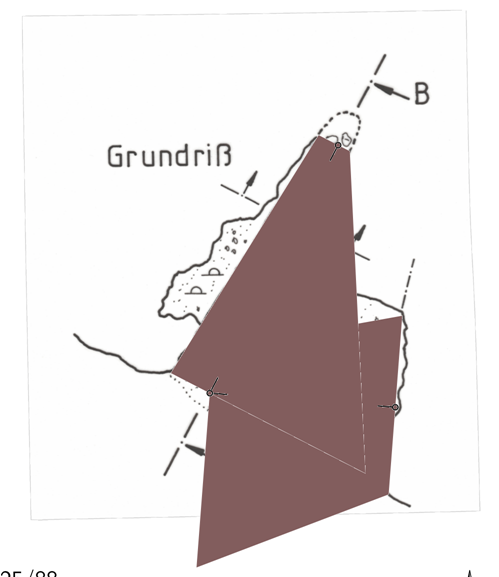
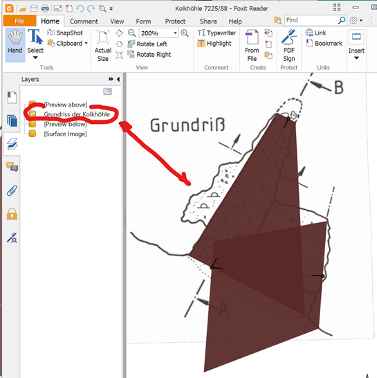
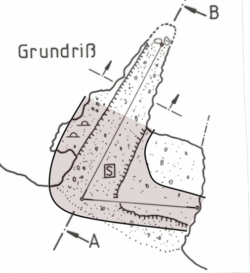
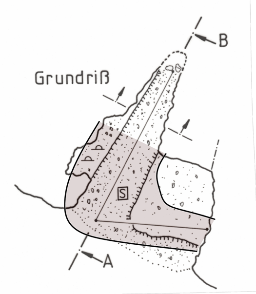
Hello Bruce, thank you very much for your explanations which are plausible. Regards, Roger ------ Originalnachricht ------ Von: "Bruce Mutton" <bruce@tomo.co.nz> An: "'List for Therion users'" <therion@speleo.sk> Gesendet: 17.04.2020 23:05:31 Betreff: Re: [Therion] Sketches on doesn't work / legacy survey
Roger
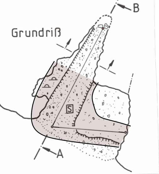
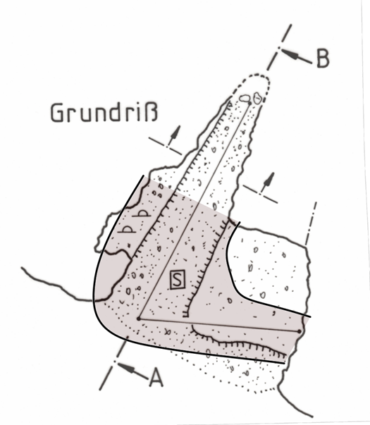
Your ‘artifacts’ are actually the passage lrud dimensions being plotted as instructed.
Here they are with a bit of colour. You see, there is your image, stations, short stubs of centreline, and solid trapezoid passage shape based on lrud.
BTW, I do think the fact that the passage trapezoids, the background images, and the scrap drawings all plot in the same pdf layer is undesirable.
The user viewing the output file cannot then isolate these components of the output, as they can with previews and surface images.
Anyway, back to Roger’s example.
A tidy way to suppress the passage centreline trapezoids is to put a ‘walls off’ statement in your th file. ie
walls off # walls off will hide the lrud passage shading
data normal from to length compass clino
etc
And yes, I see now, symbol-hide group cave-centerline will cause an error, because there is then no scrap to draw (Therion must have at least a scrap or a centreline to draw – seems that scrap station points and images don’t count).
Here is what happens if a random scrap passage wall is drawn and walls is off, and the centreline is not hidden.
There is your image, stations, short stubs of centreline ONLY inside the scrap, and no solid trapezoid passage shape.
Now, if ‘symbol-hide group cave-centreline’ is invoked, it works perfectly, even though I appreciate it is not what you want.
Here is your image, no stations, no short stubs of centreline, and no solid trapezoid passage shape. But there IS the scrap passage drawing.
Hope that helps.
Bruce
From: Therion <therion-bounces@speleo.sk> On Behalf Of Roger Schuster Sent: Saturday, 18 April 2020 07:12 To:therion@speleo.sk Subject: Re: [Therion] Sketches on doesn't work / legacy survey
Hello cavers,
finally I got it working and now I also can provide a complete example:
<https://send.firefox.com/download/68dbfd56e60e2b2c/#iSkNt75QW2_8tIZeDCD9qQ> <https://send.firefox.com/download/68dbfd56e60e2b2c/#iSkNt75QW2_8tIZeDCD9qQ>
(link will expire in seven days).
To avoid the white artifact (see file kolkhoehle_artifact.pdf) it is necessary not to hide the survey stations! As soon as you use either the attribute -visibility off or use symbol-hide point station in your layout you will have a white trapezoid on the final pdf map. Only hiding the survey line is possible. As long as the stations are visible the resulting map is fine (see kolkhoehle_ok.pdf). Btw. symbol-hide group cave-centerline causes an error.
Regards,
Roger
Am 13.04.2020 um 11:20 schrieb Roger Schuster:
Hello cavers,
currently I try to work with some legacy survey which are the original survey data and the final map with scale bar but without marked stations. My intention is to geo-reference the existing map (i.e. attaching the entrance location to the UTM grid) and use it in a cave atlas of the area. I don't want to redraw the whole map in Therion.
I followed the directions given in the therion wiki and entered the survey data and the resulting model in Loch looks fine and plausible. After that I created a scrap with the scanned map (projection plan) and scaled it using the scale bar and the scaling tool of Xtherion map editor. I marked the location of the first survey station at the cave entrance and in the layout section of my thconfig I turned on sketch export. Unfortunately it doesn't work. The generated pdf only contains the map header (with wrong length and depth statistics btw!) and a short part of the first survey shot. I expect the whole scanned background image to be visible and in scale in the pdf. Honestly said I never got the "sketches on" working with any of my old and new maps. What I am doing wrong? Any pointer to the right direction is highly appreciated.
Best regards and thanks in advance,
Roger
_______________________________________________ Therion mailing list Therion@speleo.sk https://mailman.speleo.sk/listinfo/therion
17. 4. 2020 v 21:12, Roger Schuster <roger@r-schuster.de>:
To avoid the white artifact (see file kolkhoehle_artifact.pdf) it is necessary not to hide the survey stations! As soon as you use either the attribute -visibility off or use symbol-hide point station in your layout you will have a white trapezoid on the final pdf map. Only hiding the survey line is possible. As long as the stations are visible the resulting map is fine (see kolkhoehle_ok.pdf). Btw. symbol-hide group cave-centerline causes an error.
As you may see, your .th2 file include only those three stations (and sketch). Probably it is bug in Therion that it not allows to hide stations from the final output. I may imagine the reason - MetaPost works with one scrap in time to interpret and draw that particular scrap. When it has nothing in scrap it will produce error. Martin
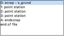
As you may see, your .th2 file include only those three stations (and sketch). Probably it is bug in Therion that it not allows to hide stations from the final output. I may imagine the reason - MetaPost works with one scrap in time to interpret and draw that particular scrap. When it has nothing in scrap it will produce error.
symbol-hide group cave-centerline will cause an error, because there is then no scrap to draw (Therion must have at least a scrap or a centreline to draw - seems that scrap station points and images don't count).
I think it is a bug. If the user hides all of the centreline objects, and also hides all scrap objects (or something like that), then Therion should trap the error and exit in a controlled manner, rather than letting metapost get in a tangle and produce a mess of messages until it finally crashes. Thanks for your insights Benoit, I had not thought of your approaches and they helped me make some mental connections. I guess redefining metapost for 'area dimensions' is the same as specifying 'walls off' in the survey file. Bruce
18. 4. 2020 v 22:25, Bruce Mutton <bruce@tomo.co.nz>:
I think it is a bug. If the user hides all of the centreline objects, and also hides all scrap objects (or something like that), then Therion should trap the error and exit in a controlled manner, rather than letting metapost get in a tangle and produce a mess of messages until it finally crashes.
Yes, it looks as it is bug. Because there are objects in that scrap - three stations from which Therion may „georeference“ sketch which is a part of the scrap too. Hide representation of objects means only to not include them in the final drawing. Martin

Hello Roger if you use the symbol-hide point station, the scrap turn "empty" and the TeX interpreter seems to be unable to get the size of the map... if you want hide the stations points, you have to redefine the p_station macro to do not draw the symbol in your layout : code metapost def p_station (expr p, m, t)(text flags) = enddef; endcode and if you want to use the "symbol-hide point station", you must add an object in your scrap, like a "point entrance" or maybe some other object without outline, but with clip off option As same way, if you want hide the "artefact" when the survey lines aren't hidden, just redefine the area dimensions : code metapost def a_dimensions (expr p) = enddef; # don't draw the LRUD enveloppe endcode Benoit *Benoit MARTINEZ - *mz.benoit@gmail.com <https://www.facebook.com/mz.benoit> <http://fr.linkedin.com/in/benoitmartinez> Le ven. 17 avr. 2020 à 21:12, Roger Schuster <roger@r-schuster.de> a écrit :
Hello cavers,
finally I got it working and now I also can provide a complete example:
<https://send.firefox.com/download/68dbfd56e60e2b2c/#iSkNt75QW2_8tIZeDCD9qQ> <https://send.firefox.com/download/68dbfd56e60e2b2c/#iSkNt75QW2_8tIZeDCD9qQ>
(link will expire in seven days).
To avoid the white artifact (see file kolkhoehle_artifact.pdf) it is necessary *not* to hide the survey stations! As soon as you use either the attribute -visibility off or use symbol-hide point station in your layout you will have a white trapezoid on the final pdf map. Only hiding the survey line is possible. As long as the stations are visible the resulting map is fine (see kolkhoehle_ok.pdf). Btw. symbol-hide group cave-centerline causes an error.
Regards,
Roger Am 13.04.2020 um 11:20 schrieb Roger Schuster:
Hello cavers,
currently I try to work with some legacy survey which are the original survey data and the final map with scale bar but without marked stations. My intention is to geo-reference the existing map (i.e. attaching the entrance location to the UTM grid) and use it in a cave atlas of the area. I don't want to redraw the whole map in Therion.
I followed the directions given in the therion wiki and entered the survey data and the resulting model in Loch looks fine and plausible. After that I created a scrap with the scanned map (projection plan) and scaled it using the scale bar and the scaling tool of Xtherion map editor. I marked the location of the first survey station at the cave entrance and in the layout section of my thconfig I turned on sketch export. Unfortunately it doesn't work. The generated pdf only contains the map header (with wrong length and depth statistics btw!) and a short part of the first survey shot. I expect the whole scanned background image to be visible and in scale in the pdf. Honestly said I never got the "sketches on" working with any of my old and new maps. What I am doing wrong? Any pointer to the right direction is highly appreciated.
Best regards and thanks in advance,
Roger
_______________________________________________ Therion mailing listTherion@speleo.skhttps://mailman.speleo.sk/listinfo/therion
_______________________________________________ Therion mailing list Therion@speleo.sk https://mailman.speleo.sk/listinfo/therion
participants (10)
-
 Benedikt Hallinger
-
 Benoit Martinez
-
 Bruce Mutton
-
 Martin Sluka
-
 Michael Ross
-
 Roger Schuster
-
 Tarquin Wilton-Jones
-
 Torsten Schnitter
-
 Xavier Robert
-
 עמרי גסטר