
Hi all I'm having some problems compiling a project which includes debris area fills. Depending on the exact symbol fill that I use, I am getting strange scale-dependant errors which seem to cause the compiler to loop endlessly until I force it to stop. I originally noticed the problem when using a custom area fill that I made by modifying the standard a_debris_AUT symbol fill. I've attached my modified metapost definition in the attached text file 'a_debris_WUG.txt'. The error occurs for any scale between 1:2000 and 1:4483 (outside of this range the project compiles fine). See attached output log 'Output log - a_debris_WUG.txt'. As you can see, the file seems to loop over and over again. Initially I thought this problem was specific to my custom fill, but then I noticed that I also get a similar error when using the standard a_debris_AUT fill, however this time the error only occurs when the scale is set to exactly 1:2000 (any other scale seems to be fine). See attached output log 'Output log - a_debris_AUT.txt'. Can anyone help with this problem? Thanks Tom

Tom This sounds familiar. The following forum thread lead to a bug discovery in 5.2.13 in around 2009. https://www.mail-archive.com/therion@speleo.sk/msg02664.html But I assume that is not what is going on in this case. There are some other threads that might hold clues, but I don’t have any helpful suggestions sorry. https://www.mail-archive.com/therion@speleo.sk/msg02506.html Bruce From: Therion [mailto:therion-bounces@speleo.sk] On Behalf Of Tom Foord via Therion Sent: Tuesday, 14 February 2017 11:26 AM To: therion@speleo.sk Cc: Tom Foord <tomfoord@gmail.com> Subject: [Therion] Scale dependant error when using area fills Hi all I'm having some problems compiling a project which includes debris area fills. Depending on the exact symbol fill that I use, I am getting strange scale-dependant errors which seem to cause the compiler to loop endlessly until I force it to stop. I originally noticed the problem when using a custom area fill that I made by modifying the standard a_debris_AUT symbol fill. I've attached my modified metapost definition in the attached text file 'a_debris_WUG.txt'. The error occurs for any scale between 1:2000 and 1:4483 (outside of this range the project compiles fine). See attached output log 'Output log - a_debris_WUG.txt'. As you can see, the file seems to loop over and over again. Initially I thought this problem was specific to my custom fill, but then I noticed that I also get a similar error when using the standard a_debris_AUT fill, however this time the error only occurs when the scale is set to exactly 1:2000 (any other scale seems to be fine). See attached output log 'Output log - a_debris_AUT.txt'. Can anyone help with this problem? Thanks Tom

Hi, I am experiencing the same problem, with debris (not original Therion one). I realised, this error depends mostly on density of rock pieces drawn in the map. While high density crash compilation even 0,5 km of passages, with lover it works well with large caves, even the amount of pieces is much bigger. I think it is because unpropriate syntax of area. Pavel Dňa 2017-02-14 09:08 Bruce Mutton via Therion napísal(a):
Tom
This sounds familiar. The following forum thread lead to a bug discovery in 5.2.13 in around 2009.
https://www.mail-archive.com/therion@speleo.sk/msg02664.html
But I assume that is not what is going on in this case.
There are some other threads that might hold clues, but I don’t have any helpful suggestions sorry.
https://www.mail-archive.com/therion@speleo.sk/msg02506.html
Bruce
FROM: Therion [mailto:therion-bounces@speleo.sk] ON BEHALF OF Tom Foord via Therion SENT: Tuesday, 14 February 2017 11:26 AM TO: therion@speleo.sk CC: Tom Foord <tomfoord@gmail.com> SUBJECT: [Therion] Scale dependant error when using area fills
Hi all
I'm having some problems compiling a project which includes debris area fills. Depending on the exact symbol fill that I use, I am getting strange scale-dependant errors which seem to cause the compiler to loop endlessly until I force it to stop.
I originally noticed the problem when using a custom area fill that I made by modifying the standard a_debris_AUT symbol fill. I've attached my modified metapost definition in the attached text file 'a_debris_WUG.txt'. The error occurs for any scale between 1:2000 and 1:4483 (outside of this range the project compiles fine).
See attached output log 'Output log - a_debris_WUG.txt'. As you can see, the file seems to loop over and over again.
Initially I thought this problem was specific to my custom fill, but then I noticed that I also get a similar error when using the standard a_debris_AUT fill, however this time the error only occurs when the scale is set to exactly 1:2000 (any other scale seems to be fine).
See attached output log 'Output log - a_debris_AUT.txt'.
Can anyone help with this problem?
Thanks
Tom _______________________________________________ Therion mailing list Therion@speleo.sk https://mailman.speleo.sk/listinfo/therion

Hi guys, Could not find the answer, so popping up to ask you the question. Is there a way to say that one survey should bear most on the distorsion ? I have a diving survey which is less accurate than the “regular” surveys, can I put some weight on that survey so it will be more distorted ? Thanks, Phil

Hi Phil, Yes, you can do that by setting the standard deviation for the survey as a whole, and then for each leg that requires it.
From the Therion book:
sd <quantity list> <value> <units> ◃ sets the standard deviation for the given measurements. The Quantity list can contain the following keywords: length, tape, bearing, compass, gradient, clino, counter, depth, x, y, z, position, easting, dx, northing, dy, altitude, dz. The sd command affects all following legs, so for a single leg, remember to set the sd back to your default again, eg:- sd compass 5 degrees sd clino 2 degree 1 2 209 10.88 -4 sd compass clino 0.5 degrees A small difference in SD makes a big difference in the distribution of error, so suggest experiment with different values. Best regards, Ben -----Original Message----- From: Therion [mailto:therion-bounces@speleo.sk] On Behalf Of Philippe Vernant via Therion Sent: 14 February 2017 23:34 To: List for Therion users Cc: Philippe Vernant Subject: [Therion] weight on distorsion depending on survey Hi guys, Could not find the answer, so popping up to ask you the question. Is there a way to say that one survey should bear most on the distorsion ? I have a diving survey which is less accurate than the “regular” surveys, can I put some weight on that survey so it will be more distorted ? Thanks, Phil _______________________________________________ Therion mailing list Therion@speleo.sk https://mailman.speleo.sk/listinfo/therion

Check Survex documentation. The principe is the same. M.s. Odesláno z iPhonu 15. 2. 2017 v 8:04, Ben Cooper via Therion <therion@speleo.sk>:
Hi Phil, Yes, you can do that by setting the standard deviation for the survey as a whole, and then for each leg that requires it.
From the Therion book:
sd <quantity list> <value> <units> ◃ sets the standard deviation for the given measurements. The Quantity list can contain the following keywords: length, tape, bearing, compass, gradient, clino, counter, depth, x, y, z, position, easting, dx, northing, dy, altitude, dz.
The sd command affects all following legs, so for a single leg, remember to set the sd back to your default again, eg:- sd compass 5 degrees sd clino 2 degree 1 2 209 10.88 -4 sd compass clino 0.5 degrees
A small difference in SD makes a big difference in the distribution of error, so suggest experiment with different values. Best regards, Ben
-----Original Message----- From: Therion [mailto:therion-bounces@speleo.sk] On Behalf Of Philippe Vernant via Therion Sent: 14 February 2017 23:34 To: List for Therion users Cc: Philippe Vernant Subject: [Therion] weight on distorsion depending on survey
Hi guys,
Could not find the answer, so popping up to ask you the question. Is there a way to say that one survey should bear most on the distorsion ? I have a diving survey which is less accurate than the “regular” surveys, can I put some weight on that survey so it will be more distorted ?
Thanks, Phil
_______________________________________________ Therion mailing list Therion@speleo.sk https://mailman.speleo.sk/listinfo/therion
_______________________________________________ Therion mailing list Therion@speleo.sk https://mailman.speleo.sk/listinfo/therion
Thanks Martin, will do. Best, Phil
On 15 Feb 2017, at 10:23 AM, Martin Sluka via Therion <therion@speleo.sk> wrote:
Check Survex documentation. The principe is the same.
M.s.
Odesláno z iPhonu
15. 2. 2017 v 8:04, Ben Cooper via Therion <therion@speleo.sk>:
Hi Phil, Yes, you can do that by setting the standard deviation for the survey as a whole, and then for each leg that requires it.
From the Therion book:
sd <quantity list> <value> <units> ◃ sets the standard deviation for the given measurements. The Quantity list can contain the following keywords: length, tape, bearing, compass, gradient, clino, counter, depth, x, y, z, position, easting, dx, northing, dy, altitude, dz.
The sd command affects all following legs, so for a single leg, remember to set the sd back to your default again, eg:- sd compass 5 degrees sd clino 2 degree 1 2 209 10.88 -4 sd compass clino 0.5 degrees
A small difference in SD makes a big difference in the distribution of error, so suggest experiment with different values. Best regards, Ben
-----Original Message----- From: Therion [mailto:therion-bounces@speleo.sk] On Behalf Of Philippe Vernant via Therion Sent: 14 February 2017 23:34 To: List for Therion users Cc: Philippe Vernant Subject: [Therion] weight on distorsion depending on survey
Hi guys,
Could not find the answer, so popping up to ask you the question. Is there a way to say that one survey should bear most on the distorsion ? I have a diving survey which is less accurate than the “regular” surveys, can I put some weight on that survey so it will be more distorted ?
Thanks, Phil
_______________________________________________ Therion mailing list Therion@speleo.sk https://mailman.speleo.sk/listinfo/therion
_______________________________________________ Therion mailing list Therion@speleo.sk https://mailman.speleo.sk/listinfo/therion
Therion mailing list Therion@speleo.sk https://mailman.speleo.sk/listinfo/therion
Hi guys, Here is the .th and .th2 file from a survey of a large chamber. What I don’t understand is why the line survey is outside below the chamber. Any advice on how to fix that ? Thanks, Phil
It looks as a problem of lox generation. But it should be a bug. Check attached picture, mostly all splay shots from station 4-10 are going upside. But it has not changed I added to stations dummy „down“ shot m.s.
15. 2. 2017 v 13:23, Philippe Vernant via Therion <therion@speleo.sk>:
Hi guys,
Here is the .th and .th2 file from a survey of a large chamber. What I don’t understand is why the line survey is outside below the chamber. Any advice on how to fix that ?
Thanks, Phil
<test.lox><test.th><test.th2><thconfig_test>_______________________________________________ Therion mailing list Therion@speleo.sk https://mailman.speleo.sk/listinfo/therion
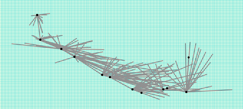

Hi, this is a problem of 3D generation algorithm of therion... If a wall is relatively far away from centreline, height and dimensions interpolation algorithm "averages too much". To overcome this, you need to play with dimensions data for stations (putting some arbitrary large numbers there - see example) or using "point dimensions -value [up down]" in 2D plan somewhere near wall that needs to be affected. But these are not nice changes. We should modify 3D generation algorithm to solve these situations correctly. S. On 15 February 2017 at 13:23, Philippe Vernant via Therion < therion@speleo.sk> wrote:
Hi guys,
Here is the .th and .th2 file from a survey of a large chamber. What I don’t understand is why the line survey is outside below the chamber. Any advice on how to fix that ?
Thanks, Phil
_______________________________________________ Therion mailing list Therion@speleo.sk https://mailman.speleo.sk/listinfo/therion
Hi Stacho, Thanks for the tip, this will greatly help me to improve my 3D !!! Therion rocks ! Best, Phil
On 21 Feb 2017, at 14:18 PM, Stacho Mudrak via Therion <therion@speleo.sk> wrote:
Hi, this is a problem of 3D generation algorithm of therion...
If a wall is relatively far away from centreline, height and dimensions interpolation algorithm "averages too much". To overcome this, you need to play with dimensions data for stations (putting some arbitrary large numbers there - see example) or using "point dimensions -value [up down]" in 2D plan somewhere near wall that needs to be affected.
But these are not nice changes. We should modify 3D generation algorithm to solve these situations correctly.
S.
On 15 February 2017 at 13:23, Philippe Vernant via Therion <therion@speleo.sk <mailto:therion@speleo.sk>> wrote: Hi guys,
Here is the .th and .th2 file from a survey of a large chamber. What I don’t understand is why the line survey is outside below the chamber. Any advice on how to fix that ?
Thanks, Phil
_______________________________________________ Therion mailing list Therion@speleo.sk <mailto:Therion@speleo.sk> https://mailman.speleo.sk/listinfo/therion <https://mailman.speleo.sk/listinfo/therion>
<test.th>_______________________________________________ Therion mailing list Therion@speleo.sk https://mailman.speleo.sk/listinfo/therion
Phil This got lost in my spam folder, hence the late response. Looks like Loch is not using the splay shots to all. Which is expected behaviour I think. Loch generally guesses vertical passage dimensions, unless you go to special efforts… Have you looked at the wiki examples page <https://therion.speleo.sk/wiki/examples?s%5b%5d=loch#loch_models_paperless_survey_plan_scraps_and_lrud> , item on Loch Models? Perhaps you can offer further insights to the notes at the bottom of that page? Bruce -----Original Message----- From: Therion [mailto:therion-bounces@speleo.sk] On Behalf Of Philippe Vernant via Therion Sent: Thursday, 16 February 2017 1:24 AM To: List for Therion users <therion@speleo.sk> Cc: Philippe Vernant <phil.vernant@gmail.com> Subject: [Therion] Troubles with the 3D generation Hi guys, Here is the .th and .th2 file from a survey of a large chamber. What I don’t understand is why the line survey is outside below the chamber. Any advice on how to fix that ? Thanks, Phil
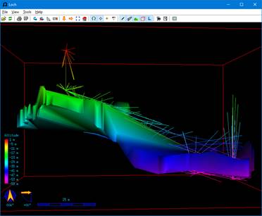
Hi Bruce, Stacho solution did the trick, you have to add some extra “dimensions” so the 3D rendering is better. Cheers, Phil
On 17 Mar 2017, at 21:43 PM, Bruce Mutton via Therion <therion@speleo.sk> wrote:
Phil This got lost in my spam folder, hence the late response. Looks like Loch is not using the splay shots to all. <image002.jpg>
Which is expected behaviour I think. Loch generally guesses vertical passage dimensions, unless you go to special efforts… Have you looked at the wiki examples page <https://therion.speleo.sk/wiki/examples?s%5b%5d=loch#loch_models_paperless_survey_plan_scraps_and_lrud>, item on Loch Models? Perhaps you can offer further insights to the notes at the bottom of that page?
Bruce
-----Original Message----- From: Therion [mailto:therion-bounces@speleo.sk <mailto:therion-bounces@speleo.sk>] On Behalf Of Philippe Vernant via Therion Sent: Thursday, 16 February 2017 1:24 AM To: List for Therion users <therion@speleo.sk <mailto:therion@speleo.sk>> Cc: Philippe Vernant <phil.vernant@gmail.com <mailto:phil.vernant@gmail.com>> Subject: [Therion] Troubles with the 3D generation
Hi guys,
Here is the .th and .th2 file from a survey of a large chamber. What I don’t understand is why the line survey is outside below the chamber. Any advice on how to fix that ?
Thanks, Phil
_______________________________________________ Therion mailing list Therion@speleo.sk <mailto:Therion@speleo.sk> https://mailman.speleo.sk/listinfo/therion <https://mailman.speleo.sk/listinfo/therion>

What is the different between "point dimensions" and "point passage-height"? If i understand the therion book correctly: - dimensions is ONLY for the 3D-tube generation and invisible in rendered maps - otherwise behaves as if "point passage-height [+<up> -<down>] would have been given. Or are there any other differences? I noticed that the chamber height changes with "passage-height" also, not just "dimensions". Am 2017-03-19 22:49, schrieb Philippe Vernant via Therion:
Hi Bruce,
Stacho solution did the trick, you have to add some extra “dimensions” so the 3D rendering is better.
Cheers, Phil
On 17 Mar 2017, at 21:43 PM, Bruce Mutton via Therion <therion@speleo.sk [1]> wrote:
Phil This got lost in my spam folder, hence the late response. Looks like Loch is not using the splay shots to all. <image002.jpg>
Which is expected behaviour I think. Loch generally guesses vertical passage dimensions, unless you go to special efforts… Have you looked at the wiki examples page [2], item on Loch Models? Perhaps you can offer further insights to the notes at the bottom of that page?
Bruce
-----Original Message----- From: Therion [mailto:therion-bounces@speleo.sk [3]] On Behalf Of Philippe Vernant via Therion Sent: Thursday, 16 February 2017 1:24 AM To: List for Therion users <therion@speleo.sk [4]> Cc: Philippe Vernant <phil.vernant@gmail.com [5]> Subject: [Therion] Troubles with the 3D generation
Hi guys,
Here is the .th and .th2 file from a survey of a large chamber. What I don’t understand is why the line survey is outside below the chamber. Any advice on how to fix that ?
Thanks, Phil _______________________________________________ Therion mailing list Therion@speleo.sk [6] https://mailman.speleo.sk/listinfo/therion [7]
Links: ------ [1] mailto:therion@speleo.sk [2] https://therion.speleo.sk/wiki/examples?s%5b%5d=loch#loch_models_paperless_s... [3] mailto:therion-bounces@speleo.sk [4] mailto:therion@speleo.sk [5] mailto:phil.vernant@gmail.com [6] mailto:Therion@speleo.sk [7] https://mailman.speleo.sk/listinfo/therion
20. 3. 2017 v 20:48, Benedikt Hallinger via Therion <therion@speleo.sk>:
What is the different between "point dimensions" and "point passage-height"?
If i understand the therion book correctly: - dimensions is ONLY for the 3D-tube generation and invisible in rendered maps - otherwise behaves as if "point passage-height [+<up> -<down>] would have been given.
point dimension: use -value option to specify passage dimensions above/below centerline plane used while creating 3D model. • value ◃ value of height, passage-height or altitude label or point dimensions height: according to the sign of the value (positive, negative or unsigned), this type of symbol represents chimney height, pit depth or step height in general. The numeric value can be optionally followed by ‘?’, if the value is presumed and units can be added (e.g. -value [40? ft]). passage-height: the following four forms of value are supported: +<number> (the height of the ceiling), -<number> (the depth of the floor or water depth), <number> (the distance between floor and ceiling) and [+<number> -<number>] (the distance to ceiling and distance to floor). altitude: the value specified is the altitude difference from the nearest station. If the altitude value is prefixed by “fix” (e.g. -value [fix 1300]), this value is used as an absolute altitude. The value can optionally be followed by length units. dimensions: -value [<above> <below> [<units>]] specifies passage dimensions above/below centerline plane used in 3D model. A bit difficult to understand. I understand passage-height [+8 -3] From water level to ceiling 8 m, depth of water 3 m. But what it means: "-<number> (the depth of the floor" or "[+<number> -<number>] (the distance to ceiling and distance to floor)"? Has floor any depth? Or it means the situation if the point „height“ is on edge of step or pit? m.s.
I had put my understandings (about ‘point dimensions’ and ‘point passage-height’) in the wiki https://therion.speleo.sk/wiki/drawingchecklist#points under the heading Passage Size, Fills and Speleothems and discussed an anomaly. Any corrections or comments welcome. Bruce -----Original Message----- From: Therion [mailto:therion-bounces@speleo.sk] On Behalf Of Martin Sluka via Therion Sent: Tuesday, 21 March 2017 10:23 AM To: List for Therion users <therion@speleo.sk> Cc: Martin Sluka <martinsluka@mac.com> Subject: Re: [Therion] Troubles with the 3D generation
20. 3. 2017 v 20:48, Benedikt Hallinger via Therion < <mailto:therion@speleo.sk> therion@speleo.sk>:
What is the different between "point dimensions" and "point passage-height"?
If i understand the therion book correctly:
- dimensions is ONLY for the 3D-tube generation and invisible in rendered maps
- otherwise behaves as if "point passage-height [+<up> -<down>] would have been given.
...<clipped>... A bit difficult to understand. I understand passage-height [+8 -3] From water level to ceiling 8 m, depth of water 3 m. But what it means: "-<number> (the depth of the floor" or "[+<number> -<number>] (the distance to ceiling and distance to floor)"? Has floor any depth? Or it means the situation if the point „height“ is on edge of step or pit? m.s.

Hello Therion users, I am trying to make a 3D model for a small horizontal cave where only plan had been drawn up. In case if I use splays for model generation it cuts through the wall surfaces and looks not very nice. If I use just walls with option "export model -wall-source maps" and bunch of "point dimensions" model comes out without floor and cealing. Maybe someone can point out what am I doing wrong? Project files attached. Thanks, Andrey
Вторник, 21 марта 2017, 5:53 UTC от Bruce Mutton via Therion <therion@speleo.sk>:
I had put my understandings (about ‘point dimensions’ and ‘point passage-height’) in the wiki https://therion.speleo.sk/wiki/drawingchecklist#points under the heading Passage Size, Fills and Speleothems and discussed an anomaly. Any corrections or comments welcome. Bruce -----Original Message----- From: Therion [mailto:therion-bounces@speleo.sk] On Behalf Of Martin Sluka via Therion Sent: Tuesday, 21 March 2017 10:23 AM To: List for Therion users < therion@speleo.sk > Cc: Martin Sluka < martinsluka@mac.com > Subject: Re: [Therion] Troubles with the 3D generation
20. 3. 2017 v 20:48, Benedikt Hallinger via Therion < therion@speleo.sk >:
What is the different between "point dimensions" and "point passage-height"?
If i understand the therion book correctly: - dimensions is ONLY for the 3D-tube generation and invisible in rendered maps - otherwise behaves as if "point passage-height [+<up> -<down>] would have been given.
...<clipped>... A bit difficult to understand. I understand passage-height [+8 -3] From water level to ceiling 8 m, depth of water 3 m. But what it means: "-<number> (the depth of the floor" or "[+<number> -<number>] (the distance to ceiling and distance to floor)"? Has floor any depth? Or it means the situation if the point „height“ is on edge of step or pit? m.s. _______________________________________________ Therion mailing list Therion@speleo.sk https://mailman.speleo.sk/listinfo/therion
-- Kind regards, Andrey
Only one very-very small dummy wall line there, check attached screen-shot. It will be all OK when you delete it. Martin
19. 1. 2019 v 20:30, Andrey via Therion <therion@speleo.sk>:
Hello Therion users,
I am trying to make a 3D model for a small horizontal cave where only plan had been drawn up.
In case if I use splays for model generation it cuts through the wall surfaces and looks not very nice. If I use just walls with option "export model -wall-source maps" and bunch of "point dimensions" model comes out without floor and cealing.
Maybe someone can point out what am I doing wrong?
Project files attached.
Thanks, Andrey
Вторник, 21 марта 2017, 5:53 UTC от Bruce Mutton via Therion <therion@speleo.sk>:
I had put my understandings (about ‘point dimensions’ and ‘point passage-height’) in the wiki
https://therion.speleo.sk/wiki/drawingchecklist#points <https://therion.speleo.sk/wiki/drawingchecklist#points> under the heading Passage Size, Fills and Speleothems
and discussed an anomaly. Any corrections or comments welcome.
Bruce
-----Original Message----- From: Therion [mailto:therion-bounces@speleo.sk] On Behalf Of Martin Sluka via Therion Sent: Tuesday, 21 March 2017 10:23 AM To: List for Therion users <therion@speleo.sk <mailto:therion@speleo.sk>> Cc: Martin Sluka <martinsluka@mac.com <mailto:martinsluka@mac.com>> Subject: Re: [Therion] Troubles with the 3D generation
20. 3. 2017 v 20:48, Benedikt Hallinger via Therion <therion@speleo.sk <x-msg://e.mail.ru/compose/?mailto=mailto%3atherion@speleo.sk>>:
What is the different between "point dimensions" and "point passage-height"?
If i understand the therion book correctly:
- dimensions is ONLY for the 3D-tube generation and invisible in rendered maps
- otherwise behaves as if "point passage-height [+<up> -<down>] would have been given.
...<clipped>...
A bit difficult to understand. I understand passage-height [+8 -3] From water level to ceiling 8 m, depth of water 3 m.
But what it means: "-<number> (the depth of the floor" or "[+<number> -<number>] (the distance to ceiling and distance to floor)"? Has floor any depth? Or it means the situation if the point „height“ is on edge of step or pit?
m.s.
_______________________________________________ Therion mailing list Therion@speleo.sk <mailto:Therion@speleo.sk> https://mailman.speleo.sk/listinfo/therion <https://mailman.speleo.sk/listinfo/therion>
-- Kind regards, Andrey <Survey_01.zip>_______________________________________________ Therion mailing list Therion@speleo.sk <mailto:Therion@speleo.sk> https://mailman.speleo.sk/listinfo/therion <https://mailman.speleo.sk/listinfo/therion>
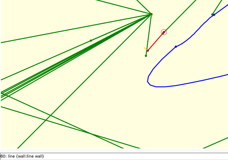
Thank you very much for catching that! Now model looks perfect! This "invalid scrap outline" warning was ringing some bells but I was too impatient when tidying up the scrap. It would be a great enhancement if there will be an option for walls to cut the spaly triangles in case if splays are not stiking through the wall lines.
Воскресенье, 20 января 2019, 12:59 UTC от Martin Sluka via Therion <therion@speleo.sk>:
Only one very-very small dummy wall line there, check attached screen-shot. It will be all OK when you delete it.
Martin
19. 1. 2019 v 20:30, Andrey via Therion < therion@speleo.sk >: Hello Therion users,
I am trying to make a 3D model for a small horizontal cave where only plan had been drawn up.
In case if I use splays for model generation it cuts through the wall surfaces and looks not very nice. If I use just walls with option "export model -wall-source maps" and bunch of "point dimensions" model comes out without floor and cealing.
Maybe someone can point out what am I doing wrong?
Project files attached.
Thanks, Andrey
Вторник, 21 марта 2017, 5:53 UTC от Bruce Mutton via Therion < therion@speleo.sk >:
I had put my understandings (about ‘point dimensions’ and ‘point passage-height’) in the wiki https://therion.speleo.sk/wiki/drawingchecklist#points under the heading Passage Size, Fills and Speleothems and discussed an anomaly. Any corrections or comments welcome. Bruce -----Original Message----- From: Therion [ mailto:therion-bounces@speleo.sk ] On Behalf Of Martin Sluka via Therion Sent: Tuesday, 21 March 2017 10:23 AM To: List for Therion users < therion@speleo.sk > Cc: Martin Sluka < martinsluka@mac.com > Subject: Re: [Therion] Troubles with the 3D generation
20. 3. 2017 v 20:48, Benedikt Hallinger via Therion < therion@speleo.sk >: What is the different between "point dimensions" and "point passage-height"? If i understand the therion book correctly: - dimensions is ONLY for the 3D-tube generation and invisible in rendered maps - otherwise behaves as if "point passage-height [+<up> -<down>] would have been given. ...<clipped>... A bit difficult to understand. I understand passage-height [+8 -3] From water level to ceiling 8 m, depth of water 3 m. But what it means: "-<number> (the depth of the floor" or "[+<number> -<number>] (the distance to ceiling and distance to floor)"? Has floor any depth? Or it means the situation if the point „height“ is on edge of step or pit? m.s.
Therion mailing list Therion@speleo.sk https://mailman.speleo.sk/listinfo/therion
-- Kind regards, Andrey <Survey_01.zip> _______________________________________________ Therion mailing list Therion@speleo.sk https://mailman.speleo.sk/listinfo/therion
Therion mailing list Therion@speleo.sk https://mailman.speleo.sk/listinfo/therion
-- Kind regards, Andrey
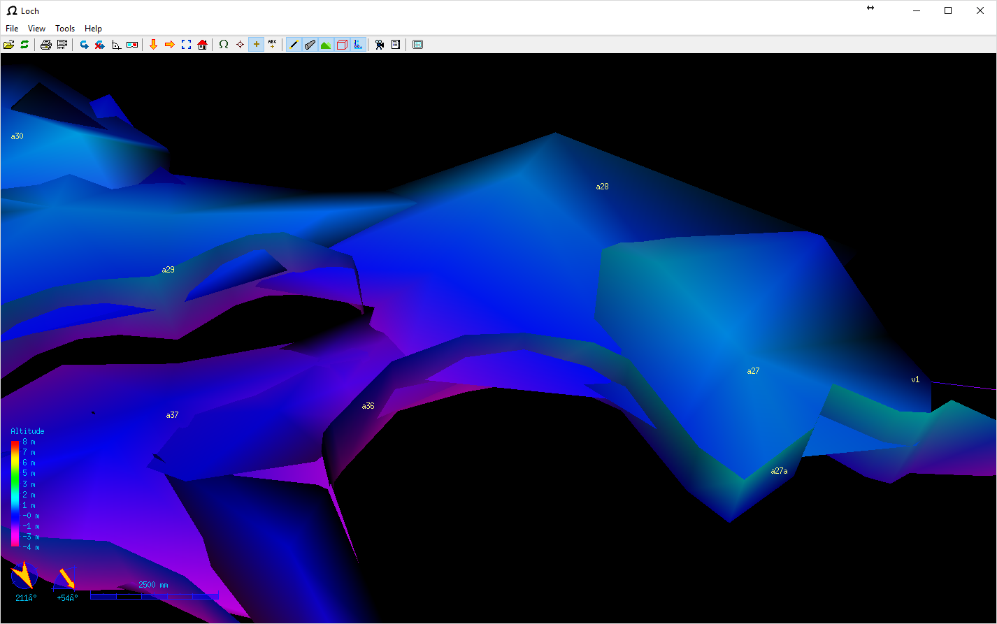
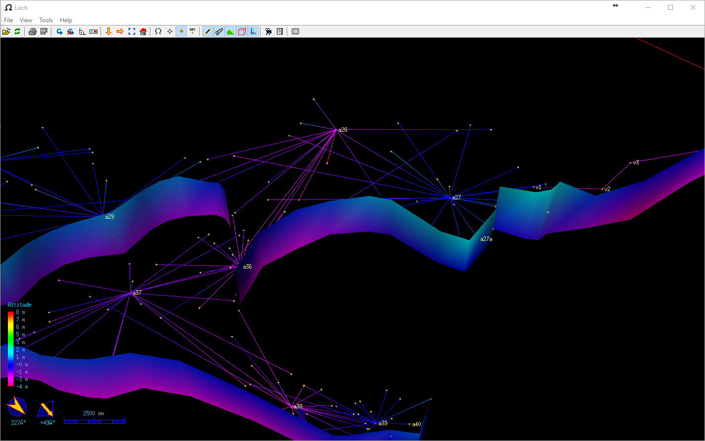
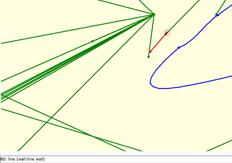
I divided it to several smaller scraps and checked, where is the problem. Martin
20. 1. 2019 v 14:41, Andrey via Therion <therion@speleo.sk>:
Thank you very much for catching that! Now model looks perfect!
This "invalid scrap outline" warning was ringing some bells but I was too impatient when tidying up the scrap.
It would be a great enhancement if there will be an option for walls to cut the spaly triangles in case if splays are not stiking through the wall lines.
<image.png>
<image.png>
Воскресенье, 20 января 2019, 12:59 UTC от Martin Sluka via Therion <therion@speleo.sk>:
Only one very-very small dummy wall line there, check attached screen-shot. It will be all OK when you delete it.
Martin
<Snímek obrazovky 2019-01-20 v 13.55.33.png>
19. 1. 2019 v 20:30, Andrey via Therion <therion@speleo.sk <x-msg://e.mail.ru/compose/?mailto=mailto%3atherion@speleo.sk>>:
Hello Therion users,
I am trying to make a 3D model for a small horizontal cave where only plan had been drawn up.
In case if I use splays for model generation it cuts through the wall surfaces and looks not very nice. If I use just walls with option "export model -wall-source maps" and bunch of "point dimensions" model comes out without floor and cealing.
Maybe someone can point out what am I doing wrong?
Project files attached.
Thanks, Andrey
Вторник, 21 марта 2017, 5:53 UTC от Bruce Mutton via Therion <therion@speleo.sk <x-msg://e.mail.ru/compose/?mailto=mailto%3atherion@speleo.sk>>:
I had put my understandings (about ‘point dimensions’ and ‘point passage-height’) in the wiki
https://therion.speleo.sk/wiki/drawingchecklist#points <https://therion.speleo.sk/wiki/drawingchecklist#points> under the heading Passage Size, Fills and Speleothems
and discussed an anomaly. Any corrections or comments welcome.
Bruce
-----Original Message----- From: Therion [mailto:therion-bounces@speleo.sk <x-msg://e.mail.ru/compose/?mailto=mailto%3atherion%2dbounces@speleo.sk>] On Behalf Of Martin Sluka via Therion Sent: Tuesday, 21 March 2017 10:23 AM To: List for Therion users <therion@speleo.sk <x-msg://e.mail.ru/compose/?mailto=mailto%3atherion@speleo.sk>> Cc: Martin Sluka <martinsluka@mac.com <x-msg://e.mail.ru/compose/?mailto=mailto%3amartinsluka@mac.com>> Subject: Re: [Therion] Troubles with the 3D generation
20. 3. 2017 v 20:48, Benedikt Hallinger via Therion <therion@speleo.sk <>>:
What is the different between "point dimensions" and "point passage-height"?
If i understand the therion book correctly:
- dimensions is ONLY for the 3D-tube generation and invisible in rendered maps
- otherwise behaves as if "point passage-height [+<up> -<down>] would have been given.
...<clipped>...
A bit difficult to understand. I understand passage-height [+8 -3] From water level to ceiling 8 m, depth of water 3 m.
But what it means: "-<number> (the depth of the floor" or "[+<number> -<number>] (the distance to ceiling and distance to floor)"? Has floor any depth? Or it means the situation if the point „height“ is on edge of step or pit?
m.s.
_______________________________________________ Therion mailing list Therion@speleo.sk <x-msg://e.mail.ru/compose/?mailto=mailto%3aTherion@speleo.sk> https://mailman.speleo.sk/listinfo/therion <https://mailman.speleo.sk/listinfo/therion>
-- Kind regards, Andrey <Survey_01.zip>_______________________________________________ Therion mailing list Therion@speleo.sk <x-msg://e.mail.ru/compose/?mailto=mailto%3aTherion@speleo.sk> https://mailman.speleo.sk/listinfo/therion <https://mailman.speleo.sk/listinfo/therion>
Therion mailing list Therion@speleo.sk <mailto:Therion@speleo.sk> https://mailman.speleo.sk/listinfo/therion <https://mailman.speleo.sk/listinfo/therion>
-- Kind regards, Andrey _______________________________________________ Therion mailing list Therion@speleo.sk <mailto:Therion@speleo.sk> https://mailman.speleo.sk/listinfo/therion <https://mailman.speleo.sk/listinfo/therion>
Maybe the most simple way could be in layout: symbol-hide group all symbol-show line wall Martin S.
20. 1. 2019 v 14:41, Andrey via Therion <therion@speleo.sk>:
Thank you very much for catching that! Now model looks perfect!
This "invalid scrap outline" warning was ringing some bells but I was too impatient when tidying up the scrap.
It would be a great enhancement if there will be an option for walls to cut the spaly triangles in case if splays are not stiking through the wall lines.
<image.png>
<image.png>
Воскресенье, 20 января 2019, 12:59 UTC от Martin Sluka via Therion <therion@speleo.sk>:
Only one very-very small dummy wall line there, check attached screen-shot. It will be all OK when you delete it.
Martin
<Snímek obrazovky 2019-01-20 v 13.55.33.png>
19. 1. 2019 v 20:30, Andrey via Therion <therion@speleo.sk <x-msg://e.mail.ru/compose/?mailto=mailto%3atherion@speleo.sk>>:
Hello Therion users,
I am trying to make a 3D model for a small horizontal cave where only plan had been drawn up.
In case if I use splays for model generation it cuts through the wall surfaces and looks not very nice. If I use just walls with option "export model -wall-source maps" and bunch of "point dimensions" model comes out without floor and cealing.
Maybe someone can point out what am I doing wrong?
Project files attached.
Thanks, Andrey
Вторник, 21 марта 2017, 5:53 UTC от Bruce Mutton via Therion <therion@speleo.sk <x-msg://e.mail.ru/compose/?mailto=mailto%3atherion@speleo.sk>>:
I had put my understandings (about ‘point dimensions’ and ‘point passage-height’) in the wiki
https://therion.speleo.sk/wiki/drawingchecklist#points <https://therion.speleo.sk/wiki/drawingchecklist#points> under the heading Passage Size, Fills and Speleothems
and discussed an anomaly. Any corrections or comments welcome.
Bruce
-----Original Message----- From: Therion [mailto:therion-bounces@speleo.sk <x-msg://e.mail.ru/compose/?mailto=mailto%3atherion%2dbounces@speleo.sk>] On Behalf Of Martin Sluka via Therion Sent: Tuesday, 21 March 2017 10:23 AM To: List for Therion users <therion@speleo.sk <x-msg://e.mail.ru/compose/?mailto=mailto%3atherion@speleo.sk>> Cc: Martin Sluka <martinsluka@mac.com <x-msg://e.mail.ru/compose/?mailto=mailto%3amartinsluka@mac.com>> Subject: Re: [Therion] Troubles with the 3D generation
20. 3. 2017 v 20:48, Benedikt Hallinger via Therion <therion@speleo.sk <>>:
What is the different between "point dimensions" and "point passage-height"?
If i understand the therion book correctly:
- dimensions is ONLY for the 3D-tube generation and invisible in rendered maps
- otherwise behaves as if "point passage-height [+<up> -<down>] would have been given.
...<clipped>...
A bit difficult to understand. I understand passage-height [+8 -3] From water level to ceiling 8 m, depth of water 3 m.
But what it means: "-<number> (the depth of the floor" or "[+<number> -<number>] (the distance to ceiling and distance to floor)"? Has floor any depth? Or it means the situation if the point „height“ is on edge of step or pit?
m.s.
_______________________________________________ Therion mailing list Therion@speleo.sk <x-msg://e.mail.ru/compose/?mailto=mailto%3aTherion@speleo.sk> https://mailman.speleo.sk/listinfo/therion <https://mailman.speleo.sk/listinfo/therion>
-- Kind regards, Andrey <Survey_01.zip>_______________________________________________ Therion mailing list Therion@speleo.sk <x-msg://e.mail.ru/compose/?mailto=mailto%3aTherion@speleo.sk> https://mailman.speleo.sk/listinfo/therion <https://mailman.speleo.sk/listinfo/therion>
Therion mailing list Therion@speleo.sk <mailto:Therion@speleo.sk> https://mailman.speleo.sk/listinfo/therion <https://mailman.speleo.sk/listinfo/therion>
-- Kind regards, Andrey _______________________________________________ Therion mailing list Therion@speleo.sk <mailto:Therion@speleo.sk> https://mailman.speleo.sk/listinfo/therion <https://mailman.speleo.sk/listinfo/therion>
Sorry, it is near station a69 Martin Sluka
19. 1. 2019 v
20:30, Andrey via Therion <therion@speleo.sk>:
Hello Therion users,
I am trying to make a 3D model for a small horizontal cave where only plan had been drawn up.
In case if I use splays for model generation it cuts through the wall surfaces and looks not very nice. If I use just walls with option "export model -wall-source maps" and bunch of "point dimensions" model comes out without floor and cealing.
Maybe someone can point out what am I doing wrong?
Project files attached.
Thanks, Andrey
Вторник, 21 марта 2017, 5:53 UTC от Bruce Mutton via Therion <therion@speleo.sk>:
I had put my understandings (about ‘point dimensions’ and ‘point passage-height’) in the wiki
https://therion.speleo.sk/wiki/drawingchecklist#points <https://therion.speleo.sk/wiki/drawingchecklist#points> under the heading Passage Size, Fills and Speleothems
and discussed an anomaly. Any corrections or comments welcome.
Bruce
-----Original Message----- From: Therion [mailto:therion-bounces@speleo.sk] On Behalf Of Martin Sluka via Therion Sent: Tuesday, 21 March 2017 10:23 AM To: List for Therion users <therion@speleo.sk <mailto:therion@speleo.sk>> Cc: Martin Sluka <martinsluka@mac.com <mailto:martinsluka@mac.com>> Subject: Re: [Therion] Troubles with the 3D generation
20. 3. 2017 v 20:48, Benedikt Hallinger via Therion <therion@speleo.sk <x-msg://e.mail.ru/compose/?mailto=mailto%3atherion@speleo.sk>>:
What is the different between "point dimensions" and "point passage-height"?
If i understand the therion book correctly:
- dimensions is ONLY for the 3D-tube generation and invisible in rendered maps
- otherwise behaves as if "point passage-height [+<up> -<down>] would have been given.
...<clipped>...
A bit difficult to understand. I understand passage-height [+8 -3] From water level to ceiling 8 m, depth of water 3 m.
But what it means: "-<number> (the depth of the floor" or "[+<number> -<number>] (the distance to ceiling and distance to floor)"? Has floor any depth? Or it means the situation if the point „height“ is on edge of step or pit?
m.s.
_______________________________________________ Therion mailing list Therion@speleo.sk <mailto:Therion@speleo.sk> https://mailman.speleo.sk/listinfo/therion <https://mailman.speleo.sk/listinfo/therion>
-- Kind regards, Andrey <Survey_01.zip>_______________________________________________ Therion mailing list Therion@speleo.sk <mailto:Therion@speleo.sk> https://mailman.speleo.sk/listinfo/therion <https://mailman.speleo.sk/listinfo/therion>
participants (9)
-
 Andrey
-
 Ben Cooper
-
 Benedikt Hallinger
-
 Bruce Mutton
-
 Martin Sluka
-
 Pavel Herich
-
 Philippe Vernant
-
 Stacho Mudrak
-
 Tom Foord